Work to Begin on the Derby-Shelton Bridge

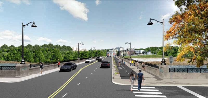
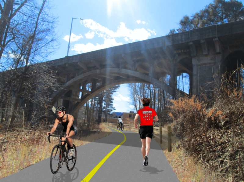
Derby Shelton Bridge design

Renovation work on the Derby-Shelton Bridge is moving forward, as the state has tapped a contractor for the project which should begin by April 1. The bridge was built in 1918 and is historically significant. While the substructure is in good condition, many elements have deteriorated over time, including the pavement structure, parapet walls, and lighting.  

The intent of the project is to renovate and rehabilitate the elements along the top of the bridge and enhance the bridge’s aesthetics. Because it connects two downtowns, there is an opportunity to improve not only its function but also its form and create an aesthetically pleasing public space for pedestrians and bicyclists. The project limits extend from the intersection with Route 34 (Main Street) in Derby to the west end of the Derby-Shelton Bridge and includes the connections to Canal Street.  This is part of a series of improvements along the Route 34 corridor in recent years.

The $6.3 million contract was awarded to Mohawk Northeast, Inc. Construction. The bid was almost $1.5 million below its pre-bid estimate on the work, completion of which should be December 2023.

Please visit this project’s webpage for more information.

New Survey for the West Main Street Corridor Study in Waterbury

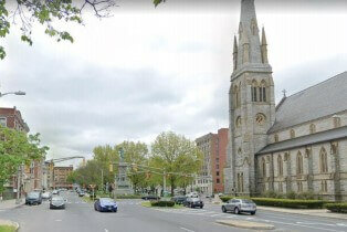
West Main Street going east facing the Green

NVCOG, in coordination with the City of Waterbury and the CT Department of Transportation, is studying the corridor of West Main Street from the underpass of Route 8 to the Waterbury Green. The intent of the study is to develop a deeper understanding of the challenges and opportunities of this stretch of road to develop solutions that improve safety for all users including pedestrians, cyclists, public transit riders, and drivers.

As part of this process, we’d like to gather feedback from the public to provide a unique perspective on how the roadway is currently used and how it could better serve your needs in the future.

Please answer the following questions and check out our project website for more information! https://www.westmainstudy.com/


Survey in English or Encuesta en Español


TOD Economic Opportunities Webinar Informs Local Leaders of Tools for Possibilities

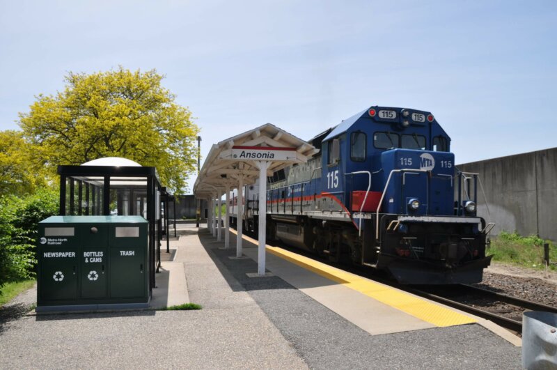
Anosnia Train Station

As part of the Route 8 and Waterbury Branch Line Corridor TOD and Alternative Modes Project, the NVCOG, and its consultant team of AECOM and CDM Smith, is investigating how to improve service on the Waterbury Rail Line and assessing the opportunities for creating Transit-Oriented Developments (TOD) in the vicinity of the Waterbury rail line stations. To date, the project team has looked at the existing conditions along the Waterbury rail line, interviewed passengers to get their opinions on current service and what is needed, held a series of TOD opportunity workshops in WRL host communities, developed a recommended rail improvement program and assessed the possibility of implementing a bus rapid transit (BRT) system within the Route 8 corridor. To learn more about the project and view published documents, please visit the project website at rt8corridorstudy.com.

The webinar was open to municipal officials, city/town planners, economic development staff,  commission members, and other elected officials with the public able to watch a live stream. While the focus is on the Waterbury rail line corridor and the host communities, this tool may be of interest to other cities and towns and we are encouraging anyone interested to view a recording of this webinar on the NVCOG YouTube Channel.

Presentation Slides

Any public comment can be submitted to Mark Nielsen at (203) 757-5305 or mnielsen@nvcogct.gov

Contract Awarded For Derby-Shelton Bridge Renovation

Derby Shelton Bridge design

For Immediate Release: February 1, 2021

Contacts:
Mark Nielsen
Naugatuck Valley Council of Governments
203-757-0535
mnielsen@nvcogct.org

CONTRACT AWARDED FOR DERBY-SHELTON BRIDGE RENOVATION

A contract to renovate the Derby Shelton-Bridge was awarded by the State of Connecticut on January 26, 2021. The project will create an aesthetically pleasing public space along the Derby-Shelton Bridge and provide an attractive gateway that is pedestrian and bicycle friendly to the downtown areas of Derby and Shelton.

The $6.3 million contract was awarded to Mohawk Northeast, Inc. Construction is scheduled to begin by April 1st, 2021, with an estimated completion date of December 2023. The bid was awarded almost $1.5 million below its pre-bid estimate.

The project design was performed by AECOM under contract to the Naugatuck Valley Council of Governments (NVCOG). Details include:

• The replacement of bridge parapet walls; The new parapet will feature a solid concrete wall similar in design to the existing wall with decorative railings similar in style to railings in the adjacent Veteran’s Memorial Park in Shelton. The railing treatment and its placement along the parapet will provide safety, as well as aesthetically attractive sightlines.

• The removal of existing lighting and replacement with period style lights that both enhance the presence of the bridge at night and comply with dark sky guidelines. The project also includes colored LED “up-lighting” that will accent the archways and parapets from below the bridge and can be changed and programmed depending on the season or special events.

• Roadway improvements will include adding a second travel lane for traffic heading to Derby, new pavement and curbing, and the shifting of the travel lanes to accommodate wider sidewalks on the south side of the bridge and a bi-directional cycle-track to separate bicyclists from both vehicle traffic and pedestrians.

The project marks the second major element of a three-part plan developed by the NVCOG to improve traffic flow and pedestrian experience connecting Derby and Shelton, according to NVCOG Executive Director Rick Dunne. “Beginning with the expansion of the Atwater Bridge crossing of the Naugatuck River on Route 34, which was completed in 2017, the three projects span two rivers from the east bank of the Naugatuck River, through downtown Derby and across to the west bank of the Housatonic River at Canal Street in Shelton”, said Dunne. “As the Derby-Shelton Bridge project commences with construction”, according to Dunne “The final phase, a complete reconstruction of Main and lower Elizabeth streets in Derby will be advertised for bid by July 2021. The Main Street project is expected to be completed in 2024”.

The Derby-Shelton Bridge project will also offer connectivity with the existing Housatonic Riverwalk trail network in Shelton and the Naugatuck River Greenway in Derby. The project limits will extend from the Bridge Street intersection with Main Street in Derby to the west end of the Derby-Shelton Bridge and along the SE Ramp to Canal Street.

“We’re excited with the announcement of state’s contract award for this project,” said Mark Nielsen, NVCOG Director of Planning. “Multiple public workshops were held in 2020 to ensure residents and stakeholders had an opportunity to provide input into the design. Several changes were made to plans because of comments we received, and the final result will benefit the Valley with an improved gateway into both cities.”

Initial funding to get the project started was obtained through the efforts of State Reps. Jason Perillo and Nicole Klarides-Ditria along with former State Reps. Themis Klarides and Linda Gentile. “Without their efforts, it is doubtful the project would be built,” said Nielsen.

“This is a special bridge with tremendous historical significance,” said Rep. Jason Perillo, R-113, Deputy House Republican Leader. “As Shelton’s downtown sees continued private investment, improvements like this make these and future projects more attractive to investors, residents, and visitors. This will become a new and beautiful gateway to Shelton over the Housatonic.”

“Smart investments like these do more than strengthen our infrastructure, they yield incredible results for the people of Derby and Shelton, including boosting local business and connecting our communities even further,” Rep. Klarides-Ditria, R-105, said. “I’m pleased this project is moving ahead and look forward to seeing the bridge finished.”

–End—

(Details and renderings of the project can be found at: https://nvcogct.gov/project/current-projects/roadway-projects/derby-shelton-bridge-pedestrian-and-bicyclist-enhancements/

New Website for Waterbury West Main Street Corridor Study!

West Main Street going east facing the Green

The Project Team, including the City of Waterbury, NVCOG, CTDOT, and consultants Fuss & O’Neil and Fitzgerald & Halliday, have launched www.westmainstudy.com to provide easy access to project developments, documents, events, and public input. The intent of the study is to develop a deeper understanding of the challenges and opportunities of this stretch of road to develop solutions that improve safety for all users including pedestrians, cyclists, public transit riders, and drivers.

An interactive map will allow you to pinpoint locations that have issues related to mobility along West Main Street. The mapping tool also allows you to provide comments associated with those locations. Your input will guide the Project Team in identifying existing issues and needed improvements within the study area.

Also, follow the West Main Street Corridor Study on Facebook!

Public Information Meeting for Spot Improvements Route 67 in Seymour

Road work ahead sign

For Immediate Release: October 30, 2020
Updated: November 19, 2020
 

Contacts: 
Mark Nielsen
Naugatuck Valley Council of Governments
(203) 757-0535
mnielsen@nvcogct.gov   


VIRTUAL PUBLIC INFORMATION MEETING 

STATE PROJECT NO. 124-165 

 ROUTE 67(BANK STREET) SPOT IMPROVEMENTS 

SEYMOUR, CONNECTICUT
MONDAY, NOVEMBER 16, 2020 


The Naugatuck Valley Council of Governments (NVCOG) held a virtual public information meeting to present preliminary design plans on Spot Improvements to Route 67 (Bank Street), in The Town of Seymour. The public meeting was held on Monday, November 16, 2020. The meeting was held online via Zoom beginning at 6 pm. The intent of the meeting was to provide residents and other interested persons an opportunity to learn about the design and proposed improvements and understand the project timeline. A presentation was made, after which there was a question and answer period.  To view the recording of this meeting and review the presentation, please visit the Route 67 (Bank St) Spot Improvements project webpage.

It is NVCOG’s and the State’s policy to keep persons informed about and involved with ongoing road improvement projects. It is important that the community share its concerns to assist in the project’s development.  

 The intent of the project is to improve traffic, pedestrian flow, and safety along the section of Route 67 (Bank Street) between River Street/Franklin Street and Klarides Village and is a continuation of the planning effort completed in 2017. The firm of Milone and MacBroom is designing the improvements under contract to the NVCOG. Construction will be advertised and administrated by the Connecticut Department of Transportation (CTDOT).  The project will include: 

Route 67 and River Street/Franklin Street Intersection 
Improve pedestrian crossings 
Widen northbound River Street approach to extend the left-turn lane onto Route 67
Make sidewalk connection from River Street to the south side of Route 67 

Route 67 between River Street/Franklin Street Intersection and Old Drive East
Widen Route 67 to provide adequate storage on northbound and southbound dedicated turn lanes and 5-foot shoulders
Widen north side of Route 67 to extend the two westbound departure lanes past Martha Street to the Walgreens Intersection.
Reconstruct stone masonry retaining wall at 100 Bank Street.
Construct new retaining wall between Martha Street and Walgreen’s driveway.
Install new traffic signal equipment.
Install new sidewalks, pedestrian accommodations, and lighting. 

 Route 67 at Walgreens Driveway
Widen Route 67 to provide a westbound dedicated right and extended right turn lane in addition to the single through lane.
Upgrade traffic signal to accommodate geometric changes at the intersection.
Implement revised signal timings. 

 Route 67 at Old Drive West
Upgrade the existing traffic signal with new pedestrian equipment.
Revised phasing to include an exclusive pedestrian phase. 

Route 67 at Klarides Village Unsignalized
Add westbound left turn lane into the driveway.
Modify driveway to prohibit left turns onto Route 67. 

 Route 67 at Beecher Street and Church Street
Reconfigure the intersection to better direct and channelize the turning movements. 

 Route 313 (River Street)
Widen River Street to provide additional storage and queuing lengths for the northbound travel lanes.
Widen bridge over Little River to provide a new sidewalk along the western side of River Street connecting to the existing Route 67 sidewalks. 

 Additional Traffic Signal Timing Improvements
Timing improvements throughout the corridor. 

Improve Pedestrian Connection to Downtown
Improve lighting and hardscape under Route 8.

Based on the preliminary design, the construction cost will be approximately $6,100,000. The Federal Highway Administration will provide 80% of the construction cost with the State providing 20%. 

The public informational meeting was held to afford an opportunity for public participation and allow open discussion of any views and comments the community may have concerning this proposed project. 

 Persons with limited internet access may request project information be mailed to them by calling  (203489-0369 or emailing  mnielsen@nvcogct.gov(Allow one week for processing and delivery.) 

 There will be a 14day comment period following the meeting.  Individuals may leave a question or comment via email/phone at ksvetz@nvcogct.gov and (203) 489-0374.

Oxford Route 67 Study Public Information Meeting and Public Input Opportunities

For Immediate Release: September 22, 2020

Contacts:
Aaron Budris
Naugatuck Valley Council of Governments
203-757-0535
abudris@nvcogct.org

Oxford Main Street Committee Announces Public Information Meeting

and Seeks Public Input on the Oxford Route 67 Alternative Transportation Study

The Oxford Main Street Project (OMSP) Committee has announced a virtual public meeting on October 8th at 7pm to hear about plans and progress along Route 67, and to provide input about ongoing projects. You can find meeting specifics at www.nvcogct.gov/event/oxfordmainstreet. The OMSP Committee has been working to make the Route 67 and Little River corridor pedestrian and bicycle friendly, and to provide better access to the businesses and natural resources throughout the corridor. In order to better inform and engage with the public on their progress, the committee has kicked off a new project visibility campaign to include enhanced public outreach and opportunities for residents to provide feedback. The Committee has started a new Facebook group that has grown to over 250 members, and residents are encouraged to join. Information about the OMSP Committee can be found at www.oxford-ct.gov/main-street-project-committee.

The OMSP Committee is overseeing the Oxford Route 67 Alternative Transportation Study that will be highlighted at the October 8th Meeting. The Study is building on the committee’s prior work to develop a cohesive plan for the entire corridor to better enable the Town to plan, prioritize, and fund future improvements. The planning study is being funded by the Naugatuck Valley Council of Governments (NVCOG) with federal transportation planning funds and is being conducted by TranSystems Corporation, a planning and engineering consultant with offices in Meriden, CT. The study is expected to be completed in Summer, 2021, when a report detailing final recommendations will be published.

Throughout the spring and summer, study partners collected and analyzed information about the existing conditions in the corridor, and they have begun investigating potential bicycle, pedestrian and transit improvements. The focus of these potential improvements will be to improve connections and transportation options to the Seymour sidewalk network, train station and Naugatuck River Greenway Trail to the south, and the Larkin Bridle Trail to the north, as well as to all of the businesses, services, green spaces, and residential areas within the corridor. The potential for transit service is also being investigated, focusing on connections to services and major residential and commercial centers and to surrounding communities.

While the Covid-19 Pandemic has altered public outreach for the study, there will still be numerous opportunities for residents and businesses to provide input. Public input will be gathered at and following the Virtual public Meeting on October 8th and comments can be left at any time through the study webpage at www.nvcogct.gov/oxfordroute67. Residents and business owners are also encouraged to complete a short survey that can be found on the webpage.

Oxford prioritized creating more of a downtown feel along Route 67 in the Town’s Plan of Conservation and Development. Unlike many of its neighbors, Oxford does not have a typical walkable New England downtown or Main Street. Instead, municipal and commercial areas are dispersed along with residences along State Route 67. Although Route 67 is fundamentally Oxford’s “Main Street,” it currently has no sidewalks or any safe bicycle or pedestrian access, and traffic speeds can be excessive with no visual cues to alert motorists that they are driving through an area where they may encounter walkers or bicyclists. In addition, no public transit is operated along Route 67 that could provide residents an alternative transportation option. Transit options by train on Metro North and by bus on CT Transit are available only one mile from the Oxford town line, but there is currently no way for Oxford residents to safely access these services without a personal motor vehicle.

Kathleen O’Neil, Oxford Grant Administrator and Chair of the Oxford Main Street Committee explained that “Oxford residents have said they want pedestrian and bicycle access along the Little River and Route 67. We are very excited to share progress toward that goal, and to give the public a chance to help guide and contribute to future work”.

Discussing the Oxford Route 67 Alternative Transportation Study, TranSystems Project Manager Casey Hardin said that, “This is a tremendous opportunity to build off the excellent work that the Oxford Main Street Committee has completed over the last several years. We are aiming to create a multimodal master plan for the corridor that can encourage sustainable transportation and growth in the Town for years to come.”

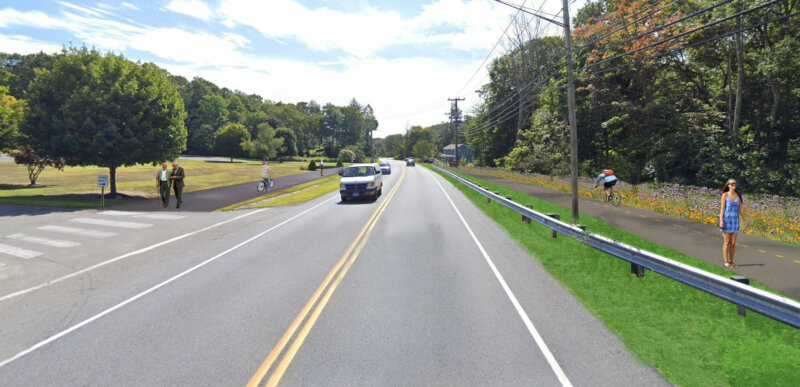
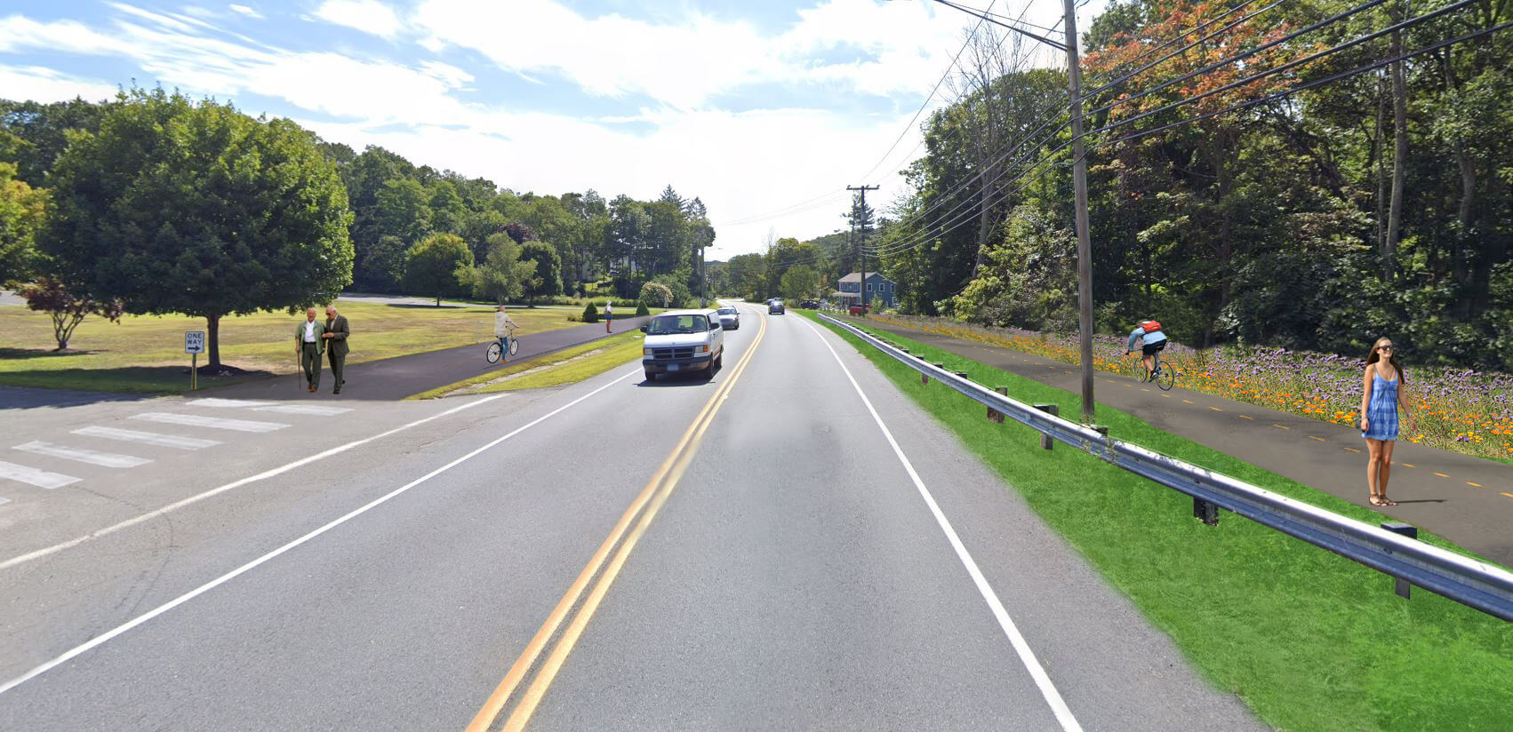
Artist rendering of possible revisions to Oxford’s Route 67/Little River Corridor. Residents will have the opportunity to provide feedback and learn details of plans for the corridor during an October 8 virtual meeting.

NVCOG and NRG Steering Committee Endorse NRG Trail Routing Feasibility Study Report

The report detailing methods and findings of the Naugatuck River Greenway (NRG) Trail Thomaston to Torrington Routing and Feasibility Study was endorsed unanimously by the NVCOG Board at its regular meeting on May 8th.  The report was also endorsed by the NRG Steering Committee (NRGSC) on May 13thThe final report and appendices can be reviewed on the project web page:  https://nvcogct.gov/nrg-thomaston-to-torrington-routing-study  

The project study area detailed in the report spans approximately 11 miles of the Naugatuck Valley from Bogue Road in Torrington to a section of trail under design adjacent to the Water Pollution Control facility on Old Waterbury Road in Thomaston.  The goals of the high level planning project, conducted by BSC Group of Glastonbury, CT, were to catalog existing conditions in the project corridor, inventory and assess all potential multi-use trail routes, identify a preferred route with input from stakeholders and the public, and develop conceptual designs, cost estimates and phasing recommendations to assist with future trail development. The intent of the project was to provide decision-makers with the information they would need to seek funding for the design and construction of NRG trail projects.

A Draft Report was published on the NVCOG website for a 30-day public comment period ending on March 13th Nearly 400 public comments were received, most of which were from self-identified off-highway-vehicle (OHV) riders and were focused on fears that the study represented efforts to eliminate or disrupt use of the OHV area at Thomaston Dam.  Responses to comments are detailed in Appendix H of the final draft report  NVCOG staff presented the comments and the project team’s responses to them at both the NVCOG and NRGSC meetings prior to endorsement.  

Concerns regarding potential impact to the OffHighway Vehicle (OHV) area at the US Army Corps of Engineers (USACE) managed Thomaston Dam were well represented in an earlier round of public comments as well.  Iresponse, the project team met several times with USACE staff and OHV representatives to address those issues. These additional meetings and the Study Team’s responses to their concerns are detailed in the report.  A route was developed that avoids the OHV area to the greatest extent possible. For a 2-mile corridor section where there was no viable alternative, a trail concept along Old Route 8 on USACE land where OHVs are currently permitted (but do not have exclusive use) was developed.  The concept presented in the report was developed collaboratively with the USACE and OHV representatives to safely separate motorized and non-motorized uses without negative impact to current OHV traffic flow.  It provides for the safe use of the Thomaston Dam Recreation Area by all currently permitted user groups while providing a critical connection for the NRG trail.  It is noted that if a trail were to be developed, managed or maintained through the Thomaston Dam area it would be the responsibility of the USACE either directly or through future agreements with outside groups. 

Stakeholders were involved throughout the project including chief elected officials and staff from the municipalities of Torrington, Litchfield, Harwinton and Thomaston along with representatives from the US Army Corps of Engineers, NVCOG, NHCOG, the Naugatuck River Greenway Steering Committee, The Railroad Museum of New England, and several property owners along the route.  The preferred route presented in the report was selected by a project steering committee consisting of officials from the involved municipalities and other stakeholders.    

NVCOG, in partnership with the Northwest Hills Council of Governments (NHCOG), received a Transit Oriented Development and Smart Growth grant from the Connecticut Office of Policy and Management (OPM) to conduct the study. The NVCOG and NHCOG oversaw the project.   

Final Draft of the Naugatuck River Greenway Trail Routing Feasibility Study Report Posted

The final draft of the report detailing  methods and findings of the Naugatuck River Greenway (NRG) Trail Thomaston to Torrington Routing and Feasibility Study has been published on the NVCOG websiteThe report and appendices can be reviewed on the project web page:  https://nvcogct.gov/nrg-thomaston-to-torrington-routing-study  


The project area detailed in the report spans approximately 11 miles of the Naugatuck Valley from Bogue Road in Torrington to a section of trail under design adjacent to the Water Pollution Control facility on Old Waterbury Road in Thomaston.  The goals of the high level planning project, conducted by BSC Group of Glastonbury, CT, were to catalogue existing conditions in the project corridor, inventory and assess all potential multiuse trail routes, identify a preferred route with input from stakeholders and the public, and develop conceptual designs, cost estimates and phasing recommendations to assist with future trail development. The intent of the project was to determine the opportunities for constructing the NRG Trail, identify the strengths and constraints of each possible route, and provide decision-makers with the information they would need when deciding whether or not to advance a section of the trail 


A Draft Report was published on the NVCOG website for a 30-day public comment period ending on March 13th Nearly 400 public comments were received, most of which were from self-identified off-highway-vehicle (OHV) riders and were focused on fears that the study represented efforts to eliminate or disrupt use of the OHV area at Thomaston Dam.  Responses to comments are detailed in Appendix H of the final draft report  


Concerns regarding potential impact to the OffHighway Vehicle (OHV) area at the US Army Corps of Engineers (USACE) managed Thomaston Dam were well represented in an earlier round of public comments as well.  Iresponse, the project team met several times with USACE staff and OHV representatives to address those issues. These additional meetings and the Study Team’s responses to their concerns are detailed in the report.  A route was developed that avoids the OHV area to the greatest extent possible. For a 2-mile corridor section where there was no viable alternative, a trail concept along Old Route 8 on USACE land where OHVs are currently permitted (but do not have exclusive use) was developed.  The concept presented in the report was developed collaboratively with the USACE and OHV representatives to safely separate motorized and non-motorized uses without negative impact to current OHV traffic flow.  It provides for the safe use of the Thomaston Dam Recreation Area by all currently permitted user groups while providing a critical connection for the NRG trail.  It is noted that if a trail were to be developed, managed or maintained through the Thomaston Dam area it would be the responsibility of the USACE either directly or through future agreements with outside groups. 


Stakeholders were involved throughout the project including chief elected officials and staff from the municipalities of Torrington, Litchfield, Harwinton and Thomaston along with representatives from the US Army Corps of Engineers, NVCOG, NHCOG, the Naugatuck River Greenway Steering Committee, The Railroad Museum of New England, and several property owners along the route.  The preferred route presented in the report was selected by a project steering committee consisting of officials from the involved municipalities and other stakeholders.    


NVCOG, in partnership with the Northwest Hills Council of Governments (NHCOG), received a Transit Oriented Development and Smart Growth grant from the Connecticut Office of Policy and Management (OPM) to conduct the study. The NVCOG and NHCOG oversaw the project.   

MTA Implements “NY Essential Service Plan” to Move Essential Personnel to the Frontlines of the COVID-19 Crisis

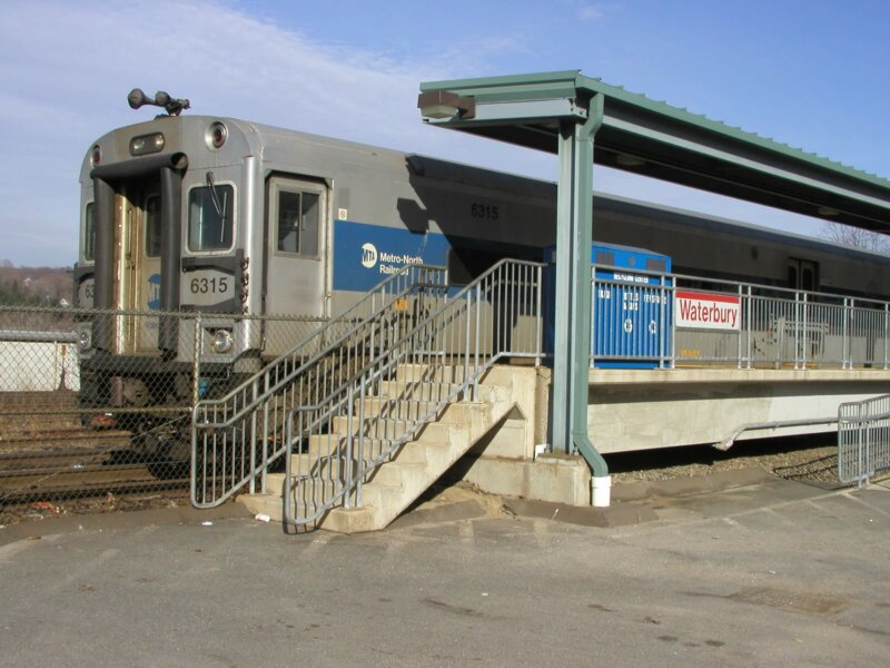
Waterbury Train Station platform

MTA IMPLEMENTS “NY ESSENTIAL SERVICE PLAN” TO MOVE HEALTHCARE WORKERS, FIRST RESPONDERS AND OTHER ESSENTIAL PERSONNEL ON FRONTLINES OF THE COVID-19 CRISIS

Service Plan Will Ensure Healthcare Workers, First Responders and Essential Personnel Get to and From Work By Mass Transit
New York City Transit, Long Island Rail Road and Metro-North Railroad Move to Reduced Schedule As Ridership Drops As Much As 90%
MTA Urges Congress to Take Action and Pass $25 Billion Federal Relief Package for Mass Transit with $4 Billion for MTA

Metro-North Railroad Service During the Coronavirus Pandemic

Modified Metro-North Weekday Schedule

MTA Continues Aggressive Efforts to Protect Customers & Employees – Around-the-Clock Disinfection of Workplaces and Rolling Stock, No Cash Transactions and Rear-Door Boarding to Ensure Social Distance
As the Metropolitan Transportation Authority (MTA) continues to respond to the COVID-19 pandemic and move the healthcare workers, first responders and essential personnel on the frontlines of this public health crisis, the Authority today announced the implementation of the “NY Essential Service Plan.” The reduced schedule will ensure service to and from work for the workers on the frontlines of this crisis, while adapting to never-before-seen ridership lows – dropping by as much as 90 percent across New York City Transit, the Long Island Rail Road and Metro-North Railroad.

The schedule change follows “New York State on PAUSE” order, which directed New Yorkers use of public transportation for only essential travel and limit potential exposure by spacing out at least six feet from other riders. New York City Transit, MTA Bus Company, Long Island Rail Road and Metro-North continue their aggressive disinfecting procedures at each of its stations twice daily, and continue daily sanitization of its fleet of rolling stock with the full fleet of train cars and buses disinfected every 72 hours or less. The Access-A-Ride dedicated fleet is disinfected daily.

In the midst of this crisis, the Metropolitan Transportation Authority is now facing financial clamity. Farebox and toll revenue, which normally constitutes nearly half of the M.T.A.’s annual budget at approximately $8 billion, has dropped significantly as more and more riders stay home. That’s on top of more than $6 billion in state and local taxes dedicated to the M.T.A. that is likely to evaporate in the inevitable economic downturn. Additionally, the MTA’s enhanced and intensive disinfecting efforts are expected to total over $300 million on an annualized basis.

In response, the MTA is urgently calling on Congress to do the right thing and include at least $25 billion in dedicated funding for mass transit, to ensure that the M.T.A. and systems across the country not only continue to operate through the crisis, but also serve as the catalyst for economic growth in local economies across the nation once the pandemic subsides.
“The MTA is committed to getting the heroes who keep this city moving where they need to go,” said MTA Chairman and CEO Patrick J. Foye. “The dramatic decrease in ridership shows our customers are continuing to follow the advice of health professionals to keep themselves and others safe. But we’re here for the critical workers and first responders, and I also want to thank our transit workers who continue to show up and keep New York moving every single day.”

“The service changes announced today will help reduce workplace density and ensure social distancing, including in crew rooms and other facilities,” said MTA Chief Safety Officer Pat Warren. “The MTA has previously taken every precaution to protect our customers and employees, including stepped up disinfecting schedules for stations and rolling stock, the implementation of rear-door boarding on buses, and the elimination of most cash transactions. We will continue to do everything we can to make sure the system remains safe for customers and employees and operating during this challenging time.”

“Like after 9-11 and Superstorm Sandy, our workers have been nothing short of amazing as they continue to show up to work at such a difficult time,” said MTA Chief Operating Officer Mario Peloquin. “The decision to reduce service is not one we take lightly, but feel at this time is in the best interest of our workers, customers and the system as a whole. Our goal has been and continues to be to move New Yorkers where they need to go. That’s never been as important as right now.”
The “MTA Essential Service Plan” will be phased in beginning Wednesday, March 25 over the course of several days, and includes the following measures:

SUBWAYS AND BUSES: On the subways – starting March 25th, lines will operate our “MTA Essential Service Plan.” Most customers will not notice a difference. This preserves our AM and PM peak to get first responders and essential personnel where they need to go. Some lines will not run Monday through Friday – including the B, W and Z lines, which will be covered by other local service. Also, some express services and branches on some lines will operate only local service. To date, there has been an 87% decline in subway ridership vs. the comparable dates last year.

Even with these changes, the New York City Transit team continues to undertake a line-by-line, hour-by-hour analysis of ridership. So, we’re retaining flexibility to increase service as necessary.

“The MTA Essential Service Plan” for buses will start on March 26th. This plan retains 75 percent of normal bus service, allows the MTA to serve essential workers and lessen crowding on transit and in crew facilities. This means that customers who still need to use buses for essential activities will continue to be accommodated. At the same time, the maximum number of buses needed is substantially reduced, requiring fewer operators and lessening crowding of depot facilities. Buses have experienced a more than 60% drop in ridership vs. the comparable dates last year.

LONG ISLAND RAIL ROAD AND METRO-NORTH: Long Island Rail Road has seen a decline of 76 percent in ridership since the pandemic began. Under the new “MTA Essential Service Plan,” Long Island Rail Road will have over 500 weekday trains running, compared to a typical weekday of over 740 trains, beginning March 27. The LIRR will also have crews and equipment on standby to supplement service if necessary.

Metro-North Railroad has seen a 94 percent decline in ridership as a result of the pandemic. Beginning on March 27, Metro-North will provide hourly service on the Harlem, Hudson and New Haven lines, with extra trains added during peak times. Normal weekday capacity will be reduced by approximately 50 percent when compared to a normal weekday. The reduced schedule will run 424 trains, down from 713 during a normal schedule. Beginning the weekend of April 4/April 5, Metro North will provide hourly service while also suspending shuttle service between Wassaic and Southeast on the Upper Harlem line.

These service changes will be reflected on our website, the MYmta app and on countdown clocks in stations and on platforms.

PARATRANSIT: The paratransit program has eliminated shared rides in accordance with the recommended public health guidance, and extended eligibility for existing Access-A-Ride customers. The paratransit system continues to have capacity to serve demand, which has declined by 71% from earlier this month.

The MTA joins a growing list of public transit agencies that have scaled back service due to a drop in ridership resulting from the COVID-19 crisis.

“The 50,000 brave men and women of New York City Transit will continue moving essential employees and keep them safe during this public health crisis,” said NYC Transit Interim President Sarah Feinberg. “The MTA Essential Service Plan is in the best interest of these workers and will keep the first responders, healthcare workers, child care workers and many more on the front lines of this crisis moving forward.”

“LIRR’s dedicated workforce will continue to move essential workers and those who need to care for loved ones as we fight to flatten the curve,” said Long Island Rail Road President Phillip Eng. “This new service pattern will continue to get customers where they need to be, and at the same time help us better ensure that our workforce is safe and healthy and able to continue this vital service.”

“Our crews and front line employees at Metro-North will continue to provide the service our customers deserve during these trying times,” said Metro-North President Catherine Rinaldi. “Our ridership has seen a steep decline over the past several weeks, but health care workers and other first responders continue to ride our trains every day. While some reduction in service makes sense right now, we will continue to run a safe and reliable service to get these critical employees to their places of employment every day.”