NVCOG Engineers Take on Transportation Resilience International Conference on Extreme Weather and Climate Change in Washington, D.C.

In November, NVCOG Transportation Engineers Karen Svetz and Kevin Ellis attended the Transportation Resilience International Conference on Extreme Weather and Climate Change Challenges held at the National Academies of Sciences, Engineering, and Medicine in Washington, D.C.

Attendees learned about emerging best practices and state-of-the-art research results on how to adapt transportation networks to the potential impacts of climate change and extreme weather events that are becoming increasingly prevalent in our country and around the world.

During the conference, presenters from the Federal Highway Administration, other states, as well as other countries, shared how they conduct research, collect data, analyze the data, quantify the risk, and prepare resilience plans. The objective of the planning is to identify resilience needs, develop specific strategies to anticipate, prepare for and mitigate events that put the transportation network at risk of disruption and damage.

Climate-related events can damage roads, bridges, railways, ports, and other transportation assets. These events include river and stream flooding, changes in sea level, drought, excessive rainfall, wildfires, changes in temperature, and the like.

With the likelihood of these events increasing in frequency, it is important to create plans and strategies with the expectation that the damages, deaths, and disruption to the affected communities can be better anticipated and reduced. 

PRESS RELEASE: NVCOG Implements EcoInteractive to Revolutionize Transportation Planning Workflow

For Immediate Release: November 29, 2023 

Contact:
Richard Donovan   
Naugatuck Valley Council of Governments   
203-757-0535   
Rdonovan@nvcogct.gov 

(Waterbury, CT) –  The Naugatuck Valley Council of Governments (NVCOG) proudly announces the integration of EcoInteractive, a cutting-edge planning software, to streamline the workflow of the Transportation Improvement Program (TIP) and Local Transportation Capital Improvement Program  (LOTCIP). By integrating this innovative technology, NVCOG aims to ensure effective collaboration and achieve sustainable transportation planning goals. 

The Transportation Improvement Program (TIP) is a critical planning tool that guides the allocation of federal funds for transportation projects in our region. Metropolitan Planning Organizations maintain a TIP to manage federal transportation spending, ensuring that projects work to enhance safety, capacity, and reliability of the region’s transportation network. By applying EcoInteractive’s advanced capabilities, NVCOG aims to significantly improve the efficiency and accuracy of the TIP process, ultimately leading to more effective project selection and implementation.  

EcoInteractive offers NVCOG a centralized platform that allows for improved coordination and communication between the COG’s staff, municipalities, and CTDOT. As MPOs must approve all federal spending before projects can begin, streamlining this process will reduce delays and errors in the process while also providing additional visibility into projects and plans to the public. Similarly, the LOTCIP program, which uses state funds managed by the COG to support municipal transportation projects, will be centralized within the system to ensure that the public remains informed of project progress while also ensuring a simple and effective means of communication between the COG and municipal project sponsors.

A key feature of the new system, the public facing website, will not only allow the public to see proposed changes before they are adopted but will provide more project information, regular status updates, and the opportunity for the public to ask questions or provide comment on projects and changes.   

“We are thrilled to integrate EcoInteractive into our planning workflow for the Transportation Improvement Program,” said Rick Dunne, Executive Director of NVCOG. “We are taking a significant step towards increasing our efficiency and transparency. This partnership will strengthen our ability to better serve our communities.” 

Naugatuck Valley Council of Governments Spearheads Regional Response Effort to Achieve VMT Reduction Strategies

Waterbury, CT – The Naugatuck Valley Council of Governments (NVCOG) takes immense pride in announcing its proactive response to the Connecticut Department of Transportation’s (CTDOT) Vehicle Miles Traveled (VMT) reduction goal. NVCOG has diligently developed a comprehensive set of reduction strategies to ensure a sustainable future for transportation in the greater Naugatuck Valley region.

The CTDOT recently announced its ambitious target to reduce VMT by 5% by the year 2030. VMT reduction is crucial for curbing greenhouse gas emissions, reducing congestion, and promoting sustainable transportation choices. Recognizing the significance of this initiative, NVCOG, in alignment with its mission to provide transportation planning and regional assistance to its member municipalities, has actively engaged in research and analysis to devise comprehensive solutions tailored to the specific needs and challenges faced by the Naugatuck Valley region.

The prepared response encompasses a multifaceted approach, targeting various aspects of transportation and mobility. From enhancing public transit options and promoting active transportation alternatives to encouraging zoning and development policies centered around transit-oriented development, these strategies aim to create a sustainable and efficient transportation system for the residents and businesses of the region and the state.

Key Reduction Strategies Proposed by NVCOG include:

1. Enhancing Public Transportation Infrastructure:

NVCOG is committed to developing and expanding existing public transportation services, making them more accessible, reliable, and user-friendly. This includes improving connectivity across the region, enhancing last-mile connections, and increasing the frequency of services. 

2. Promoting Active Transportation:

In order to reduce dependency on private vehicles, NVCOG will prioritize the promotion of active transportation modes such as walking, rolling, cycling, shared micro mobility options, and the implementation of pedestrian-friendly infrastructure.

The full VMT Reduction Strategy can be accessed via the NVCOG website at https://nvcogct.gov/project/vmt-reduction-strategy/.

Central Naugatuck Valley Metropolitan Planning Organization Designated a Transportation Management Area

For Immediate Release: November 14, 2023

Contact:
Richard Donovan
Naugatuck Valley Council of Governments
203-757-0535
Rdonovan@nvcogct.gov

Central Naugatuck Valley Metropolitan Planning Organization (CNVMPO) Designated a Transportation Management Area (TMA) for Vital Transportation Planning

(Waterbury, CT) – The Central Naugatuck Valley Metropolitan Planning Organization (CNVMPO) is pleased to announce its recent designation as a Transportation Management Area (TMA), approved by the Secretary of the U.S. Department of Transportation. As specified under the federal transportation regulations codified in 23 USC §134(k)(1), the CNVMPO requested designation because its population did not meet the threshold for such designation automatically. Governor Lamont fully supported and concurred with this request. This significant designation represents a pivotal moment in the CNVMPO’s ongoing commitment to enhancing transportation infrastructure and services in the Waterbury urban area and its surrounding communities.

The CNVMPO, chaired by Mayor of Waterbury Neil O’Leary, is the federally designated metropolitan planning organization for the Waterbury urban area, serving a diverse urban population of 331,564 people, according to the most recent Census statistics. The complex, diverse, multimodal transportation infrastructure in the CNVMPO planning region necessitates a thorough approach to system performance evaluation and identifying opportunities for improvement. TMA designation provides the CNVMPO more local control to implement transportation projects that align with the needs and aspirations of the municipalities it serves. Furthermore, this designation secures federal funding opportunities to drive transformative projects aimed at improving quality of life, decreasing congestion, and protecting the environment.

Richard Donovan, Transportation Planning Director at the Naugatuck Valley Council of Governments (NVCOG), expressed his gratitude, stating, “We deeply appreciate the Connecticut Department of Transportation, Governor Lamont, and USDOT for acknowledging the quality of the planning program executed by the staff of the CNVMPO. We eagerly anticipate the positive impact that the TMA designation will bring to our communities. With the aging transportation network in the Waterbury Urban Area, we see a valuable opportunity to revitalize our infrastructure in a way that promotes economic development, enhances safety, and fosters transportation equity within our region.”

This designation was made possible through collaboration and coordination with the CNVMPO’s partners, including the Connecticut Department of Transportation (CTDOT). The CNVMPO worked closely with the CTDOT and Connecticut Division of Federal Highway Administration. Their support was invaluable for securing this designation.        

More than $54 Million in LOTCIP Funds Awarded to Municipalities in the NVCOG Region

The Naugatuck Valley Council of Governments (NVCOG) is excited to announce that more than $54 million in Local Transportation Capital Improvement Program (LOTCIP) funds have been awarded to municipalities within our region since the inception of the program. NVCOG is responsible for soliciting, programming, and working with our towns to initiate and implement projects. The Connecticut State Legislature created the LOTCIP program in late 2013, facilitated by the regional COGs, to help make local projects easier and quicker to build. Funds are provided through the CT Department of Transportation (CTDOT) based on designs developed by the municipalities. These projects have included work ranging from road reconstruction to safety improvements, pedestrian enhancements, and bridges. Many projects have included streetscape improvements and upgrades to some of our most vital downtown streets. 

NVCOG has been proactive in soliciting and initiating projects from our member towns. We provide assistance to project sponsors with refining applications, evaluating a project’s purpose and need, as well as assessing appropriate actions that will fix identified problems. Since the inception of the program, 13 projects have been completed at a value of just under $27 million and another seven are under construction with an awarded total $27.2 millionThrough Fiscal Year 2022, over $70.2 million in LOTCIP funds have been allocated to NVCOG, meaning we have obligated 77% of our funds to date. In addition, 11 projects, have received a “commitment to fund” letter and are in the design phase. The commitment to fund letter is the CTDOT’s assurance that LOTCIP funds will be awarded to the project. The value of these projects is slightly over $38 million, bringing the region’s commitment of LOTCIP funds to $92.3 million. Given design schedules, NVCOG anticipates that sufficient funds will be allocated to the region to fully the committed program. 

Click the charts below for more details.

LOTCIP Project Information: 

Visit the LOTCIP webpage for more information.

Traffic Lane Shift on the Derby-Shelton Bridge

Road work ahead sign

Project No.: 0126-0174

Headline: Traffic Lane Shift on the Derby-Shelton Bridge (Bridge No. 01659) over the Housatonic River Which Carries Bridge Street in the Town of Shelton

The Connecticut Department of Transportation is announcing that lanes will be shifted towards the south side of the Derby-Shelton Bridge and the north-side sidewalk will be closed for Stage 1 of construction work starting on or about Wednesday, August 25, 2021.

The Connecticut Department of Transportation is announcing that the traffic flow will be reconfigured to accommodate the Stage 1 construction work. Both East and Westbound travel lanes will be reduced to 11’ wide and the northernmost sidewalk will be closed. Pedestrians and cyclists will still be able to cross the structure on the existing 10.5’ southern sidewalk. A row of precast concrete barriers will be installed to delineate the work area and reconstruction of the existing parapet will begin.

Utility work associated with the project will continue in and around the Main St., Olivia St., and 3RD St. Triangle.

The project consists of the rehabilitation and realignment of the travel ways on the existing structure. The final condition will provide a 5’ wide concrete sidewalk (north) and a 7’ wide sidewalk (south). One 11’ wide Westbound travel lane and two 11’ wide Eastbound travel lanes with 2’ shoulders for vehicles. A 3’-8” buffer zone, and a 10’ wide paved bike lane (south).

DOT Project No. 0126-0174 was awarded to Mohawk Northeast, Inc. on January 26, 2021, at a cost of $6,393,565.45 and is scheduled to be completed by November 27, 2023. This project is administered by the Office of Construction – District 3, New Haven.

Please visit the Derby-Shelton Bridge Pedestrian and Bicyclist Enhancements page for further information.

TRAFFIC IMPACT INFO

 Motorists can expect normal conditions except for the new fixed 11’ wide lanes. The current schedule allows for work behind the barrier both day and night if needed. Pedestrians and cyclists will be restricted to the existing southern sidewalk for passage during this stage.

Draft Oxford Route 67 Alternative Transportation Plan Report Published

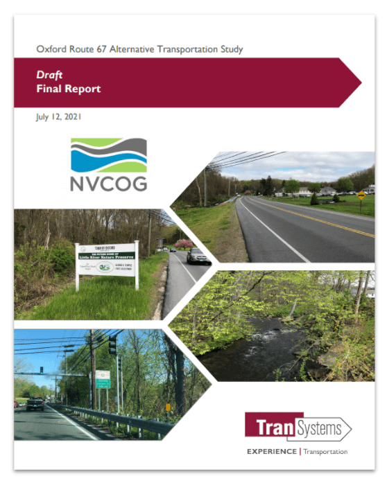
The public is invited to review and provide feedback on a Draft Oxford Route 67 Alternative Transportation Study Report.  The Draft report presents the existing conditions in the corridor along with recommendations for bicycle, pedestrian, and transit improvements. Comments can be submitted until August 15th, 2021.  The report and more information can be found on the project webpage at www.nvcogct.gov/oxfordroute67 .

The Oxford Main Street Alternative Transportation Study has been underway since December 2019, investigating the potential for non-motorized transportation alternatives and transit in the Route 67 corridor between Seymour and Southford. Study partners collected and analyzed information about the existing conditions in the corridor, collected input from stakeholders and the public, and investigated potential bicycle, pedestrian, and transit improvements. The focus is to improve connections and transportation options to the Seymour sidewalk network, train station and Naugatuck River Greenway Trail to the south, and the Larkin Bridle Trail to the north, as well as to all the businesses, services, green spaces, and residential areas within the corridor. The potential for transit service was also investigated, focusing on connections to services and major residential and commercial centers and to surrounding communities.

The Oxford Main Street Project Committee is overseeing the project, and it builds on previous work the committee has undertaken to improve access to the Little River and natural resources along Route 67. The goal is to provide better access to the businesses and natural resources throughout the corridor. The final report will provide a cohesive plan for the entire corridor to better enable the Town to plan, prioritize, and fund future improvements. The Naugatuck Valley Council of Governments (NVCOG) is funding the project with federal transportation planning funds. TranSystems Corporation, a planning and engineering consultant with offices in Meriden, CT is the project consultant. A final report, incorporating comments from stakeholders and the public, will be published this summer.

Oxford’s Plan of Conservation and Development prioritized creating more of a downtown feel along Route 67. Unlike many of its neighbors, Oxford does not have a typical walkable New England downtown or Main Street.

Instead, municipal and commercial areas are dispersed along with residences along State Route 67. While Route 67 fundamentally functions as Oxford’s “Main Street,” it currently has no sidewalks or safe bicycle or pedestrian access. In addition, there is currently no public transit currently operated along Route 67 providing residents an alternative transportation option. Transit options by train on Metro North and by bus on CT Transit are available only one mile from the Oxford town line, but there is currently no way for Oxford residents to safely access these services without a personal motor vehicle.

Oxford First Selectman George Temple explained that “Oxford residents have voiced support for pedestrian and bicycle access along the Little River and Route 67. This study allows us to make progress toward that goal, and to give the public a chance to help guide and contribute to future efforts”.

TranSystems Project Manager Casey Hardin said that “This is the time for area residents to provide input on the planning for this important municipal resource. The study includes recommendations to improve mobility options for bicyclists and pedestrians, as well as folks who would like options beyond their automobile”.

The New Mix: A Long-term Plan for the I-84 & Route 8 “Mixmaster” Interchange

Aerial photo of the Mixmaster from the train station

An introduction of future plans to local leaders for what is locally known as the “Mixmaster” in Waterbury from HNTB and CTDOT. The presentation includes a brief history of the Mixmaster, what has been completed thus far, the analysis of options to move forward, and how the public will be involved.

Watch a recording of this presentation on the NVCOG YouTube Channel.

This does not discuss the rehabilitation work that is currently being completed.


Public Information Meeting Scheduled for the Oxford Route 67 Alternative Transportation Plan

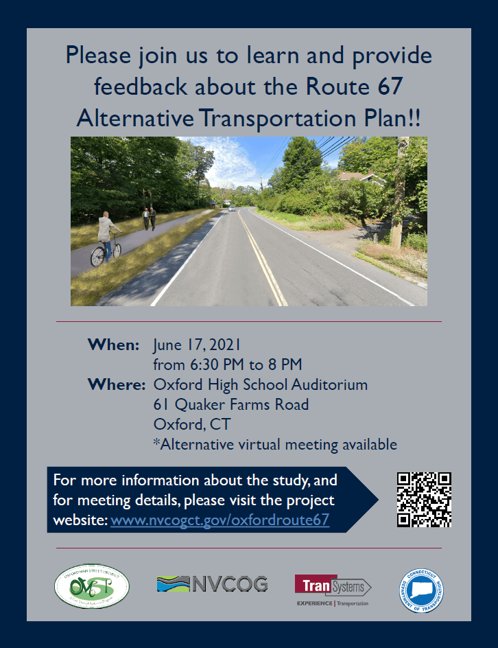
Oxford residents and business owners are invited to review and provide feedback on a Draft Oxford Route 67 Alternative Transportation Study report during a Public Information Meeting on June 17th, 2021, beginning at 6:30 p.m. in the Oxford High School auditorium.  The Draft report presents the existing conditions in the corridor along with recommendations for bicycle, pedestrian, and transit improvements. Project partners will present the draft plan and be available to take comments and answer questions at the June 17 meeting. An alternative virtual broadcast of the presentation will be available for those unable to attend in person.  The draft report and meeting details can be found on the study webpage at www.nvcogct.gov/oxfordroute67.

The Oxford Main Street Alternative Transportation Study has been underway since December 2019, investigating the potential for non-motorized transportation alternatives and transit in the Route 67 corridor between Seymour and Southford. Study partners collected and analyzed information about the existing conditions in the corridor, collected input from stakeholders and the public, and investigated potential bicycle, pedestrian, and transit improvements. The focus is to improve connections and transportation options to the Seymour sidewalk network, train station and Naugatuck River Greenway Trail to the south, and the Larkin Bridle Trail to the north, as well as to all the businesses, services, green spaces, and residential areas within the corridor.  The potential for transit service was also investigated, focusing on connections to services and major residential and commercial centers and to surrounding communities.

The Oxford Main Street Project Committee is overseeing the project, and it builds on previous work the committee has undertaken to improve access to the Little River and natural resources along Route 67. The goal is to provide better access to the businesses and natural resources throughout the corridor.  The final report will provide a cohesive plan for the entire corridor to better enable the Town to plan, prioritize, and fund future improvements. The Naugatuck Valley Council of Governments (NVCOG) is funding the project with federal transportation planning funds.  TranSystems Corporation, a planning and engineering consultant with offices in Meriden, CT is the project consultant.  A final report, incorporating comments from stakeholders and the public, will be published this summer.

Oxford’s Plan of Conservation and Development prioritized creating more of a downtown feel along Route 67. Unlike many of its neighbors, Oxford does not have a typical walkable New England downtown or Main Street.

Instead, municipal and commercial areas are dispersed along with residences along State Route 67. While Route 67 fundamentally functions as Oxford’s “Main Street,” it currently has no sidewalks or safe bicycle or pedestrian access.  In addition, there is currently no public transit currently operated along Route 67 providing residents an alternative transportation option.  Transit options by train on Metro North and by bus on CT Transit are available only one mile from the Oxford town line, but there is currently no way for Oxford residents to safely access these services without a personal motor vehicle.

Oxford First Selectman George Temple explained that “Oxford residents have voiced support for pedestrian and bicycle access along the Little River and Route 67. This study allows us to make progress toward that goal, and to give the public a chance to help guide and contribute to future efforts”.

TranSystems Project Manager Casey Hardin said that “This is the time for area residents to provide input on the planning for this important municipal resource. The study includes recommendations to improve mobility options for bicyclists and pedestrians, as well as folks who would like options beyond their automobile”.

Naugatuck River Greenway Updates

Naugatuck river Greenway in Beacon Falls

There have been some recent developments in planning and construction of the Naugatuck River Greenway Trail and other region multiuse trails.

NRG Trails Priority Projects Identified

On March 10, the Naugatuck River Greenway Steering Committee (NRGSC) endorsed updated NRG Trail Project Priorities.  The NRG Trail Project Priorities – March 2021 Report and accompanying Interactive Map, provide details about the seven identified priority sections and criteria used to identify them as such.  It also provides up to date information about the routing and status of all trail sections. 

Ansonia Riverwalk Sections 3 and 4 Construction Underway

Construction on Ansonia Riverwalk Segments 3 and 4, part of the NRG Trail, is underway.  The sections consist of a paved walkway on the existing levee embankment that will extend from South Main Street to the parking lot on the Target property on the East side of the Naugatuck River. There will be two rest areas with benches and one observation platform to view the natural habitat. Additional trees and landscaping improvements will be made at the main entrance adjacent to the Target parking lot. Schultz Corporation will be doing the construction and the project was designed by Luchs/DeCarlo and Doll. The project was funded through the Transportation Alternatives Set Aside Program.

Waterbury Phase I Delayed

The first NRG section in Waterbury along the Naugatuck River is going to be delayed a bit longer due to shortages of building material that stems from issues related to the COVID-19 pandemic, according to city officials. The City planned to start this spring on a 2.2-mile stretch of the pathway, which will eventually be part of of the City’s 7.5-mile section of NRG Trail. Now, Mayor Neil M. O’Leary expects to begin work in mid-June.

Improvements to Derby-Shelton Bridge Underway

Construction has commenced on a project to renovate and rehabilitate the Derby-Shelton Bridge. Improvements will include a connection between the NRG Trail in Derby and Shelton’s River Walk with the creation of a larger pedestrian space and a bi-directional cycle track to separate bicyclists from both vehicular traffic and pedestrians. 

Watertown Steele Brook Greenway Segment Funded

Funding has been awarded to Watertown for the construction of a section of Steele Brook Greenway, a multi-use trail in Watertown. This project will connect two existing sections of trail and construct a new pedestrian bridge over Steele Brook near French Street. Watertown was awarded federal funding for the project under the Transportation Alternatives Set Aside Program. The project has not yet been initiated.

Visit our Naugatuck River Greenway page for more information.