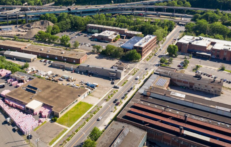
318 N. Main St, Southington Remediation Meeting

Former Beaton & Corbin Site
Cleanup of 318 North Main Street, Southington, CT
Community Relations PlanAnalysis of Brownfields Clean-up Alternatives


318 North Main LLC. has received a loan through the Naugatuck Valley Council of Governments (NVCOG) EPA Brownfields Revolving Fund. Loan funding will be applied to eligible remediation activities at 318 North Main Street, Southington. The borrower intends to remediate and redevelop the site as proposed office space.

The Licensed Environmental Professional (LEP) engaged for the project has developed a draft Analysis of Brownfields Clean-up Alternatives (ABCA) and a draft Community Relations Plan (CRP). The draft ABCA and CRP are available for public review and written comments above.

Written comments regarding the ABCA & CRP may be submitted via email or  U.S. Postal Service to Ricardo Rodriguez (rrodriguez@nvcogct.gov), NVCOG, 49 Leavenworth Street, Third Floor, Waterbury, CT 06702.

Oxford Route 67 Study Public Information Meeting and Public Input Opportunities

For Immediate Release: September 22, 2020

Contacts:
Aaron Budris
Naugatuck Valley Council of Governments
203-757-0535
abudris@nvcogct.org

Oxford Main Street Committee Announces Public Information Meeting

and Seeks Public Input on the Oxford Route 67 Alternative Transportation Study

The Oxford Main Street Project (OMSP) Committee has announced a virtual public meeting on October 8th at 7pm to hear about plans and progress along Route 67, and to provide input about ongoing projects. You can find meeting specifics at www.nvcogct.gov/event/oxfordmainstreet. The OMSP Committee has been working to make the Route 67 and Little River corridor pedestrian and bicycle friendly, and to provide better access to the businesses and natural resources throughout the corridor. In order to better inform and engage with the public on their progress, the committee has kicked off a new project visibility campaign to include enhanced public outreach and opportunities for residents to provide feedback. The Committee has started a new Facebook group that has grown to over 250 members, and residents are encouraged to join. Information about the OMSP Committee can be found at www.oxford-ct.gov/main-street-project-committee.

The OMSP Committee is overseeing the Oxford Route 67 Alternative Transportation Study that will be highlighted at the October 8th Meeting. The Study is building on the committee’s prior work to develop a cohesive plan for the entire corridor to better enable the Town to plan, prioritize, and fund future improvements. The planning study is being funded by the Naugatuck Valley Council of Governments (NVCOG) with federal transportation planning funds and is being conducted by TranSystems Corporation, a planning and engineering consultant with offices in Meriden, CT. The study is expected to be completed in Summer, 2021, when a report detailing final recommendations will be published.

Throughout the spring and summer, study partners collected and analyzed information about the existing conditions in the corridor, and they have begun investigating potential bicycle, pedestrian and transit improvements. The focus of these potential improvements will be to improve connections and transportation options to the Seymour sidewalk network, train station and Naugatuck River Greenway Trail to the south, and the Larkin Bridle Trail to the north, as well as to all of the businesses, services, green spaces, and residential areas within the corridor. The potential for transit service is also being investigated, focusing on connections to services and major residential and commercial centers and to surrounding communities.

While the Covid-19 Pandemic has altered public outreach for the study, there will still be numerous opportunities for residents and businesses to provide input. Public input will be gathered at and following the Virtual public Meeting on October 8th and comments can be left at any time through the study webpage at www.nvcogct.gov/oxfordroute67. Residents and business owners are also encouraged to complete a short survey that can be found on the webpage.

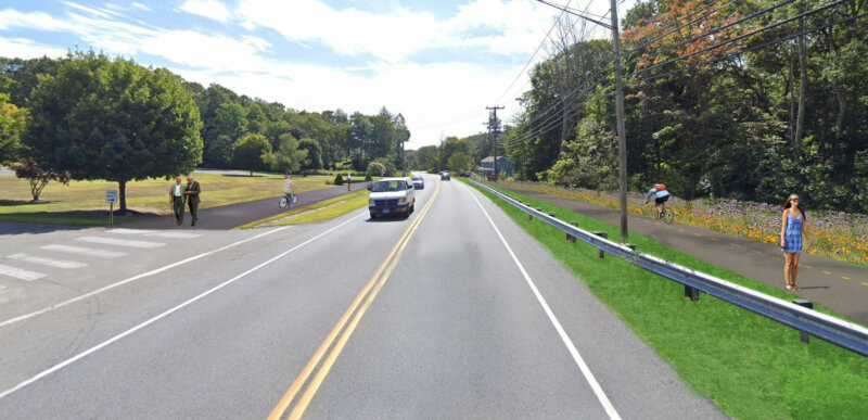
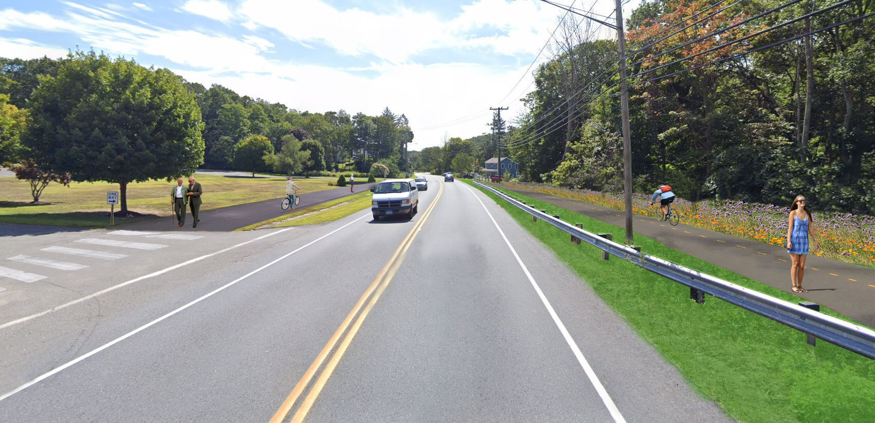
Oxford prioritized creating more of a downtown feel along Route 67 in the Town’s Plan of Conservation and Development. Unlike many of its neighbors, Oxford does not have a typical walkable New England downtown or Main Street. Instead, municipal and commercial areas are dispersed along with residences along State Route 67. Although Route 67 is fundamentally Oxford’s “Main Street,” it currently has no sidewalks or any safe bicycle or pedestrian access, and traffic speeds can be excessive with no visual cues to alert motorists that they are driving through an area where they may encounter walkers or bicyclists. In addition, no public transit is operated along Route 67 that could provide residents an alternative transportation option. Transit options by train on Metro North and by bus on CT Transit are available only one mile from the Oxford town line, but there is currently no way for Oxford residents to safely access these services without a personal motor vehicle.

Kathleen O’Neil, Oxford Grant Administrator and Chair of the Oxford Main Street Committee explained that “Oxford residents have said they want pedestrian and bicycle access along the Little River and Route 67. We are very excited to share progress toward that goal, and to give the public a chance to help guide and contribute to future work”.

Discussing the Oxford Route 67 Alternative Transportation Study, TranSystems Project Manager Casey Hardin said that, “This is a tremendous opportunity to build off the excellent work that the Oxford Main Street Committee has completed over the last several years. We are aiming to create a multimodal master plan for the corridor that can encourage sustainable transportation and growth in the Town for years to come.”

Artist rendering of possible revisions to Oxford’s Route 67/Little River Corridor. Residents will have the opportunity to provide feedback and learn details of plans for the corridor during an October 8 virtual meeting.

Public Comment Period Has Opened for the Draft 2021-2024 CNVMPO TIP

Road work ahead sign

The public comment period has opened for the Draft 2021-2024 Central Naugatuck Valley Metropolitan Planning Organization Transportation Improvement Program (CNVMPO TIP). The TIP lists all proposed highway and transit improvement projects programmed to receive federal financial assistance from the US Department of Transportation – Federal Highway Administration and Federal Transit Administration – over the next four federal fiscal years. The MPO’s TIP conforms to the State Transportation Improvement Program (STIP) being developed by the Connecticut Department of Transportation. The CTDOT has completed the air quality assessment of the draft TIP and the results of the analyses are also available for review and comment.

A forty-five (45) day review and comment period has been established, beginning on August 24, 2020, and ending on October 9, 2020. The public is welcomed and encouraged to review and comment on the MPO’s draft TIP and air quality analyses.

The TIP is expected to require about $1,113.9 million to implement over the next four years. This funding requirement includes regional (specific projects located in one of the fifteen municipalities in the Central Naugatuck Valley MPO area), statewide, and multi-region projects. Project located wholly within the CNV planning area accounts for $70.4 million of this total value. The complete list of projects is available in the CNVMPO TIP.

The public is invited to attend and offer comments on the draft TIP and air quality conformity documents at the virtual CNVMPO meeting to be held on October 9th at 10:00 AM. A virtual public information meeting to be held on September 16th at 5:00 PM. Agency and CTDOT staff will be available to informally discuss any aspects relating to the draft TIP/STIP, air quality conformity determinations, and any other transportation issues and concerns. All documents and additional information is being made available here.

NVCOG and NRG Steering Committee Endorse NRG Trail Routing Feasibility Study Report

The report detailing methods and findings of the Naugatuck River Greenway (NRG) Trail Thomaston to Torrington Routing and Feasibility Study was endorsed unanimously by the NVCOG Board at its regular meeting on May 8th.  The report was also endorsed by the NRG Steering Committee (NRGSC) on May 13thThe final report and appendices can be reviewed on the project web page:  https://nvcogct.gov/nrg-thomaston-to-torrington-routing-study  

The project study area detailed in the report spans approximately 11 miles of the Naugatuck Valley from Bogue Road in Torrington to a section of trail under design adjacent to the Water Pollution Control facility on Old Waterbury Road in Thomaston.  The goals of the high level planning project, conducted by BSC Group of Glastonbury, CT, were to catalog existing conditions in the project corridor, inventory and assess all potential multi-use trail routes, identify a preferred route with input from stakeholders and the public, and develop conceptual designs, cost estimates and phasing recommendations to assist with future trail development. The intent of the project was to provide decision-makers with the information they would need to seek funding for the design and construction of NRG trail projects.

A Draft Report was published on the NVCOG website for a 30-day public comment period ending on March 13th Nearly 400 public comments were received, most of which were from self-identified off-highway-vehicle (OHV) riders and were focused on fears that the study represented efforts to eliminate or disrupt use of the OHV area at Thomaston Dam.  Responses to comments are detailed in Appendix H of the final draft report  NVCOG staff presented the comments and the project team’s responses to them at both the NVCOG and NRGSC meetings prior to endorsement.  

Concerns regarding potential impact to the OffHighway Vehicle (OHV) area at the US Army Corps of Engineers (USACE) managed Thomaston Dam were well represented in an earlier round of public comments as well.  Iresponse, the project team met several times with USACE staff and OHV representatives to address those issues. These additional meetings and the Study Team’s responses to their concerns are detailed in the report.  A route was developed that avoids the OHV area to the greatest extent possible. For a 2-mile corridor section where there was no viable alternative, a trail concept along Old Route 8 on USACE land where OHVs are currently permitted (but do not have exclusive use) was developed.  The concept presented in the report was developed collaboratively with the USACE and OHV representatives to safely separate motorized and non-motorized uses without negative impact to current OHV traffic flow.  It provides for the safe use of the Thomaston Dam Recreation Area by all currently permitted user groups while providing a critical connection for the NRG trail.  It is noted that if a trail were to be developed, managed or maintained through the Thomaston Dam area it would be the responsibility of the USACE either directly or through future agreements with outside groups. 

Stakeholders were involved throughout the project including chief elected officials and staff from the municipalities of Torrington, Litchfield, Harwinton and Thomaston along with representatives from the US Army Corps of Engineers, NVCOG, NHCOG, the Naugatuck River Greenway Steering Committee, The Railroad Museum of New England, and several property owners along the route.  The preferred route presented in the report was selected by a project steering committee consisting of officials from the involved municipalities and other stakeholders.    

NVCOG, in partnership with the Northwest Hills Council of Governments (NHCOG), received a Transit Oriented Development and Smart Growth grant from the Connecticut Office of Policy and Management (OPM) to conduct the study. The NVCOG and NHCOG oversaw the project.   

Final Draft of the Naugatuck River Greenway Trail Routing Feasibility Study Report Posted

The final draft of the report detailing  methods and findings of the Naugatuck River Greenway (NRG) Trail Thomaston to Torrington Routing and Feasibility Study has been published on the NVCOG websiteThe report and appendices can be reviewed on the project web page:  https://nvcogct.gov/nrg-thomaston-to-torrington-routing-study  


The project area detailed in the report spans approximately 11 miles of the Naugatuck Valley from Bogue Road in Torrington to a section of trail under design adjacent to the Water Pollution Control facility on Old Waterbury Road in Thomaston.  The goals of the high level planning project, conducted by BSC Group of Glastonbury, CT, were to catalogue existing conditions in the project corridor, inventory and assess all potential multiuse trail routes, identify a preferred route with input from stakeholders and the public, and develop conceptual designs, cost estimates and phasing recommendations to assist with future trail development. The intent of the project was to determine the opportunities for constructing the NRG Trail, identify the strengths and constraints of each possible route, and provide decision-makers with the information they would need when deciding whether or not to advance a section of the trail 


A Draft Report was published on the NVCOG website for a 30-day public comment period ending on March 13th Nearly 400 public comments were received, most of which were from self-identified off-highway-vehicle (OHV) riders and were focused on fears that the study represented efforts to eliminate or disrupt use of the OHV area at Thomaston Dam.  Responses to comments are detailed in Appendix H of the final draft report  


Concerns regarding potential impact to the OffHighway Vehicle (OHV) area at the US Army Corps of Engineers (USACE) managed Thomaston Dam were well represented in an earlier round of public comments as well.  Iresponse, the project team met several times with USACE staff and OHV representatives to address those issues. These additional meetings and the Study Team’s responses to their concerns are detailed in the report.  A route was developed that avoids the OHV area to the greatest extent possible. For a 2-mile corridor section where there was no viable alternative, a trail concept along Old Route 8 on USACE land where OHVs are currently permitted (but do not have exclusive use) was developed.  The concept presented in the report was developed collaboratively with the USACE and OHV representatives to safely separate motorized and non-motorized uses without negative impact to current OHV traffic flow.  It provides for the safe use of the Thomaston Dam Recreation Area by all currently permitted user groups while providing a critical connection for the NRG trail.  It is noted that if a trail were to be developed, managed or maintained through the Thomaston Dam area it would be the responsibility of the USACE either directly or through future agreements with outside groups. 


Stakeholders were involved throughout the project including chief elected officials and staff from the municipalities of Torrington, Litchfield, Harwinton and Thomaston along with representatives from the US Army Corps of Engineers, NVCOG, NHCOG, the Naugatuck River Greenway Steering Committee, The Railroad Museum of New England, and several property owners along the route.  The preferred route presented in the report was selected by a project steering committee consisting of officials from the involved municipalities and other stakeholders.    


NVCOG, in partnership with the Northwest Hills Council of Governments (NHCOG), received a Transit Oriented Development and Smart Growth grant from the Connecticut Office of Policy and Management (OPM) to conduct the study. The NVCOG and NHCOG oversaw the project.   

Update on NVCOG Staff Operations

In response to the COVID-19 public health emergency, and in accordance with Governor Lamont’s directives, most of the employees of NVCOG will be working from home for the next two weeks, beginning Monday, March 16, 2020. Individual staff members may still be reached directly via their direct-dial numbers or by using the company directory. Messages left at our main phone number, (203) 757-0535, are being actively monitored and will be returned as quickly as possible. All staff email accounts are active and being monitored as they normally are. Status updates will be posted on our website www.nvcogct.gov and our Social Media outlets.

DRAFT Naugatuck River Greenway Trail Routing Feasibility Study Report Published for Public Comment

The Naugatuck Valley Council of Governments (NVCOG) has published a draft report detailing the methods and findings of the Naugatuck River Greenway Trail Thomaston to Torrington Routing Feasibility Study. Public comments will be accepted at the project webpage through March 13th, 2020.

The project area detailed in the report spans approximately 11 miles of the Naugatuck Valley from Bogue Road in Torrington to a section of trail under design adjacent to the Water Pollution Control facility on Old Waterbury Road in Thomaston. The goals of the project, being conducted by BSC Group of Glastonbury, CT, were to catalogue existing conditions in the project corridor, inventory and assess all potential multiuse trail routes, identify a preferred route with input from stakeholders and the public, and develop conceptual designs, cost estimates and phasing recommendations to assist with future trail development.

BSC and project partners inventoried all potential trail routes, including points of interest and environmental constraints along the way, and documented property ownership and stakeholder preferences and concerns. This information was used to narrow down prospective routes to those that were most feasible. Public input on various potential routing options was solicited at a series of public information meetings held in February and March 2019 in Harwinton, Litchfield and Torrington. Comments received at those meetings and during a public comment period that followed, helped refine and identify a preferred route that is presented in the report. The preferred route was selected by a project steering committee consisting of officials from the involved municipalities and other stakeholders.

Concerns regarding potential impact to the Off Highway Vehicle (OHV) area at the US Army Corps of Engineers (USACE) managed Thomaston Dam were well represented in public comments. The project team met several times with USACE staff and OHV representatives to address those issues. A compromise route was developed that avoids the OHV area to the greatest extent possible, and a trail concept along Old Route 8 was developed collaboratively between project partners, the USACE and OHV representatives that would safely separate motorized and non-motorized uses without negative impact to current OHV traffic flow.

Stakeholders were involved throughout the project including chief elected officials and staff from the municipalities of Torrington, Litchfield, Harwinton and Thomaston along with representatives from the US Army Corps of Engineers, NVCOG, NHCOG, the Naugatuck River Greenway Steering Committee, The Railroad Museum of New England, and several property owners along the route.

The NRG corridor has been officially designated as a greenway by the CT Greenways Council and the CT Department of Energy and Environmental Protection (DEEP). The entire NRG Trail is identified as a trail of statewide significance in the Connecticut Recreational Trails Plan, and was designated as one of 101 America’s Great Outdoors projects in 2011 by the U. S. Department of the Interior. An Economic Impact Study conducted by NVCOG in 2017 estimated that there would be substantial economic, health and community benefits of constructing the trail. The overall planned NRG trail route will follow the river for 44 miles, bringing it through parts of Torrington, Litchfield, Harwinton, Thomaston, Watertown, Waterbury, Naugatuck, Beacon Falls, Seymour, Ansonia and Derby. To date, trail sections have been constructed and are open to the public in Torrington, Watertown, Naugatuck, Beacon Falls, Seymour, Ansonia and Derby. Municipalities along the NRG Trail route are heading up the development of the trail locally, often funded with state and federal grants. For trail segments on federal land at Thomaston Dam, the USACE would be responsible for any trail development.

“The project team studied the corridor in detail, and worked hard to incorporate public and stakeholder desires and concerns in the preferred route and report,” said Bill Paille, Transportation Engineer at BSC Group. “The preferred route presented in the report is designed to meet each community’s long term goals and the information provided in the report will ensure that decisions made about NRG Trail development in the future will be well informed.”

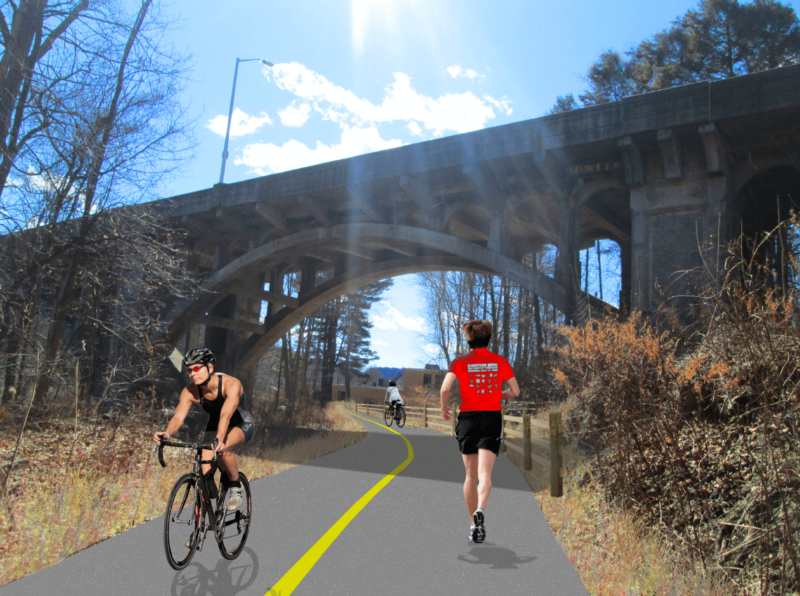
The report includes information about the NRG Trail and the purpose of the study, along with a detailed explanation of the methods used by the project team. For each of seven corridor sections, it includes a description of existing conditions, summary of all routes investigated, and narrative and map of the preferred route. Cost estimates, phasing recommendations, and other pertinent information about the preferred route are presented, and a chapter about trail development considerations provides information to assist municipalities planning and developing trail sections in the future.

NVCOG, in partnership with the Northwest Hills Council of Governments (NHCOG), received a Responsible Growth and Transit Oriented Development grant from the Connecticut Office of Policy and Management (OPM) to conduct the study. The NVCOG and NHCOG are overseeing the project.

More information can be found, and comments can be submitted at:
https://nvcogct.gov/project/current-projects/naugatuck-river-greenway/nrg-thomaston-to-torrington-routing-study/

NVCOG Applies For Two Regional Performance Incentive Program (RPIP) Grants

The State of Connecticut Office of Policy and Management was accepting applications for the FY 2020 Regional Performance Incentive Program grant round up until December 31, 2019.  NVCOG  submitted the following applications:

NVCOG is also included in a Multi-COG project that was submitted by WestCOG.

Funding for RPIP grants is provided under CGS Section 4-66k using a portion of the hotel and car rental taxes.


Public Information Meeting: Waterbury-Oxford Airport Master Plan Update

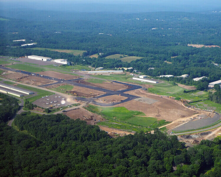
Aerial of Waterbury-Oxford Airport

NOTICE IS HEREBY GIVEN that the Connecticut Airport Authority (CAA) will be holding a Public Information Meeting for the Waterbury-Oxford Airport Master Plan Update. The meeting will include both a presentation and an opportunity for the public to ask questions and provide comments.

The public information meeting will be on Wednesday, December 11, 2019, from 6 pm to 8 pm at the Wyndham Southbury, 1284 Strongtown Road, Southbury, CT 06488.

The presentation will include an introduction to the master planning process, an overview of the airport’s facilities and operational environment, and a summary of the goals and potential facility improvements that serve as the focus of the master plan.

A second public meeting will be held later in the planning process, following the release of the draft master plan report.

For additional information please visit Waterbury-Oxford-Planning.com.