The Naugatuck River Greenway Thomaston to Torrington Routing Feasibility Study Report was endorsed by the Northwest Hills COG Board on December 10, 2021, by the NVCOG Board on May 8, 2020, and by the Naugatuck River Greenway Steering Committee on May 13, 2020.
Where should the Naugatuck River Greenway (NRG) Trail be developed between Torrington and Thomaston?
The NRG Trail Thomaston to Torrington Routing Feasibility Study was conducted to answer that question. In 2018 and 2019, study partners investigated environmental conditions and potential trail route options throughout the corridor, and talked with stakeholders and the public to help determine a preferred route for the NRG trail. The goal of the study was to identify a single preferred route for the NRG Trail through field investigation and public and stakeholder engagement, and to develop project phasing with cost estimates in preparation for future funding opportunities.
Final Report

Report Appendices
The study was conducted by the BSC Group in partnership with NVCOG, The Northwest Hills Council of Governments (NHCOG), the City of Torrington and the Towns of Litchfield, Harwinton and Thomaston. The study was funded by a Responsible Growth and Transit Oriented Development grant from the Connecticut Office of Policy and Management (OPM), supplemented by funding from CT DOT and FHWA.
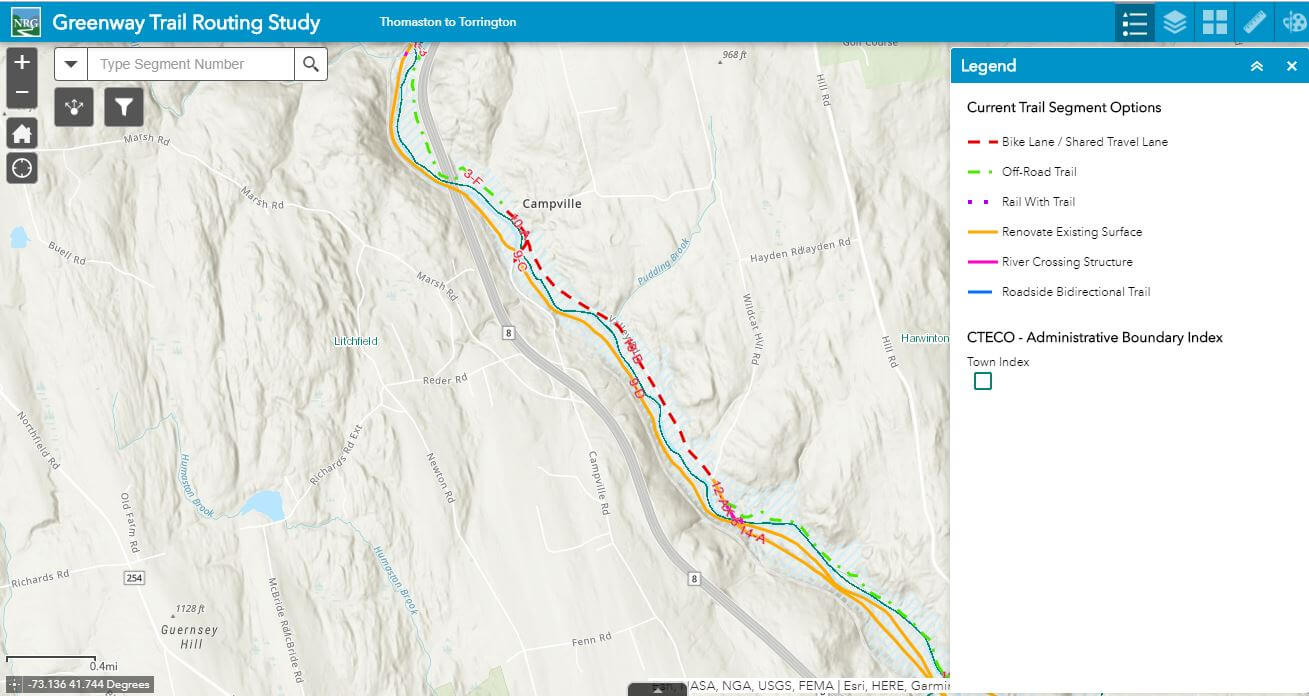
Explore the Project Area
The interactive Project Webmap allows users to explore the project corridor and preferred route in greater detail by turning on and off various data layers that informed the study.
Staff contact:
Aaron Budris
Environmental Planning Director
abudris@nvcogct.gov