The New Mix: A Long-term Plan for the I-84 & Route 8 “Mixmaster” Interchange

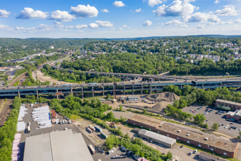
Aerial photo of the Mixmaster from the train station

An introduction of future plans to local leaders for what is locally known as the “Mixmaster” in Waterbury from HNTB and CTDOT. The presentation includes a brief history of the Mixmaster, what has been completed thus far, the analysis of options to move forward, and how the public will be involved.

Watch a recording of this presentation on the NVCOG YouTube Channel.

This does not discuss the rehabilitation work that is currently being completed.


Public Information Meeting Scheduled for the Oxford Route 67 Alternative Transportation Plan

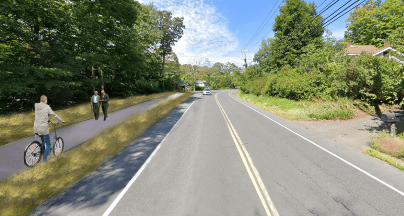
Oxford residents and business owners are invited to review and provide feedback on a Draft Oxford Route 67 Alternative Transportation Study report during a Public Information Meeting on June 17th, 2021, beginning at 6:30 p.m. in the Oxford High School auditorium.  The Draft report presents the existing conditions in the corridor along with recommendations for bicycle, pedestrian, and transit improvements. Project partners will present the draft plan and be available to take comments and answer questions at the June 17 meeting. An alternative virtual broadcast of the presentation will be available for those unable to attend in person.  The draft report and meeting details can be found on the study webpage at www.nvcogct.gov/oxfordroute67.

The Oxford Main Street Alternative Transportation Study has been underway since December 2019, investigating the potential for non-motorized transportation alternatives and transit in the Route 67 corridor between Seymour and Southford. Study partners collected and analyzed information about the existing conditions in the corridor, collected input from stakeholders and the public, and investigated potential bicycle, pedestrian, and transit improvements. The focus is to improve connections and transportation options to the Seymour sidewalk network, train station and Naugatuck River Greenway Trail to the south, and the Larkin Bridle Trail to the north, as well as to all the businesses, services, green spaces, and residential areas within the corridor.  The potential for transit service was also investigated, focusing on connections to services and major residential and commercial centers and to surrounding communities.

The Oxford Main Street Project Committee is overseeing the project, and it builds on previous work the committee has undertaken to improve access to the Little River and natural resources along Route 67. The goal is to provide better access to the businesses and natural resources throughout the corridor.  The final report will provide a cohesive plan for the entire corridor to better enable the Town to plan, prioritize, and fund future improvements. The Naugatuck Valley Council of Governments (NVCOG) is funding the project with federal transportation planning funds.  TranSystems Corporation, a planning and engineering consultant with offices in Meriden, CT is the project consultant.  A final report, incorporating comments from stakeholders and the public, will be published this summer.

Oxford’s Plan of Conservation and Development prioritized creating more of a downtown feel along Route 67. Unlike many of its neighbors, Oxford does not have a typical walkable New England downtown or Main Street.

Instead, municipal and commercial areas are dispersed along with residences along State Route 67. While Route 67 fundamentally functions as Oxford’s “Main Street,” it currently has no sidewalks or safe bicycle or pedestrian access.  In addition, there is currently no public transit currently operated along Route 67 providing residents an alternative transportation option.  Transit options by train on Metro North and by bus on CT Transit are available only one mile from the Oxford town line, but there is currently no way for Oxford residents to safely access these services without a personal motor vehicle.

Oxford First Selectman George Temple explained that “Oxford residents have voiced support for pedestrian and bicycle access along the Little River and Route 67. This study allows us to make progress toward that goal, and to give the public a chance to help guide and contribute to future efforts”.

TranSystems Project Manager Casey Hardin said that “This is the time for area residents to provide input on the planning for this important municipal resource. The study includes recommendations to improve mobility options for bicyclists and pedestrians, as well as folks who would like options beyond their automobile”.

PUBLIC NOTICE – MAP Forum Spring Web Meeting, June 10, 2021

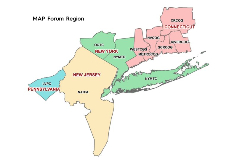
Map of MAP Forum
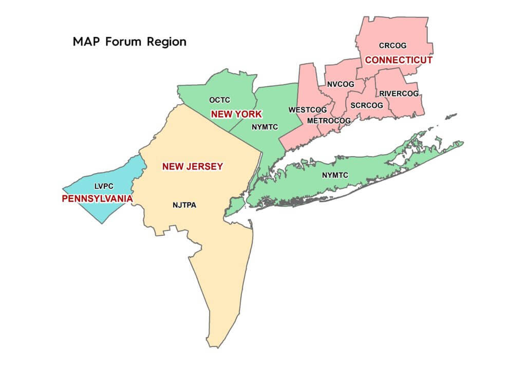
Map of MAP Forum

The Metropolitan Area Planning (MAP) Forum announces its 2021 Spring Meeting on Thursday June 10, 2021 at 10:30 am. Due to the current public health emergency, this meeting will be held as a web meeting and will be hosted by the Lehigh Valley Planning Commission.

To register, please RSVP via Eventbrite at https://www.eventbrite.com/e/2021-spring-web-meeting-of-the-metropolitan-area-planning-map-forum-tickets-157240678101 The meeting agenda appears below.

Agenda

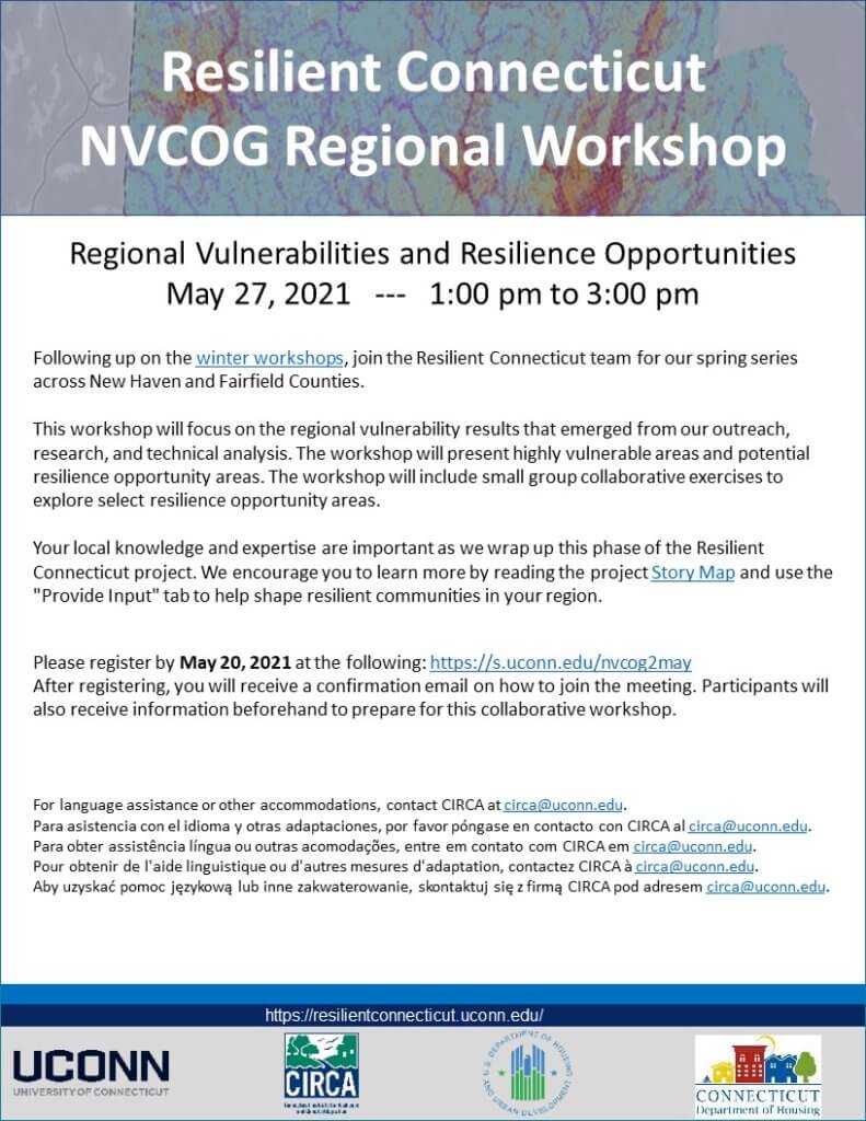
Resilient Connecticut NVCOG Regional Spring Workshop

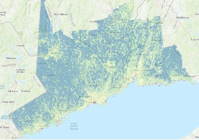
Resilient CT map

Regional Vulnerabilities and Resilience Opportunities

Following up on the winter workshops, join the Resilient Connecticut team for their spring series across New Haven and Fairfield Counties.

This workshop will focus on the regional vulnerability results that emerged from their outreach, research, and technical analysis. The workshop will present highly vulnerable areas and potential resilience opportunity areas. The workshop will include small group collaborative exercises to explore select resilience opportunity areas.

Your local knowledge and expertise are important as they wrap up this phase of the Resilient Connecticut project. We encourage you to learn more by reading the project’s story map and use the “Provide Input” tab to help shape resilient communities in our region.

Please register by May 20, 2021, at the following: https://s.uconn.edu/nvcog2may.
After registering, you will receive a confirmation email on how to join the virtual meeting. Participants also receive information beforehand to prepare for this collaborative workshop.Resilient CT Second NVCOG Workshop

For language assistance or other accommodations, contact CIRCA at circa@uconn.edu.
Para asistencia con el idioma y otras adaptaciones, por favor póngase en contacto con CIRCA al circa@uconn.edu.
Para obter assistência língua ou outras acomodações, entre em contato com CIRCA em circa@uconn.edu.
Pour obtenir de l’aide linguistique ou d’autres mesures d’adaptation, contactez CIRCA à circa@uconn.edu.
Aby uzyskać pomoc językową lub inne zakwaterowanie, skontaktuj się z firmą CIRCA pod adresem circa@uconn.edu

Naugatuck River Greenway Updates

Naugatuck river Greenway in Beacon Falls

There have been some recent developments in planning and construction of the Naugatuck River Greenway Trail and other region multiuse trails.

NRG Trails Priority Projects Identified

On March 10, the Naugatuck River Greenway Steering Committee (NRGSC) endorsed updated NRG Trail Project Priorities.  The NRG Trail Project Priorities – March 2021 Report and accompanying Interactive Map, provide details about the seven identified priority sections and criteria used to identify them as such.  It also provides up to date information about the routing and status of all trail sections. 

Ansonia Riverwalk Sections 3 and 4 Construction Underway

Construction on Ansonia Riverwalk Segments 3 and 4, part of the NRG Trail, is underway.  The sections consist of a paved walkway on the existing levee embankment that will extend from South Main Street to the parking lot on the Target property on the East side of the Naugatuck River. There will be two rest areas with benches and one observation platform to view the natural habitat. Additional trees and landscaping improvements will be made at the main entrance adjacent to the Target parking lot. Schultz Corporation will be doing the construction and the project was designed by Luchs/DeCarlo and Doll. The project was funded through the Transportation Alternatives Set Aside Program.

Waterbury Phase I Delayed

The first NRG section in Waterbury along the Naugatuck River is going to be delayed a bit longer due to shortages of building material that stems from issues related to the COVID-19 pandemic, according to city officials. The City planned to start this spring on a 2.2-mile stretch of the pathway, which will eventually be part of of the City’s 7.5-mile section of NRG Trail. Now, Mayor Neil M. O’Leary expects to begin work in mid-June.

Improvements to Derby-Shelton Bridge Underway

Construction has commenced on a project to renovate and rehabilitate the Derby-Shelton Bridge. Improvements will include a connection between the NRG Trail in Derby and Shelton’s River Walk with the creation of a larger pedestrian space and a bi-directional cycle track to separate bicyclists from both vehicular traffic and pedestrians. 

Watertown Steele Brook Greenway Segment Funded

Funding has been awarded to Watertown for the construction of a section of Steele Brook Greenway, a multi-use trail in Watertown. This project will connect two existing sections of trail and construct a new pedestrian bridge over Steele Brook near French Street. Watertown was awarded federal funding for the project under the Transportation Alternatives Set Aside Program. The project has not yet been initiated.

Visit our Naugatuck River Greenway page for more information.

Work to Begin on the Derby-Shelton Bridge

Derby Shelton Bridge design

Renovation work on the Derby-Shelton Bridge is moving forward, as the state has tapped a contractor for the project which should begin by April 1. The bridge was built in 1918 and is historically significant. While the substructure is in good condition, many elements have deteriorated over time, including the pavement structure, parapet walls, and lighting.  

The intent of the project is to renovate and rehabilitate the elements along the top of the bridge and enhance the bridge’s aesthetics. Because it connects two downtowns, there is an opportunity to improve not only its function but also its form and create an aesthetically pleasing public space for pedestrians and bicyclists. The project limits extend from the intersection with Route 34 (Main Street) in Derby to the west end of the Derby-Shelton Bridge and includes the connections to Canal Street.  This is part of a series of improvements along the Route 34 corridor in recent years.

The $6.3 million contract was awarded to Mohawk Northeast, Inc. Construction. The bid was almost $1.5 million below its pre-bid estimate on the work, completion of which should be December 2023.

Please visit this project’s webpage for more information.

April Household Hazardous Waste Collection Event

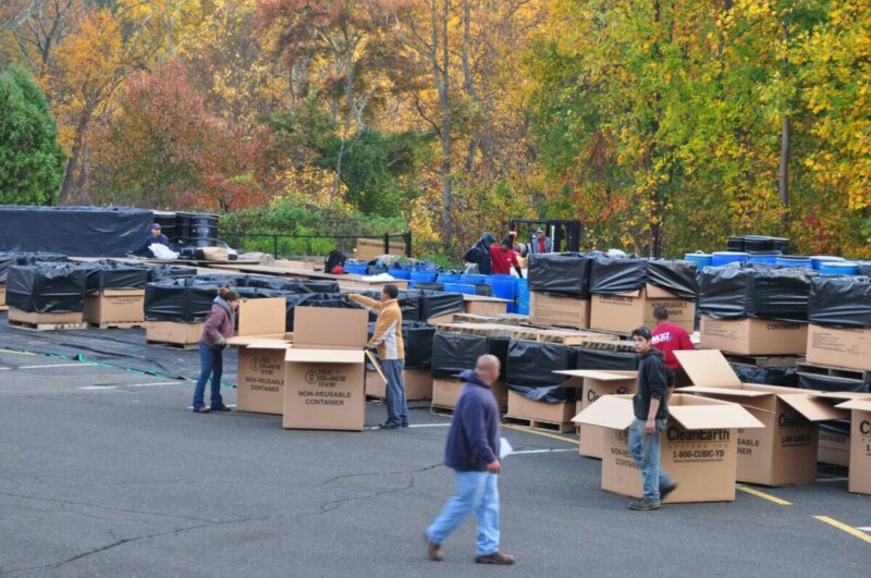
NVCOG is hosting Household Hazardous Waste (HHW) and Paint Collection Day on Saturday, April 17, 2021This is the first event currently scheduled in 2021.

The event goes from 8:00 am to 2:00 pm at Naugatuck Events Center, 6 Rubber Avenue in Naugatuck.

NVCOG’s HHW events only serve the towns of Ansonia, Beacon Falls, Bethlehem, Cheshire, Derby, Middlebury, Naugatuck, Oxford, Prospect, Seymour, Southbury, Thomaston, Waterbury, Watertown, Wolcott, and Woodbury.

For future updates on this program, visit NVCOG’s HHW webpage as well as information on how to properly dispose of common household items. Also look for postings on NVCOG’s Facebook and Twitter page, as well as local and municipal websites for updates.

Household hazardous wastes are any wastes produced in the home that are poisonous, flammable, reactive, or corrosive. These wastes are harmful to human health and the environment if not disposed of properly. The goal of the program is to keep potentially hazardous waste out of local landfills and sewers, providing extra protection for wetlands and waterways.

Residents may now bring latex (water-based) paint to the collection event. While not considered hazardous waste, the latex paint is also accepted as part of the statewide paint product stewardship program.

New Survey for the West Main Street Corridor Study in Waterbury

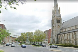
West Main Street going east facing the Green

NVCOG, in coordination with the City of Waterbury and the CT Department of Transportation, is studying the corridor of West Main Street from the underpass of Route 8 to the Waterbury Green. The intent of the study is to develop a deeper understanding of the challenges and opportunities of this stretch of road to develop solutions that improve safety for all users including pedestrians, cyclists, public transit riders, and drivers.

As part of this process, we’d like to gather feedback from the public to provide a unique perspective on how the roadway is currently used and how it could better serve your needs in the future.

Please answer the following questions and check out our project website for more information! https://www.westmainstudy.com/


Survey in English or Encuesta en Español


Bethlehem Organic Compost Facility Plans to be Aired

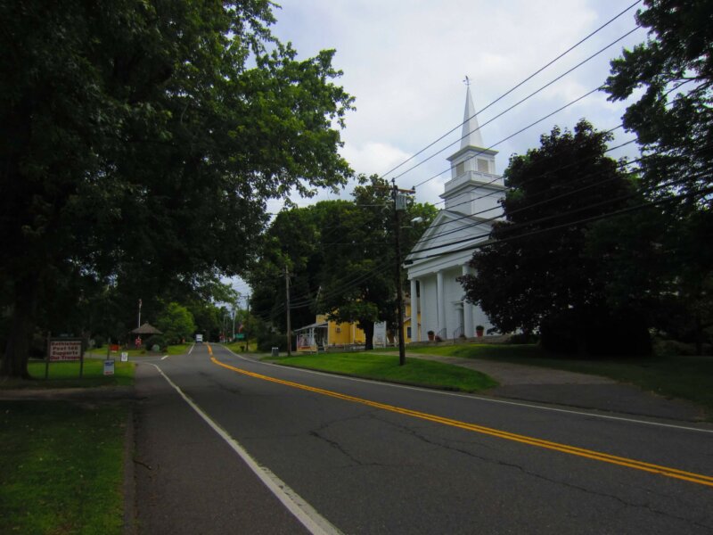
Main Street Bethlehem

Original Press Release

Posted on March 8, 2021

Residents in the next 60 days will have continued opportunities to voice their comments or concerns about an organic composting facility proposed on nearly 70 acres at 331 and 351 Main St. South.

The first is at a virtual town meeting, planned for March 23, at which voters will decide whether to adopt a noise ordinance, which was drafted in part as a response to citizens’ expressing apprehension about truck and machine sounds echoing from the facility.

In addition, a hearing is scheduled for April 27 on a revised application for a town permit to operate the facility. At this hearing residents can express their views about the plans from Grillo Services, LLC of Milford, developers of the site.

Town officials said that these are part of the necessary steps toward a decision on whether this business can create on the property various forms of mulch, top soil and other soil-related materials. They are sold on the bulk, commercial and residential markets.

The company plans on receiving trees, brush, leaves and demolition items that are separated for use or discarded.

Town and state permits are required for the composting and other plans for the property. None have been granted yet for this site because reviews are still underway.

Bethlehem First Selectman Leonard Assard said that the go-ahead to a town meeting for the noise ordinance came at Tuesday’s Board of Selectmen meeting.

A recent hearing on the ordinance — the first for this small community — produced questions about its effects on residents’ everyday lives and some opposition to putting more regulations on the community.

The local measure would apply to all businesses and residents in the town. In essence, it says people risk sanctions and a possible $100 maximum fine if noise reaches beyond property boundaries in excess of 55 decibels between 7 a.m. and 10 p.m., or in excess of 45 decibels between 10 p.m. and 7 a.m. This also applies to motor vehicles and there are exceptions.

“This ordinance is really designed for the constant noise that’s there all day long,” Assard said trying to reassure residents concerned about incidental noise, such as early-morning lawn mowing or excessively loud parties.

In those instances, the police would ask those responsible to stop or quiet down the noise, he said. Repeat offenders, however, could be slapped with a summons. A copy of the full ordinance is available on the town’s website at ci.bethlehem.ct.us Also meeting Tuesday evening, the town’s Inlands/

Wetlands Agency approved Grillo’s revised application for the permit.

Board Chairman Robert Smith said that this application, unlike an earlier submission, addressed missing issues. It has now been referred to the town’s engineering consultant, LandTech Consultants, Inc., of Westford, Mass., for a detailed analysis.

The board expects that the analysis will be completed for the April 27 hearing and for public review.

In accepting the revised permit application, Smith said that Grillo made certain adjustments and scaled back some of the plans. The full application with reports and maps runs about 600 pages and can be found under the March 2 Inland/ Wetlands Agency agenda on the town website.

For instance, the company at first wanted to include other areas of the property for potential expansion. However, that aspect has been removed based on the panel wanting to limit this permit to just the current proposed operational site, Smith said.

“They will need to come back if they want to do any expansion and go through this process again for review,” he said. Part of the company’s plans involve creating different colored mulch and chemicals are used in that process, the chairman said.

It has now included more storm water mitigation – also known as a “rain garden” – filtering areas close to water courses and property lines. This mitigation helps to sift debris, chemical waste and other solids from water as it moves deeper into soil, Smith said.

Nearby streams and other waterways drain into East Spring Brook that empties into the Watertown Fire District’s well fields, which help provide drinking water for sections of Watertown, he said.

“We want to make sure that it doesn’t get contaminated. That’s the biggest concern, the groundwater contamination for us. Groundwater eventually becomes drinking water,” Smith said.