PRESS RELEASE: Governor Lamont Announces State Grants To Protect 2,270 Acres of Open Space and Create Six New Community Green Spaces

Click here to access the press release from the office of Governor Ned Lamont

7/15/25

(HARTFORD, CT) – Governor Ned Lamont today announced that his administration is awarding $14.3 million in state funding to aid in the purchase and protection of more than 2,270 acres of open space through 25 properties in 22 towns and cities across Connecticut. Additionally, $725,353 is being awarded to support the creation of six new community green spaces.

These funds are being provided through the state’s Open Space and Watershed Land Acquisition Grant Program (OSWA) and the Urban Green and Community Gardens Grant Program (UGCG), both of which are administered by the Connecticut Department of Energy and Environmental Protection (DEEP).

“Open space is a big contributor to our great quality of life here in Connecticut, and we are excited to help all these communities improve access to the outdoors with these funds,” Governor Lamont said. “These community assets help our residents stay active and healthy by providing free recreational opportunities while also helping to improve air and water quality. Open space makes Connecticut a great place to live, work, and play.”

A Connecticut state law (C.G.S. Section 23-8) sets a goal of protecting 673,210 acres of the state’s land base (21%) as open space. It calls for 320,576 acres (10%) to be held by DEEP as part of the state’s system of parks, forests, fisheries, and natural resource management areas, and 352,634 acres (11%) to be acquired by DEEP’s partners, which include municipalities, nonprofit land conservation organizations, and water companies.

As of December 31, 2024, DEEP estimates that its partners held approximately 255,169 acres, or 72.4% of their share of the state’s open space goal, and that DEEP held approximately 263,969 acres or 82.34% of its share. In total, 519,138 acres have been preserved (77.11% of the total goal), leaving an additional 154,072 acres remaining to meet the 21% open space goal.

“Since the state’s open space program began in 1998, more than $190 million in state funding has been awarded to municipalities, nonprofit land conservation organizations, and water companies to assist in the protection of more than 48,000 acres of publicly accessible land,” DEEP Commissioner Katie Dykes said. “From large tracts of land to small pocket parks, this group of projects benefits a variety of communities across the state. DEEP is excited to see recent program changes bringing new communities and partners to the table.”

In recent years, DEEP and the state legislature have made changes to both programs to remove barriers to participation and enable more communities across the state to benefit. These updates include allowing OSWA applicants to seek reimbursement for incidental costs associated with land acquisition, expanding UGCG eligibility to nonprofit organizations, and extending UGCG eligibility to more communities across the state. This year, 10 of the 31 awardees across the two programs took advantage of recent program changes, and DEEP hopes those numbers will only increase in the years to come.

Today’s grants are the 27th grant round under both programs. DEEP has opened the application period for the 28th grant round for both programs, and the deadline to submit applications is November 3, 2025. For grant application materials and instructions, visit portal.ct.gov/deep/open-space/open-space.

The complete list of grants included in the 27th grant round for both programs is as follows:

Open Space and Watershed Land Acquisition Grants

Project Name: Fontanella Property
Sponsor: Town of Berlin
Location: 0 Chamberlain Highway, Berlin
Grant Amount: $61,750.00
Size: 15.74 Acres
Description: This 15.74-acre property has an address of 0 Chamberlain Highway in South Kensington. It is contiguous to the town’s 420-acre Blue Hills Conservation Area. The town will add a parking area by the south end of Summit Wood Drive, providing access to a scenic loop trail which the Town plans to connect to the Metacomet Trail, southerly of the subject. This acquisition expands the Blue Hills Conservation Area with additional scenic traprock ridgeline along the Metacomet Trail, which is part of a larger open space corridor from DEEP’s Hatchery Brook Conservation Area to the north, through Berlin and into Meriden.

Project Name: Hoppers-Birge Pond Nature Preserve Expansion
Sponsor: City of Bristol
Location: Perkins Street, Bristol
Grant Amount: $420,000.00 + $8,700.00 in incidental costs
Size: 10.69 Acres
Description: This 10-acre parcel is southerly of the town-owned Roberts Dog Park and westerly of the town’s Pigeon Hill Preserve (a prior OSWA grant) a/k/a Hoppers-Birge Pond Nature Preserve. This addition will contribute to the viewshed, the trail system and unique geology of the area. It contains essential elements of ridgeline (glacial esker) and hiking trails, as well as part of a large glacial formation known as a kettle (locally referred to as “Hoppers”). A section of the Old Colonial Road, an historic native American trail and colonial road, runs through the property. Several endangered and species of concern are present on the property.

Project Name: Killingworth Turnpike Open Space (Greystone Property)
Sponsor: Clinton Land Conservation Trust (CLCT)
Location: Killingworth Turnpike (CT Route 81), Clinton
Grant Amount: $103,350.00
Size: 23.57 Acres
Description: This 23.57-acre property adds to an existing 150-acre open space corridor. It is adjacent to property owned by Eversource and other CLCT protected open space. Indian River flows through the southwest portion of the property, and it is in the Indian River Watershed. Preservation of this property protects the inland wetland resources that contribute to Connecticut Water Company’s public water supply. CLCT plans to create a loop trail on this property which will pass through Eversource property and connect to other CLCT property and the designated parking area for this parcel. CLCT and Eversource are collaborating on the public access trail system. The property contains unique landscapes such as open areas with native grasses, rocky outcrops and a Class A waterbody, and is situated between two NDDB areas. It expands community access to large, uninterrupted natural areas and trails. The property abuts Route 81 along a public bus route, expanding access to visitors using public transportation.

Project Name: Cobble Forest
Sponsor: Cornwall Conservation Trust, Inc. (CCT)
Location: CT Route 128, Cornwall
Grant Amount: $122,200.00
Size: 41.78 Acres
Description: This forested and scenic ridgeline property contains Heffers Brook, a high-quality cold-water stream that flows into Mill Brook, a tributary of the Housatonic River. The property rises 330 feet from Heffers Brook along its frontage, up to the rocky slopes of The Cobble. This purchase will create a 332-acre forest block including CCT’s Day Preserve, Walker Preserve, and the Housatonic State Forest. The forested slopes support a mix of northern transitional forest hardwoods and conifers, and the complex terrain includes a stream, a ridgeline, rock outcrops, coarse woody debris, and Statewide Important Farmland Soils. The forest, stream and rugged terrain are excellent habitat for interior forest nesting birds and northwestern forest-dwelling wildlife. The Housatonic Heritage Area’s Hou-Bike Trail and Housatonic Covered Bridge Trail pass along the property frontage. The blue-blazed Mohawk Trail, Appalachian Trail, and Housatonic River are nearby. A parking area on Route 128 will provide access to the trail taking hikers up to The Cobble summit and scenic overlook and connect to trails on CCT’s Day Preserve.

Project Name: Furnace Brook Forest
Sponsor: Cornwall Conservation Trust, Inc. (CCT)
Location: Furnace Brook Road (CT Route 4), Cornwall
Grant Amount: $195,000.00
Size: 90 Acres
Description: This forested ridgeline parcel is on the slopes of Dean Hill, across the road from the Wyantenock State Forest. It links to CCT’s Furnace Brook Preserve (2018 OSWA grant). The wetlands and steep slopes drain to Furnace Brook and thence to the Housatonic River. The property supports a mixed northern traditional forest of hardwoods, eastern white pine and hemlock and the ridgeline has chestnut oak, white oak, red oak and hickory. The complex terrain includes a 400-foot elevation gain and long ridgeline with rock outcrops and coarse woody debris. The forested slopes provide excellent habitat for interior forest nesting birds and forest dwelling wildlife. The Housatonic Heritage Area’s Hou-Bike trail and Housatonic Covered Bridge Trail pass along the property frontage. The blue-blazed Mohawk Trail, Appalachian Trail, and Housatonic River are nearby. CCT will create an off-street parking area that will take hikers to a scenic overlook at the Dean Hill summit, with views of Wyantenock State Forest and the Coltsfoot Mountains.

Project Name: R. Smith Connection Property
Sponsor: East Haddam Land Trust, Inc. (EHLT)
Location: Tater Hill Road, East Haddam
Grant Amount: $70,200.00
Size: 14.12 acres
Description: This property, in southeastern East Haddam contains mature hardwood forest and enhances bird habitat in a greenway of connected preserves. It protects two watersheds, a vernal pool and wooded wetland. Two-thirds of the property is in the Eightmile River Wild and Scenic Watershed, one-third is in the Whalebone Creek/Hemlock Valley Brook/Roaring Brook Watershed, and the entire property is in the Audubon Lyme Forest Block Important Bird Area. EHLT’s Walls Way Preserve abuts the property to the west, EHLT’s Miller Farm Preserve abuts to the north and the town’s Lena Reserve abuts the property to the south, further connecting to the DEEP Hand Property and The Nature Conservancy’s Burnham Brook Preserve.

Project Name: Poindexter Preserve Addition
Sponsor: Aspetuck Land Trust, Inc. (ALT)
Location: 398 Judd Road, Easton
Grant Amount: $182,250.00
Size: 3.57 Acres
Description: This property will be added to ALT’s Poindexter Preserve, introducing essential amenities such as safe off-street parking, a new central trailhead and better access for maintaining and effectively doubling the existing grassland fields. It will enhance a migration corridor through interconnected State, Municipal, Aquarion Water Co. and ALT lands. It is a vital ecological asset in the Mill River headwaters and serves as a riparian buffer for Wicker Brook, a cold-water stream. This acquisition safeguards diverse wildlife habitats, scenic rock walls, a wetland and grassland meadow cherished by nature enthusiasts.

Project Name: Victor & Murray Czeczotka & Lucy LeFevre Property
Sponsor: Avalonia Land Conservancy, Inc. (ALC)
Location: 166 Colonel Brown Road, Griswold
Grant Amount: $161,250.00 + $20,050.00 in incidental costs
Size: 28.13 Acres
Description: This property contains 2nd growth mature upland forest, limited palustrine wetlands and vernal pools. It is adjacent to ALC’s 152-acre Dutka Preserve, Pachaug Pond, and ALC’s Scola Preserve on Burton Island, forming a mile plus long greenway. All the parcels provide a sizable forest preserve, aquifer protection, and wildlife corridor. ALC will create a small, compacted stone dust ADA accessible parking area along Colonel Brown Road and develop a loop trail on this property that connects to three miles of hiking trails on the adjacent ALC Dutka Preserve.

Project Name: Westwoods West
Sponsor: Guilford Land Conservation Trust, Inc. (GLCT)
Location: Moose Hill Road, Guilford
Grant Amount: $412,750.00
Size: 33.46 Acres
Description: This mostly wooded property is on the northwest side of the 1,000+-acre Westwoods Forest (mostly GLCT-owned with a portion in Cockaponset State Forest). It is home to a mature upland oak-hickory forest, as well as an increasingly rare early successional habitat created by a powerline cut (the lines and structures were removed in 2022). It contains boulder fields of Stony Creek Granite and a small surface stream that is part of the watershed flowing into Lost Lake and then Long Island Sound. The property hosts a range of imperiled flora and fauna and serves as a buffer for this rare core forest located along the I-95 corridor in New Haven County. This acquisition will complement the well-loved hiking trails in the Westwoods Trail system.

Project Name: East River Preserve – West Side
Sponsor: Town of Guilford
Location: Tanner Marsh Road, Guilford
Grant Amount: $1,592,500.00
Size: 20 Acres
Description: This is a habitat-rich parcel on the East River in Guilford. The property contains tidal river wetlands, inland wetlands, a hayfield, and a mature upland oak/hickory forest. It is located across the river from the town-owned 610-acre East River Preserve and Eastwood Preserve, owned by the Guilford Land Conservation Trust, and upstream from the Guilford Salt Meadows Audubon Sanctuary and the State of Connecticut’s East River Marsh Wildlife Management Area. This acquisition will protect numerous imperiled flora and fauna and the health of the East River and the East River Marsh complex as it reaches Long Island Sound. Just one mile from downtown Guilford, the acquisition will create access to views of the East River from the western bank. Visitors will enjoy a trail that begins at Tanner Marsh Road and runs along the edge of the hayfield and river. The acquisition will also increase access to the historic Smallpox Burial Ground owned by the Madison Historical Society. For those enjoying the East River through kayaking, fishing and other types of water recreation, this purchase helps maintain the quality of the river.

Project Name: Sterling Street Sanctuary
Sponsor: Trust For Public Land
Location: Sterling Street, Hartford
Grant Amount: $172,500.00 + $14,350.00 in incidental costs
Size: 1.2 Acres
Description: This property in North Hartford is a designated federal Promise Zone, a neighborhood with the direst need for community investments. This property will be a community gathering space providing experiential education and opportunities for healthy integration, offer respite in a densely populated area, and serve as a foundation for culturally relevant education. Through landscape design and on-going planning, the sanctuary will promote an Afrocentric understanding through hands-on experiences and a tangible connection to a rich cultural heritage. There is an existing gazebo for gathering, offering a space for conversation, reflection, learning and growth, and a labyrinth for self-guided or facilitated walks. The space is leased by Kamora’s Cultural Corner, an agency charged with the collaborative goals of the residents and their care, necessary in an economically disadvantaged community. The space will promote humility and diversity, fostering community building, and cultural awareness.

Project Name: Halsted Lovig Property
Sponsor: Kent Land Trust, Inc. (KLT)
Location: Camps Flat Road, Kent
Grant Amount: $422,500.00
Size: 62.2 Acres
Description: This property in Southern Kent on the New Milford town line is iconic to Kent’s agricultural history. For several decades, it was a humus farm but has been vacant for the past quarter-century. KLT will create a recreational resource and protect its critical ecological functions. The property is exceptional for recreation, nestled between two popular trail systems enabling trail connectivity along a roadway convenient to Kent’s Center on the main route of the Western New England Greenway and Hou-Bike Walk Trails. It will offer ample parking and multi-use trails, connecting to the adjacent Alice McCallister Memorial Sanctuary, that are accessible to people of all abilities and ages. The habitat is critical for biodiversity and climate resilience. Approximately 89% is core forest within a 1,219-acre forest complex. A prominent ridgeline provides several wildlife linkages to protected forest to the north, with confirmed sightings of bear, bobcat, and other mammals. The property also contains diverse wetlands and spring-fed open pools, with data suggesting these habitats support at least seven avian species in great need of protection. The ponds adjoin the parking area for easily accessed nature-watching and fishing.

Project Name: Camp Laurel
Sponsor: Avalonia Land Conservancy and Trust for Public Land
Location: Clubhouse Road, Lebanon
Grant Amount: $1,365,000.00
Size: 352.89 Acres
Description: This former Girl Scout Camp is the largest unpreserved parcel in Lebanon. The Girl Scouts will retain a portion of the property with continued access to the remainder, together with the public. Recreational opportunities include swimming, kayaking, sailing, hiking, horseback riding, and cross-country skiing. The mostly forested property contains 55 acres of wetlands, the headwaters of the Ten Mile River and Stiles Pond. The waterbodies, undeveloped shorelines, and wetlands are crucial for maintaining biodiversity for species dependent on vernal pools and forest habitats, and function as natural sponges for precipitation, control runoff, filter contaminants and provide groundwater recharge. This acquisition will safeguard a significant ecological corridor that links the core forest of Mono Pond State Park with other nearby forested lands. The connectivity supports wildlife migration and resilience in the face of climate change, ensuring the protection of diverse habitats across the region. The property’s six-mile multi-use trail network is proximate to the Air Line State Park Trail. The Town of Lebanon hopes to expand its recreational resources by connecting this property to the Air Line State Park Trail.

Project Name: Puhlick Woods
Sponsor: Joshua’s Trust
Location: Fowler Road, Lebanon
Grant Amount: $637,650.00
Size: 178 Acres
Description: This parcel lies within the largest priority forest block in Lebanon. The property has a varied topography with two streams, vernal pools, wetlands, well-drained forest uplands and bedrock outcroppings. It harbors a variety of wildlife species including deer, turkey, coyote, black bear, as well as core forest and shrubland songbirds. Protection of Puhlick Woods will serve to maintain the water quality of Gillette Brook and Waterman Brook that flow through the property before entering the Yantic River greenway. The public will access the site utilizing the existing logging roads for hiking and birdwatching. The roads will be maintained and improved to better facilitate forest management and programs to highlight that management. Educational programming will focus on core forest, wildlife, forest ecology, and forest management using collaborations with experts from UConn, Yale, NRCS, and DEEP. This preservation will positively impact three equidistant communities of Willimantic, Colchester, and Norwich by providing quiet recreation and high-quality wildlife habitat for public enjoyment.

Project Name: Raymond & Althea Main Conservation Area
Sponsor: Avalonia Land Conservancy, Inc. (ALC)
Location: 173-175 Stoddards Wharf Road, Ledyard
Grant Amount: $182,000.00
Size: 30.3 Acres
Description: This property is a key connector parcel for habitat protection, greenway establishment and trail connectivity (via the Glacial Park Trail Connector and Tri-Town Trail). It features over 30% farmland soils in level fields that were once part of a 1000-acre farm used for grazing sheep, evidenced by a long stone tunnel under nearby Avery Hill Road Extension. An inclined upslope wooded area includes the glacial moraine edge with extensive large erratics. Passive recreation opportunities include hiking, mountain biking, equestrian and birdwatching, as well as snowshoeing and cross-country skiing. ALC will seek funding for the installation of accessible trails that comply with the Forest Service Trail Accessibility Guidelines and at least one ADA accessible parking space. ALC will provide ADA-compatible events including amplified guided walks, augmented by live sonograms of bird calls and periodic sign language interpretive walks.

Project Name: Shiloh Preserve
Sponsor: Avalonia Land Conservancy (ALC)
Location: Williams Street, New London
Grant Amount: $195,000.00 + $32,950.00 in incidental costs
Size: 22.85 Acres
Description: This forested property on Soldier Hill is adjacent to the I-95 and Route 32 interchange. The 750-acre Connecticut College Arboretum property abuts this property to the north. Briggs Brook bisects the parcel, so this acquisition will protect the biodiversity and watershed as the impacts of climate change intensify. There are remnants of an abandoned quarry, old stone walls and pre- and Revolutionary War historic and cultural value for educational purposes. The main entrance is on Williams Street, which passes through the Hodges Square neighborhood and is linked to downtown New London via a bike lane, public transit, and a sidewalk. The parcel will be jointly managed by ALC and the Connecticut College Arboretum. They will establish hiking trails for passive recreational use and provide educational opportunities for the residents of New London and all who visit. The City of New London is a distressed municipality, with the least amount of open space per capita in all of Connecticut.

Project Name: Gary Kincaid Property
Sponsor: Avalonia Land Conservancy (ALC)
Location: 51 Babcock Road, North Stonington
Grant Amount: $300,000.00 + $32,150.00 in incidental costs
Size: 100 Acres
Description: This property features rolling topography with a mixture of second growth hardwoods, bedrock ridgelines, pastures, and riparian wetlands draining to the Shunock River. It is westerly of and contiguous with ALC’s Babcock and Erisman Preserves that total 136.34 acres of protected woodlands. This is the second largest of the 19 parcels identified as conservation priorities in the Town of North Stonington’s 2023 Plan of Conservation and Development. The parcel includes an onsite pond with two brook drainages, a pasture and woodlands. The existing roads will serve as public access trails, connecting the adjacent preserve trails to this property. ALC will add an off-street, ADA accessible parking lot on the Babcock Road frontage, providing access to trails on the subject and adjacent ALC Preserves.

Project Name: Abbott Property
Sponsor: Wyndham Land Trust, Inc. (WLT)
Location: Brayman Hollow Road (CT Route 244), Pomfret
Grant Amount: $633,100.00
Size: 380 Acres
Description: This forested tract is adjacent to roughly 1,200 acres of WLT conservation land and is part of the Nightingale Forest, a core forest large enough to support species that need forested areas to successfully thrive. Species of birds like black-throated blue warbler, broad-winged hawk, and scarlet tanagers breed here. It contains over 2,900 feet of frontage on both sides of Nightingale Brook and over 3,400 feet of frontage on both sides of Angel Brook. With this acquisition, WLT will own about 75% of the frontage on Nightingale Brook. The entire property has been identified as having high resilience to climate change. The public will have access to new hiking trails in the forest, connected to trails on the adjacent 365-acre WLT Townshend Preserve, with an existing parking area on Quarry Road in Woodstock. This property has been identified as highest importance for protection by the Town of Pomfret and WLT for years.

Project Name: Weinberg Property
Sponsor: Roxbury Land Trust (RLT)
Location: Southbury Road (CT Route 67), Roxbury
Grant Amount: $929,500.00
Size: 191 Acres
Description: This property is a vital tract of core forest on Bronson Mountain with sensitive wetlands, vernal pools, wildlife corridors, and significant ridgeline features essential to the region’s ecological health. This purchase will ensure a continuous habitat for local wildlife, especially species dependent on unfragmented forest ecosystems and aquatic habitats for breeding and migration. It supports flood mitigation, water quality protection and climate resilience for surrounding communities. This purchase furthers RLT’s mission to conserve Roxbury’s natural beauty, provide public access through passive recreational opportunities, and protect water quality and wildlife habitats. RLT is committed to managing the property for sustainable recreation, education, and passive public enjoyment. The trails on this property will connect to RLT’s adjacent Hurlburt and Tierney Preserves, increasing the trail system by two miles, and creating a larger network of protected forest and water resources. Parking areas and trailheads will be located on Southbury Road and Flagg Swamp Road.

Project Name: Miles Mountain
Sponsor: Salisbury Association, Incorporated (SA)
Location: Weatogue Road, Salisbury
Grant Amount: $886,600.00
Size: 163.59 Acres
Description: This 220.5-acre property on Weatogue Road is easterly of Tom’s Hill, a previous SA OSWA-acquired property. The property is subject to a 57-acre conservation easement held by Trustees of Reservations, so the DEEP OSWA conservation easement will encumber 163.59 acres (which surrounds the already preserved parcel on three sides). It has a gorgeous hay meadow on Weatogue Road and core forest that rises to the top of the Miles Mountain ridgeline. Bartholomew’s Cobble abuts the property to the north, a popular and environmentally important preserve in Massachusetts. The forested slopes support 127 acres of core forest, a mixed northern transitional forest of hardwoods and conifers. The complex terrain includes a floodplain, ravine, and a ridgeline with rock outcrops and coarse woody debris. It adjoins large blocks of protected land that link the property to the Housatonic River. There are six state-listed NDDB species at or near this property and prime, statewide and locally important farmland soils, with 22 acres in agriculture as pasture or hay production. SA will add a public parking area on Weatogue Road and a public access trail. The trail will follow the edge of the farm field, climb Miles Mountain, and connect to the Trustees of Reservations trail on the Bartholomew’s Cobble Preserve, further connecting to a parking area on Copper Hill Road in Massachusetts.

Project Name: Surdan Mountain
Sponsor: Northwest Connecticut Land Conservancy, Inc. (NCLC)
Location: Surdan Mountain Road, Sharon
Grant Amount: $1,381,250.00
Size: 49.26 Acres
Description: NCLC will purchase 108 acres (59 acres already NCLC protected) with more than 49 acres eligible for OSWA protection/grant purposes. Both properties are adjacent to the 2,200-mile Appalachian Trail corridor that extends from Georgia to Maine. It is connected via protected lands to the National Wild and Scenic Housatonic River, Housatonic State Forest, and Housatonic Meadows State Park. It is in an Important Bird Area (IBA) designated by the National Audubon Society and connects to two other large IBAs. The property’s forested slopes are nearly all core forest. There are rock outcrops and ridgeline, wetlands, and a stream that drains into the Housatonic River. The site has prime and locally important farmland soils. NCLC will add a parking area on Surdan Mountain Road and create a loop trail offering spectacular views. NCLC hopes to connect this trail to the Appalachian Trail, through the adjacent Housatonic SF property.

Project Name: Sackett Preserve
Sponsor: Warren Land Trust, Inc. (WLT)
Location: CT Route 45, Warren
Grant Amount: $479,375.00
Size: 135 Acres
Description: This parcel represents a significant opportunity to preserve a vital ecosystem and create a 370-acre block of protected land, by connecting WLT’s Leach Preserve (to the north) with Tanner Farm (a prior WLT OSWA protected property, to the south). This project enhances climate change resilience, taking the core forest block to 73% protected, adding carbon sequestration capacity, fostering biodiversity and providing an essential wildlife corridor and habitat. Lake Waramaug Brook, known as Sucker Brook, flows through the western portion. Protection of this cold-water stream is critical to the lake’s environmental health and is part of a larger resilient river network and drinking water resource area. WLT will add two on-site, off-street parking areas (Lake Road/Route 341 and Angevine Road) and an extensive trail network for public enjoyment, through the woodlands and along a scenic portion of Sucker Brook, connecting trails on Tanner Farm to the Blue-Blazed Mattatuck Trail via WLT’s Coords and Graham Bush Preserves.

Project Name: Hidden Valley Expansion Cornell Parcels Acquisition
Sponsor: Steep Rock Association (SRA)
Location: Whittlesey Road, Romford Road & Upper Mt. Tom Road, Washington
Grant Amount: $1,957,800.00
Size: 125.44 Acres
Description: Five parcels totaling approximately 145 acres will be added to SRA’s Hidden Valley Preserve (HVP), with 125.44 OSWA eligible acres. The property is contiguous to and provides connectivity between SRAs 970-acre HVP and 1,096 acres of protected open space, including the Bronson Fields parcel (2010 OSWA project) and the Cook, Mount Tom, and Bantam parcels (2023 OSWA projects). The property includes a .7-mile section of the historic Shepaug Valley railroad bed that forms the central backbone of SRA’s 50-mile trail system and the state-designated Shepaug Greenway. There are numerous key habitats of Greatest Conservation Need, including a large river riparian habitat along the banks of the Shepaug and Bantam Rivers, mixed upland forest and woodland, forested inland wetland, talus slopes, and other rare and unusual habitats. It is part of Audubon Society’s 13,800-acre Shepaug Forest Block of Important Bird Areas and DEEP’s Natural Diversity Areas. There are 17 acres of stratified drift surficial material filtering groundwater recharge near two groundwater wells. It provides significant climate change resilience, adaptation and mitigation value, protecting intact core forest and embedded terrestrial, wetland, and aquatic habitats.

Project Name: Harlow Conservation Area
Sponsor: Avalonia Land Conservancy (ALC)
Location: 36 Butlertown Road, Waterford
Grant Amount: $552,500.00
Size: 165.3 Acres
Description: This parcel contains a large expanse of intact upland and riparian forested communities in a core forest area of northwest Waterford, in the Oil Mill Brook watershed. Willys Meadow Brook flows through the parcel, a perennial headwater tributary to the Niantic River. Preservation of this property will help protect the quality of the Oil Mill Brook watershed, Willys Meadow Brook and the Niantic River. The property contains Beaver Pond and a large, forested swamp, which supports a great blue heron rookery. The wetlands and riparian corridors in this watershed ranked high on the Conservation Priority Index developed as part of the Niantic River Watershed Protection Plan. ALC will create an off-street public and ADA accessible parking area off Butlertown Road with access to the onsite trail network. Passive recreational opportunities include hiking, (leashed) dog walking, biking, equestrian on appropriate pathways, cross-country skiing, and snowshoeing. Hunting will also be allowed, within the confines of a management plan, to be completed after the acquisition.

Project Name: Edward and Adelaide Piteo Preserve
Sponsor: Wolcott Land Conservation Trust, Inc.
Location: Midwood Avenue, Wolcott
Grant Amount: $104,000.00
Size: 34.63 Acres
Description: This 34.63-acre parcel is located on Midwood Ave, in an area around Hitchcock Lake, in the Town of Wolcott. This acquisition will benefit the community, contributing to protected forest lands and passive recreational opportunities, and enhancing the region’s ability to sequester carbon. There is a small stone-covered space for off-street parking. The land trust will improve the parking area and provide access to a new passive recreation loop trail. This will be the only publicly accessible open space in the area.

Urban Green and Community Gardens Grants

Project Name: Restoring Tarrywile Park’s Beauty through Art, Community, and Biodiversity
Sponsor: Friends of Tarrywile Park
Town: Danbury
Grant Amount: $63,026.00
Description: Friends of Tarrywile Park will utilize funding to construct a community garden and improved greenspaces in one of the state’s largest municipally owned parks. Totaling 722 acres, Tarrywile Park features 21 miles of multiuse trails, several picnic areas, and waterbodies. New amenities will include additional seating, a public art installation, fencing, bioswales, and rain barrels that will provide water for the new gardens.

Project Name: Marfuggi Riverwalk Enhancements
Sponsor: Riverfront Recapture
Town: Hartford
Grant Amount: $517,519.00
Description: Riverfront Recapture, Inc., will utilize funding to install trailside amenities, including plantings, signage, and benches associated with the construction of the Joe Marfuggi Riverwalk and Galleries in Hartford’s historic Riverside Park. The Marfuggi Riverwalk will feature a 12-foot wide paved multi-modal trail and four scenic overlooks at the river’s edge, connecting the main paved Riverwalk to an existing single-track trail running along the top of the riverbank. The Riverwalk will extend 2.2 miles north through the floodplain forest on what is currently dirt trails or existing levee maintenance roads and connect to Windsor Meadows State Park.

Project Name: Chapman Street Community Garden Revitalization
Sponsor: New Britain ROOTS
Town: New Britain
Grant Amount: $15,000.00
Description: New Britain ROOTS will utilize funding to improve an existing community garden at 145 Chapman Street by installing 42 new planter boxes, including two raised beds that are accessible to those with mobility challenges. Funding will contribute improved amenities, including a storage shed, picnic tables, and composting area. The Chapman Street Garden is proximal to several bus stops and hosts a variety of educational workshops and community events.

Project Name: Community Garden and Nature Preserve Improvements
Sponsor: Gather New Haven
Town: New Haven
Grant Amount: $92,975.00
Description: Gather New Haven, through professional staff and dedicated network of volunteers supports 45 community gardens and six nature preserves throughout New Haven, all accessible to the public. Funding will be used to enhance and restore the functionality and appearance of ten gardens and two nature preserves by installing new planter boxes, native plantings, maintenance sheds, hoop houses, and low tunnels to extend the use of the gardens. Work will also include trail maintenance at the preserves and the replacement of an outmoded entry gate with one that is accessible to those with mobility challenges.

Project Name: Preston Rain Garden
Sponsor: Town of Preston
Town: Preston
Grant Amount: $15,000.00
Description: The Town of Preston will utilize funding to construct a rain garden and bioswale next to Town Hall and the Public Library. The new garden will include native plantings and mitigate stormwater runoff from adjacent impervious surfaces.

Project Name: Vernon Community Giving Garden
Sponsor: Town of Vernon
Town: Vernon
Grant Amount: $21,682.20
Description: The Town of Vernon will utilize funding to construct a community garden and greenspace on an undeveloped parcel at 8 Maple Street. The site will feature accessible pathways, raised beds for native plantings, benches, and pollinator gardens.

PRESS RELEASE: CTDOT Awards more than $17.3 million in State Local Bridge Funding for 15 Projects

Click here to access the press release.

7/07/25

The Connecticut Department of Transportation (CTDOT) announced today more than $17.3 million in grants for 15 projects in Connecticut under the state-funded State Local Bridge Program.

The State Local Bridge Program is a cost-matching grant program that provides 50% of project costs for locally owned bridges. Cities and towns administer all design and construction aspects of their projects, while the CTDOT oversees project milestones and provides guidance for the municipalities.

“This program helps keep locally owned bridges in good repair, ensuring they remain safe and reliable for all travelers,” said Connecticut Department of Transportation Commissioner Garrett Eucalitto. “As the program continues to deliver real results for communities both big and small, its popularity grows year after year. We’re proud to support these efforts and get the projects to the finish line.”

The grants approved in this round for current projects include:

  • Cheshire: Replace Bridge #025006, Notch Road over Ten Mile River ($1,244,100)
  • New Milford: Replace Bridge #095016, Walker Brook Road over Walker Brook ($533,375)
  • New Milford: Replace Bridge #095019, Walker Brook Road over Walker Brook ($550,250)
  • Newtown: Replace Bridge #096006, Stony Brook Road over Unnamed Brook ($642,250)
  • Newtown: Replace Bridge #096028, Jacklin Road over Limekiln Brook ($647,000)
  • Redding: Replace Bridge #116011, Sport Hill Road over Unnamed Stream ($1,130,250)
  • Redding: Replace Bridge #116020, Greenbush Road over Little River ($2,452,800)
  • Redding: Replace Bridge #116022, Brookside Road over Gilbert Bennett Brook ($1,096,700)
  • Redding: replace bridge #116025, Long Wall Road over Unnamed Stream ($1,385,875)
  • Sharon: Replace Bridge #125011, Kirk Road over Unnamed Stream ($523,750)
  • Southbury: Replace Bridge #130006, Bucks Hill Road over Walnut Hill Brook ($581,100)
  • Southbury: Replace Bridge #130029, Munn Road over Walnut Hill Brook ($562,250)
  • Stafford: Replace Bridge #134015, Cooper Lane over Unnamed Brook ($532,550)
  • Stamford: Replace Bridge #135010, Old Long Ridge Road over East Branch Mianus River ($1,434,500)
  • Waterbury: Replace Bridge #151020, Brown Street over Great Brook ($4,028,200)

Since 2016, the State Local Bridge Program has provided approximately $162 million in grants to Connecticut’s cities and towns.

The Connecticut General Assembly created the Local Bridge Program in 1984 as part of the State’s Infrastructure Renewal Program. In Connecticut, there are approximately 4,200 local bridges and culverts on locally maintained roads. Construction and maintenance of these structures is the responsibility of the cities and towns who own them. The State Local Bridge Program provides significant financial relief to municipalities.

For more information on the State Local Bridge Program, visit the program’s website.

PRESS RELEASE: Governor Lamont Announces $10 Million Investment in Rural Transportation Infrastructure

Click here to access the press release from the office of Governor Ned Lamont

6/30/25

(HARTFORD, CT) – Governor Ned Lamont and Transportation Commissioner Garrett Eucalitto today announced that $10 million in state funding is being awarded to eight rural communities in Connecticut through the Transportation Rural Improvement Program (TRIP), a state grant program administered by the Connecticut Department of Transportation that is designed to support the state’s rural communities, which are often ineligible for many federal transportation programs.

“Connecticut’s rural communities are often shut out of many federal programs because of their size or density, and the state’s TRIP program fixes that problem,” Governor Lamont said. “Our smaller towns are one of the many things that make Connecticut such a wonderful place to live, work, and raise a family. More importantly, these state grants will not only strengthen transportation but help to ensure our communities remain safe and connected for future generations.”

“This program helps rural communities deliver important safety improvement projects that may otherwise have been shelved due to a lack of funding,” Commissioner Eucalitto said. “No matter the population size, Connecticut’s municipalities deserve to have access to funding and programs that can improve safety and mobility.”

The eight selected projects include:

  • Barkhamsted – Roadway Improvements on West River Road ($1,077,856): This project includes repaving and infrastructure enhancement of West River Road, a 4.04-mile scenic road running along the West Branch of the Farmington River. The road is a vital corridor through the American Legion State Forest and passes the Austin Hawes State Campground connecting the Pleasant Valley section of town to the historic Village of Riverton.
  • Bethlehem – Roadway Improvements on Flanders Road ($2,000,000): This project includes paving, drainage, and safety improvements for the 1.6- mile Flanders Road. This roadway provides connectivity between Route 6 in Woodbury and Route 61 in Bethlehem, linking the two town centers.
  • Bolton – Replacement of Lyman Road Bridge ($1,413,238): This project includes replacing the existing twin 6’ diameter asphalt coated corrugated metal pipe culverts with an 18’ clear span by 6’ rise precast concrete box culvert. The roadway connects several neighborhoods to neighboring towns, access to Gay City State Park, shopping and entertainment for a significant area of Bolton.
  • Burlington – Roadway Improvements on West Chippen Road ($1,545,500): The project includes full-depth reconstruction of the roadway and drainage improvements, which will make conditions safer for drivers, bicyclists, and pedestrians. In the vicinity of the project area are the Session Woods Wildlife Management Area and the Tunxis Trail hiking area. Additionally, the roadway provides an alternate travel route from Bristol to Burlington.
  • Columbia – Thompson Hill Road Bridge over Clark Brook ($1,479,899): The project includes replacing the 5’ diameter precast concrete culvert with a three sided, 18’ clear span concrete frame that will address frequent flooding and road damage caused by inadequate drainage. The new culvert will improve water flow, reduce the risk of flooding, and enhance the durability and safety of the roadway. Thompson Hill Road serves as a critical connector between two major state routes, Route 6 and Route 66, ensuring efficient transportation for residents, commuters, and businesses.
  • Goshen – West Hyerdale Drive Bridge Rehabilitation over the Marshapaug River ($1,500,000): The project includes lining four existing corrugated metal pipe culverts, extending the life of the bridge for an estimated 75 years. The roadway connects neighborhoods together and provides the shortest route for both emergency vehicles and the public to access to the town center.
  • Litchfield: Roadway Improvements on Campville Road ($968,000): The project includes full-depth reconstruction of the roadway and drainage improvements, which will make conditions safer for drivers, bicyclists, and pedestrians. This roadway is a link between Route 8 and Route 254 and provides access from Route 8 to facilities such as Humaston Brook State Park, Northfield Brook Lake Park, and Topsmead State Forest.
  • Marlborough – Sidewalk Extension on Lake Road ($341,179): This project will construct more than 300 feet of sidewalk and a crosswalk on Lake Road, as well as provide upgrades to existing crossing technology on North Main Street. Construction of this segment of the sidewalk completes the interconnection between Blish Park and the Elmer Thienes/Mary Hall Elementary School passing through the town center.

The TRIP program was established in 2022 and is fully supported by state funding. The first round of awards was announced in January 2024, with $9 million in grants issued. Future TRIP grant opportunities will be announced later this year, pending funding availability.

For more information on the program, visit portal.ct.gov/dot/programs/trip.

PRESS RELEASE: Household Hazardous Waste and Paint Collection Scheduled for Saturday, July 26 in Watertown

FOR IMMEDIATE RELEASE: June 30, 2025

Contact:
NVCOG
(203) 757-0535
hhw@nvcogct.gov
https://nvcogct.gov/HHW

Household Hazardous Waste and Paint Collection Scheduled for Saturday, July 26 in Watertown

Do you have paints, cleaners, and other chemicals in your home that you need to dispose of? The Naugatuck Valley Council of Governments (NVCOG) and participating municipalities will sponsor a Household Hazardous Waste (HHW) and Paint Collection event on Saturday, July 26, 2025. The collection will take place from 8 a.m. to 2 p.m. at the John Trumbull Primary School, 779 Buckingham St, Oakville, CT 06779.

The collection is open to residents of the following communities: Ansonia, Beacon Falls, Bethlehem, Derby, Middlebury, Naugatuck, Oxford, Prospect, Seymour, Southbury, Thomaston, Waterbury, Watertown, Wolcott, and Woodbury. There is no charge to residents. Proof of residency, such as a driver’s license, tax bill, or other identification, is required for entry. There is no need to line up before the 8 a.m. start time. This event will be held rain or shine.

Hazardous waste consists of poisonous, flammable, and corrosive materials that are harmful to human health if not disposed of properly. The only waste that will be accepted is hazardous waste produced by households. Materials generated by a commercial enterprise or non-profit entity will not be accepted. A full list of acceptable and unacceptable materials can be viewed at nvcogct.gov/hhw.

Examples of wastes that will be accepted include: oil- and latex-based paints and stains, thermometers and thermostats containing mercury, drain and oven cleaners, upholstery cleaners, wood cleaners, strippers and varnishes, pesticides, poisons, pool and photo chemicals, automotive cleaners and fluids, gasoline and motor oil, grease and rust solvents, aerosols, and metal polishes.

Items that will not be accepted include: auto batteries, propane tanks over 1 lb., compressed gas cylinders, asbestos, smoke detectors, explosives, radioactive or medical waste, grout, joint compound, lead paint chips, and empty containers of any kind. Aerosol containers will not be accepted unless they contain a non-paint chemical. Empty aerosols that contain food products can be recycled. Full or partially full spray paint, full or partially full food products, and empty chemical aerosol containers can be placed in the trash. The contractor reserves the right to reject additional materials.

Up to 50 lbs. of residential waste will be accepted per vehicle. Residents should leave materials in the original container whenever possible. If you think you might exceed this limit, send an email with your name, address, and type of waste to hhw@nvcogct.gov at least one week in advance of the collection. When arriving at the collection site, residents must remain in their cars at all times. Trained waste handlers will remove materials from the cars. All liquid-based products, including gasoline and motor oil should arrive in a sealed container. For safety reasons, containers used to transport hazardous materials will not be returned. Residents are advised to use containers that do not need to be returned and ensure they are securely sealed.

Unacceptable materials will be returned or left in the vehicle and information, if known, will be provided on how to dispose of them. For further information, please contact hhw@nvcogct.gov or call (203) 757-0535.

PRESS RELEASE: Governor Lamont Announces State Grants for Assessment and Remediation of 23 Blighted Properties

Click here to access the press release from the office of Governor Ned Lamont

06/12/2025

(HARTFORD, CT) – Governor Ned Lamont announced today that he is releasing $18.8 million in state grants that will be used for the assessment and remediation of 227 acres of contaminated land across Connecticut. The funding will support 23 properties in 19 towns and cities, helping cover the costs of cleaning up these parcels so they can be redeveloped and returned to productive use.

The grants are being released through the Connecticut Department of Economic and Community Development’s (DECD) Brownfield Remediation and Development Program. This round of funding is projected to attract $218 million in private investment and facilitate the creation of 450 housing units. Approximately 52% of the total funding will be allocated to distressed municipalities.

“Old, polluted, blighted properties that have sat vacant for decades do nothing to stimulate our economy, grow jobs, and support housing growth,” Governor Lamont said. “With these grants, we are partnering with towns and developers to take unused, lifeless properties and bring them back from the dead, rejuvenating land that can be used for so much more and can bring value back to these neighborhoods.”

“Our brownfield redevelopment efforts continue to produce great results, not only for the communities that can now capitalize on new opportunities for growth and vibrancy but also for the residents who directly benefit from the new end uses for these reclaimed properties, whether it be housing, parks, commercial space, or community centers,” DECD Commissioner Daniel O’Keefe said.

The grants announced today under this funding round include:

  • Ansonia: $200,000 grant to the city for the assessment of the 4.21-acre site located at 35 and 65 Main Street, the former Farrel Ansonia Facility that has been vacant since 2018. These assessment activities will enable the city to determine the best use for the site.
  • Bridgeport: $200,000 planning grant to the Connecticut Metropolitan Council of Governments (MetroCOG) for planning activities on the western bank of the Yellow Mill Channel along Waterview Avenue. These planning activities will enable MetroCOG and the city to advance a comprehensive plan for development of a Waterfront Pathway.
  • Danbury: $200,000 grant to the city for the environmental assessment of the former Fairfield County Courthouse. This assessment will enable future reuse of the building as municipal office space in the historic district.
  • Danbury: $200,000 grant to the city for assessment activities at 13 Barnum Court, which was formerly used for hat manufacturing. The assessment work will help identify potential end uses and developers to cleanup and reuse the site.
  • Derby: $200,000 grant to the city to further evaluate site conditions and planning activities for the O’Sullivan’s Island (OSI) property at Caroline Street, a 17.25-acre peninsula of land located south of the downtown commercial district at the confluence of the Housatonic and Naugatuck Rivers. The former regional fire training center is now part of the Naugatuck River Greenway and accessible to the public as a park. The assessment and planning activities will enable the city to further investigate the site to address previously identified contamination and open up the property for additional recreational activities.
  • East Lyme: $200,000 grant to the town to conduct assessment activities at 278 Main Street. These assessment activities will help to identify contamination and evaluate the cost of remedial action.
  • Hartford: $4,000,000 grant to the city for the demolition and abatement of the existing structure at the 2.95-acre site at 150 Windsor Street. Remediation of this strategic downtown property will open the site to future development opportunities.
  • Monroe: $100,000 grant to the town to complete assessment activities at the 7.74-acre site of the former Saint Jude School located at 709 Monroe Turnpike. The town is proposing to adaptively reuse the building for use as a community center and town offices.
  • Naugatuck: $200,000 grant to the borough for assessment work on the 36.2-acre site that was formerly a Hershey & Peter Paul Cadbury manufacturing site. This assessment will enable the site to be returned to productive use after 18 years of vacancy.
  • New Britain: $2,000,000 grant to the city for abatement and clean-up activities at the New Britain Business Park located at 221 South Street. The 54.91-acre site has historically been a commercial and industrial park and was home to the New Britain Machine Company. These cleanup activities will facilitate the adaptive reuse of 123,000 square feet of existing building space, providing new manufacturing, R&D, warehousing/distribution, and office spaces to meet local and regional market demands.
  • New Haven: $880,000 grant to the city for the remediation of the 1.13-acre vacant lot located at 275 South Orange Street. The site was formerly a portion of the New Haven Coliseum and is currently used for parking. The remediation will enable the construction of phase 1B of a multi-use development that will include 7,159 square feet of amenity and retail space and 120 residential units.
  • New Haven: $947,500 grant to the city for the demolition and abatement of blighted buildings and excavation of petroleum-impacted soil at 185, 212, and 213 Front Street. The 1.34-acre site, located along the Quinnipiac River, has a history of industrial use, including a coal yard, fuel tank farm, and metalworking shop. The remediation will pave the way for the construction of 70 residential units, retail spaces, and a 29,000 square foot green space and boardwalk to improve pedestrian access.
  • New Milford: $150,000 grant to the New Milford Economic Development Corporation for assessment activities at the Former East Street School, a 4.63-acre site located at 50 East Street. These assessment activities will enable the repurposing of the historical former school into a Cultural Center for the Arts and Community Hub, which could include affordable living spaces for creative professionals.
  • Norwich: $100,000 grant to the Norwich Community Development Corporation (NCDC) for the assessment of the former Norwich State Hospital, located at 628 and 705 Laurel Hill Road. The funding will enable the NCDC to complete a Phase III ESA, along with a conceptual remedial action plan, structural assessment, hazardous building materials assessment, and estimates of remediation, abatement, and cleanup costs. The NCDC is looking to renovate the property in concert with the neighboring Preston Riverwalk Development.
  • Redding: $200,000 grant to the town to conduct assessment activities at 19 North Main Street, which will help identify contamination at the former wastewater treatment facility of the Gilbert and Bennett Wire Mill and inform redevelopment efforts.
  • Shelton: $2,975,500 remediation grant to the Naugatuck Valley Council of Governments for groundwater and soil cleanup, excavation, and disposal at 113 and 125 Canal Street, sites that were previously used for electroplating and other industrial operations. These remediation efforts will enable the development of two mixed-use complexes with a total of more than 120 residential units, retail space, and a parking garage. In addition, the walkway along the Housatonic River to Veterans Memorial Park will be extended.
  • Stonington: $177,000 grant to the town to conduct assessment activities at the Former Campbell Grain Facility, a 1.86-acre project site located at 27 West Broad Street and 15 Cogswell Street in Stonington. These assessment activities will help identify the level of contamination and the cost of a remedial action plan.
  • Torrington: $600,000 grant to the city for the abatement and demolition of the remaining buildings (buildings 21 and 24) at the 9.39-acre site located at 70 North Main Street. The proposed grant funds will be used for the remaining abatement and demolition. Upon completion, conceptual plans include construction of new commercial/industrial/light manufacturing buildings with a possible installation of a fuel-cell to generate necessary site power.
  • Torrington: $200,000 grant to the New Colony Development Corporation for the completion of assessment and planning activities at 100 Franklin Drive. The funding will enable the city to identify and partner with a potential developer to repurpose the former manufacturing site for potentially residential development.
  • West Hartford: $200,000 grant to the town for assessment activities of the Former AC Petersen Ice Cream Production Facility, a 1.02-acre site located at 240 Park Road. The assessment and subsequential cleanup will allow the building’s existing businesses, including the Playhouse on Park, a performing arts theater, to expand into the environmentally affected areas which have been unused or underused for several decades.
  • West Hartford: $688,000 grant to the town for demolition and remediation of the 1.21-acre site located at 579 New Park Avenue. The remediation activities will enable the construction of a mixed-use/TOD project consisting of 70 residential units.
  • Winchester: $200,000 planning grant to the Northwest Hills Council of Governments to examine a stretch/corridor of vacant and blighted industrial properties along the Mad River. Funds will be used to address potentially contaminated structures and create a comprehensive plan.
  • Windsor Locks: $4,000,000 grant to the town for abatement, demolition, and remediation activities at 255 Main Street, which is adjacent to the proposed location of the new train station. The cleanup activities will enable the construction of the first phase of a 120-unit mixed-use/TOD development.

For more information on Connecticut’s Brownfield Remediation and Development Program, visit www.ctbrownfields.gov.

PRESS RELEASE: NVCOG To Receive $2 Million in EPA Brownfield Grants to Advance Regional Revitalization

For Immediate Release: May 22, 2025

Contact:
Ricardo Rodriguez
Brownfields Program Director
Naugatuck Valley Council of Governments
203-982-0797
Rrodriguez@nvcogct.gov

NVCOG To Receive $2 Million in EPA Brownfield Grants to Advance Regional Revitalization

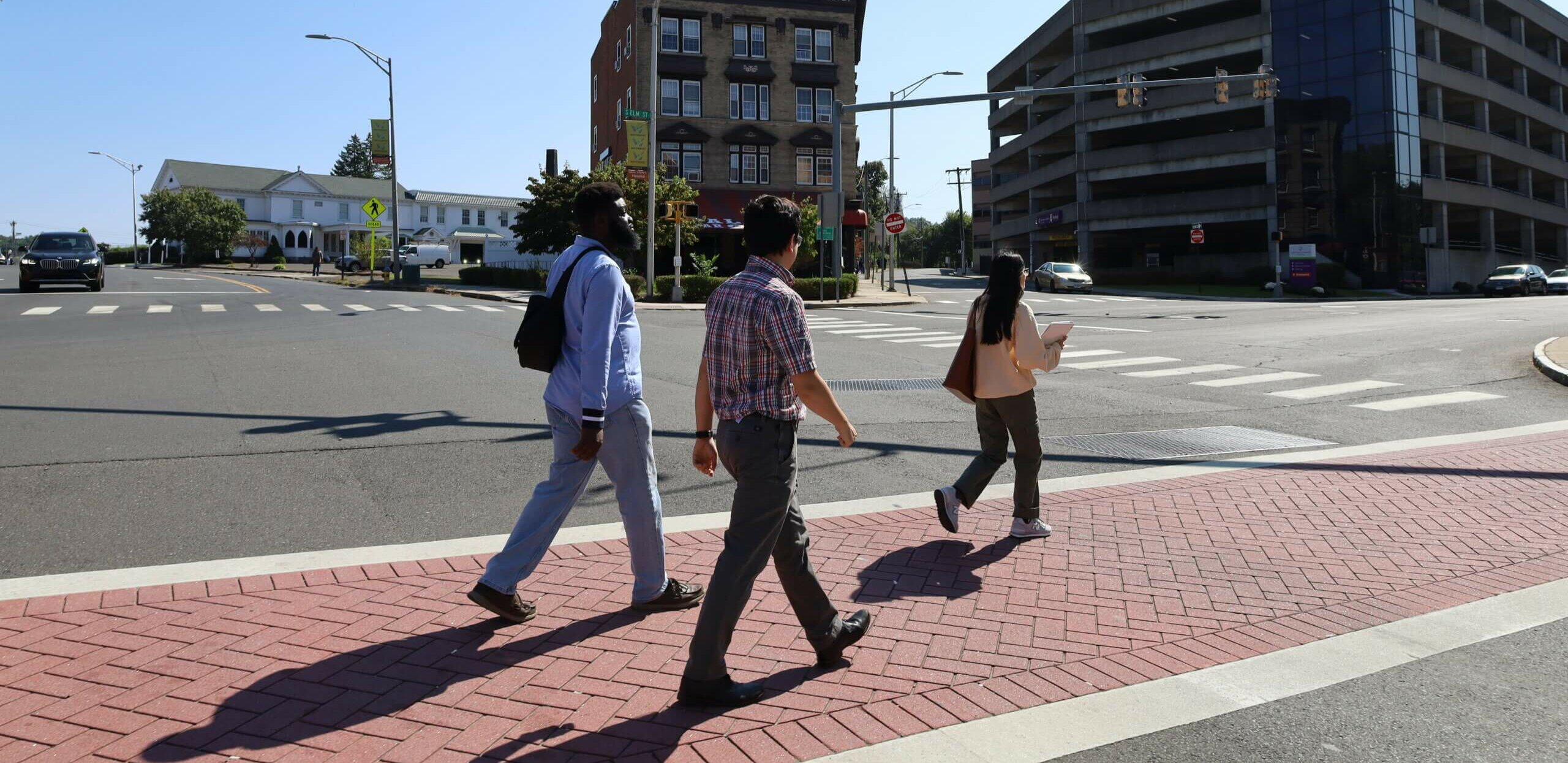
(Waterbury, CT) – The Naugatuck Valley Council of Governments (NVCOG) will receive $2 million in supplemental funding from the U.S. Environmental Protection Agency (EPA) to further its mission of transforming contaminated and underutilized properties into thriving community assets. This funding is part of EPA’s FY 2025 Brownfields Grant Program, which allocated over $267 million to communities across the nation to support the assessment and cleanup of brownfield sites.

This new funding will expand NVCOG’s successful Revolving Loan Fund (RLF) Program, allowing the agency to provide additional sub grants and low-interest loans to municipalities and developers across its Regional Brownfields Partnership (RBP). The RBP encompasses 25 cities and towns in west-central Connecticut, working together to meet the collective redevelopment challenges that brownfields present in the region.

This latest grant underscores the EPA’s recognition of NVCOG as a high-performing RLF recipient, capable of effectively utilizing funds to achieve significant environmental and economic outcomes. Including this year’s award, NVCOG has now received a total of $16.8 million in Brownfield’s funding from the EPA through multiple award cycles.
Since 2005, NVCOG’s RLF program has supported 44 projects, leveraging $90 million in non-federal investments.

“This funding is a testament to the success of our Brownfields program and the collaborative efforts of our regional partners,” said Rick Dunne, Executive Director of NVCOG. “With these additional resources we can accelerate the remediation of brownfield sites, paving the way for new housing, businesses, and green spaces that benefit our communities.”

For more information about NVCOG’s Brownfields program please visit https://nvcogct.gov/who-we-are/commissions-committees/regional-brownfields-partnership/.

PRESS RELEASE: NVCOG Releases Draft Unified Planning Work Program for Public Comment

For Immediate Release: May 15, 2025

Contact:
Richard Donovan
Transportation Planning Director
Naugatuck Valley Council of Governments
203-757-0535
rdonovan@nvcogct.gov

NVCOG Releases Draft Unified Planning Work Program for Public Comment

Waterbury, CT – The Naugatuck Valley Council of Governments (NVCOG) has released the draft Unified Planning Work Program (UPWP) for the Central Naugatuck Valley Metropolitan Planning Organization (CNVMPO), inviting public review and comment.

The UPWP identifies the planning process for the CNVMPO transportation planning department over the two-year period between July 1, 2026, and June 30, 2027. This document details the planning priorities, projects, and deliverables expected to be completed in this period. The UPWP forms the foundation of CNVMPO’s transportation planning work and will be endorsed by the CNVMPO board at adoption and following any updates.

Metropolitan Planning Organizations (MPOs) are required to create a Unified Planning Work Program (UPWP) that documents the metropolitan transportation planning activities to be performed in compliance with the requirements of US Code of Federal Regulations (23 CFR Part 450.308). The transportation planning tasks identified in the UPWP are funded through a combination of federal, state, and local sources.

The NVCOG encourages the public to review and participate in shaping this important document. A draft version of the document is available at https://nvcogct.gov/what-we-do/transportation-planning-2/work-program-upwp/

The public comment period is open from May 15, 2025, to June 30, 2025. Open office hours, during which NVCOG staff will be available to answer questions and respond to comments regarding the UPWP, will be held on Monday, June 16, 2025, both virtually and at the NVCOG offices, located at 49 Leavenworth Street, Waterbury, CT 06702. Those wishing to join virtually can do so using the Zoom link at https://bit.ly/upwp-nvcog-25. Individuals with limited internet access can listen to the meeting by calling +1 929 205 6099 and entering the Meeting ID when prompted: 829 1869 3987.

Comments can also be sent via email to Rich Donovan, Transportation Planning Director, at rdonovan@nvcogct.gov, called in to the NVCOG office at (203) 757-0535, or mailed to the NVCOG’s office at the address above.

Language assistance is available. Requests for language assistance should be made at least five business days prior to the meeting by contacting Desira Blanchard, Civil Rights Officer, at dblanchard@nvcogct.gov or call 203-757-0535.

Community Planning Newsletter Spring 2025

Quarterly Updates

The NVCOG Community Planning Division published the spring edition of its quarterly newsletter. The newsletter is a resource for municipal land use staff and decision makers on all things land use policy and planning.

Subscribe

Subscribe to the NVCOG newsletter to receive quarterly updates.

PRESS RELEASE: NVCOG Releases Draft Open Space Map and Report for Public Comment

For Immediate Release: May 12, 2025 

Contact:  
Christine O’Neill 
Naugatuck Valley Council of Governments 
203-489-0351 
coneill@nvcogct.gov 
 

NVCOG Releases Draft Open Space Map and Report for Public Comment

WATERBURY, CT – The Naugatuck Valley Council of Governments (NVCOG) has published a draft Open Space Inventory map and report for public comment from May 12, 2025, to June 13, 2025. The interactive map displays every open space property across the 19-town region, with information on ownership, acreage, use, and level of legal protection, while the report provides important background and highlights key properties for each municipality. The map and report are available at nvcogct.gov/osi.

The term “open space” covers a variety of undeveloped land used for conservation, recreation, historic preservation, agriculture, or similar purposes. Understanding where open spaces are located within the region, what they are used for, and whether they are legally protected from development helps local governments and land trusts engage in well-informed planning. 

The interactive map allows users to click on any open space property in the region and access details about it. Data layers related to endangered species, farmland soils, and demographics can be overlaid on the map to identify areas of interest. 

To accompany the map, a report and guide document provides background on open space, details research methodology, lists key regional findings, and highlights each municipality with a unique two-page profile. The report has been designed to serve as a snapshot of existing conditions and a planning tool for municipal staff, commissioners, and open space advocates in the region.  

NVCOG’s Geographic Information Systems (GIS) mapping department has long maintained an online open space inventory, with data acquired from various sources through the years. A $92,000 grant from the U.S. Forest Service in 2023 empowered NVCOG to perform a comprehensive, town-by-town update that involved extensive land records research to make protection determinations on each property. 

The Naugatuck Valley region contains the communities of Ansonia, Beacon Falls, Bethlehem, Bristol, Cheshire, Derby, Middlebury, Naugatuck, Oxford, Plymouth, Prospect, Seymour, Shelton, Southbury, Thomaston, Waterbury, Watertown, Wolcott, and Woodbury. 

Public comments may be submitted to coneill@nvcogct.gov

In accordance with Federal law and U.S. Department of Agriculture (USDA) civil rights regulations and policies, this institution is prohibited from discriminating on the basis of race, color, national origin, sex, age, disability, and reprisal or retaliation for prior civil rights activity. (Not all prohibited bases apply to all programs.)   

Program information may be made available in languages other than English. Persons with disabilities who require alternative means of communication for program information (e.g., Braille, large print, audiotape, and American Sign Language) should contact the responsible State or local Agency that administers the program or USDA’s TARGET Center at (202) 720-2600 (voice and TTY) or contact USDA through the Federal Relay Service at (800) 877-8339.   

To file a program discrimination complaint, a complainant should complete a Form AD-3027, USDA Program Discrimination Complaint Form, which can be obtained online athttps://www.ocio.usda.gov/document/ad-3027, from any USDA office, by calling (866) 632-9992, or by writing a letter addressed to USDA. The letter must contain the complainant’s name, address, telephone number, and a written description of the alleged discriminatory action in sufficient detail to inform the Assistant Secretary for Civil Rights (ASCR) about the nature and date of an alleged civil rights violation. The completed AD-3027 form or letter must be submitted to USDA by:   

(1) Mail: U.S. Department of Agriculture, Office of the Assistant Secretary for Civil Rights, 1400 Independence Avenue SW, Washington, D.C. 20250-9410; or   

(2) Fax: (833) 256-1665 or (202) 690-7442; or   

(3) Email:program.intake@usda.gov.   


PRESS RELEASE: Watershed Based Plan Under Development for Mad River in Bristol, Waterbury, and Wolcott

For Immediate Release: Friday, May 9, 2025

Contact:
Christine O’Neill
Naugatuck Valley Council of Governments
203-489-0351
coneill@nvcogct.gov

Watershed Based Plan Under Development for Mad River in Bristol, Waterbury, and Wolcott

WATERBURY, CT – The Naugatuck Valley Council of Governments (NVCOG) has received a federal Clean Water Act Section 319 Nonpoint Source grant funded by the U.S. Environmental Protection Agency and administered by the CT Department of Energy and Environmental Protection (CT DEEP) to develop a Watershed Based Plan for the Mad River Watershed in partnership with the City of Bristol, the City of Waterbury, and the Town of Wolcott.

The Mad River Watershed spans over 13,000 acres in the northern Naugatuck Valley. The watershed’s northernmost point is Cedar Lake in Bristol; the river winds south through the majority of Wolcott, feeding one of its premier recreation areas, Scovill/Woodtick Reservoir; and joins the Naugatuck River in eastern Waterbury near Hamilton Park and the Brass Mill Center.

The goal of the Watershed Based Plan is to identify nonpoint source pollution – defined as water pollution that is not concentrated within a drainage system or discharged from a discrete point, like a pipe – through land use analysis, field surveys, and water sampling. Once the existing conditions have been established, implementation strategies to reduce pollution and improve water quality will be developed. The final Plan will be approved by the EPA, CT DEEP, and a Steering Committee made up of stakeholders from the three host communities.

According to the 2022 CT DEEP Integrated Water Quality Report to Congress, 3 segments of the Mad River are impaired for recreation (due to elevated levels of bacteria) as well as for aquatic life (due to unknown causes). In addition, a segment of Lilly Brook, a tributary of the Mad River, and upstream Hitchcock Lake are also both impaired for recreation. Certain portions of the watershed contain dense development with abundant impervious surfaces, which can lead to increased pollution from stormwater runoff. A Watershed Based Plan can help address these issues by identifying appropriate interventions, such as rain gardens, homeowner education, or improving riparian buffers.

“Implementation of a Watershed Based Plan is about more than just improving water quality,” says NVCOG Executive Director Rick Dunne. “It’s a catalyst for broader environmental and community benefits, from reducing flooding and restoring native habitats to deepening public awareness and stewardship of our natural resources. By aligning efforts across the communities of Waterbury, Bristol, and Wolcott, we’re creating a blueprint for long-term resilience and shared success.”

To learn more about the project, visit https://nvcogct.gov/project/madriver/ or contact coneill@nvcogct.gov with ideas and questions.

This project was funded, in part, by the U.S. Environmental Protection Agency. The funding is administered by the Connecticut Department of Energy and Environmental Protection.The Connecticut Department of Energy and Environmental Protection is an Affirmative Action/Equal Opportunity Employer that is committed to complying with the requirements of the Americans with Disabilities Act. Please contact us at (860) 418-5910 or deep.accommodations@ct.gov if you: have a disability and need a communication aid or service; have limited proficiency in English and may need information in another language; or if you wish to file an ADA or Title VI discrimination complaint.