Waterbury
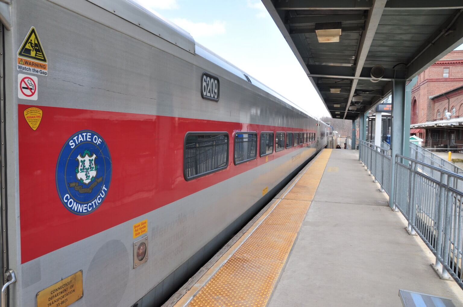
Currently Waterbury has the only ADA accessible platform in the NVCOG region. However, this platform is too short for high-level boarding at all doors and lacks amenities and comforts that passengers need. Meanwhile, the adjacent Waterbury Union Station, a spectacular example of New Haven Railroad architecture, is unavailable to passengers, who often have to wait significant amounts of time between trains. Two projects will, together, make the Waterbury Station a better, more comfortable place for riders while also allowing for more frequent and longer trains.
New Platform
The current platform in Waterbury is only long enough for trains with two cars, and even then only one car can open all of its doors. There are no ticket vending machines currently, and at arrivals and departures the small platform feels crowded. Using state funds added to the federal All Stations Accessibility Award, CTDOT will replace the current platform with one that meets all current standards, including being ADA accessible, 350 long to be able to accept 4 car trains, and equipped with all of the modern station amenities like ticket vending, real time arrival and departure information, and better space for waiting riders. In addition to the functional improvements, the new platform will match the Department’s new platform aesthetic, making for a more attractive station to match the significant improvements that have already been made to station area parking and pedestrian spaces.
Indoor Waiting
Waterbury is fortunate to have an amazing example of Connecticut Railroad Architecture with the Waterbury Station building, a hallmark of the New Haven Railroad’s system in its day. However, it has been many years since an indoor waiting space with amenities was available for riders of the Waterbury Line.
The CTDOT is currently working on plans to convert the southern portion of the old station building into a facility for riders, returning passengers to the building to provide a comfortable waiting space, restrooms, and station amenities.
Naugatuck
The existing Naugatuck Station, located north of Downtown near the site of the historic Naugatuck Station, will be relocated south to a point closer to Downtown and key development parcels.
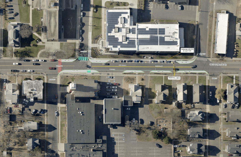
New Station
The new Naugatuck Station, located south of Maple Street and adjacent to Parcel B, will be more visible, easier to access from Downtown, and will help spur economic development in the area. The new station will similarly be built to modern station design standards, including a 350 foot, high-level platform, ticket vending, real-time arrival information, and will be fully ADA accessible. With modern but classic visual elements and consistent signage, the Naugatuck Station will serve as a centerpiece of a revitalized Naugatuck as well as a high-quality connection between the Borough and the Rail Line.
To facilitate the new station, improvements will be made by the CTDOT to Water Street and surrounding on-street parking, and will align with projects currently planned by the Borough for improvements to Maple Street and the surrounding area, will create a mixed-use, walkable neighborhood between Downtown, the East Side of the Naugatuck River, and the new station. Additional connections between the station, Downtown, and the Naugatuck River Greenway will further support these efforts.
Additional information about the project can be found on the CTDOT website here.
The currently proposed site plan, provided by CTDOT, can be found here.
Beacon Falls
The Town of Beacon Falls will receive an upgraded station built on the site of the existing station. Currently, Beacon Falls has a small, low-level platform, a parking area, and very few other amenities. The station, located across the Naugatuck River from Downtown and the Naugatuck River Greenway, is poorly integrated to the surrounding community and does not provide access to riders with mobility restrictions.
Funded through the USDOT’s All Station Accessibility Program and state matching dollars, the station will receive a new, 350 foot platform , starting near the same southern end of the existing platform and moving north along the parking area. This new platform will be covered, enclosed with a wrap-around windscreen, include real-time arrival information, ticket vending, and an enhanced waiting space, as well as be fully ADA compliant. New visual elements, including wayfinding signage and classic design elements, will better define the station area for travelers and better integrate the Beacon Falls Station with the surrounding businesses, homes, and natural amenities.
Seymour
The town of Seymour will have an upgraded station built on the site of the existing station. Currently, Seymour has a small, low level platform, a mostly enclosed but not climate controlled waiting building, limited commuter parking, and few other amenities. In place of the existing station, a new, 350 foot platform will be built parallel to Route 115 and the Downtown area. This new platform will be covered, enclosed with a wrap-around windscreen, include real-time arrival information, ticket vending, and an enhanced waiting space, as well as be fully ADA compliant. Landscaping and way-finding will further provide a better and safer passenger experience.
Ansonia
Located between the Naugatuck River and Downtown, the existing Ansonia station is within close proximity to new Downtown restaurants and businesses, expanded housing, and a large industrial development site. Within Ansonia, the new station will be built on the site of the existing station, which is made up of two bus-shelter like waiting areas and a short canopy. Like the other Waterbury Line stations, Ansonia will receive a new, 350 foot platform, starting at the southern end near the gate in the flood wall and moving north to under the Maple Street Bridge. This new platform will be covered, enclosed with a wrap-around windscreen, include real-time arrival information, ticket vending, and an enhanced waiting space, as well as be fully ADA compliant. Landscaping and way-finding will further provide a better and safer passenger experience.
Derby-Shelton
The Derby-Shelton station not only provides access for both communities to the Waterbury Line but serves as a critical juncture for the CTtransit New Haven Division, Greater Bridgeport Transit, and Valley Transit District bus services. The original Derby-Shelton Station, built by the New Haven Railroad, still stands, and though the building is closed to the public at this time the platform is still in service as the current station. The Derby-Shelton Station project is being funded by a RAISE Grant provided by the USDOT, as well as state funds. In conjunction with the ongoing reconstruction of Route 34, the new station will be well connected to Downtown Derby, Downtown Shelton, and the many new residences and businesses within the two communities.
Indoor Waiting
The existing Derby-Shelton station building, empty since the merger that created the NVCOG in 2015, will be restored in close coordination with the State’s Historic Preservation Office. By ensuring that the building retains its historic elements, not only will it provide a safe and comfortable waiting area for passengers but continue to serve as an important and living piece of Derby’s history.
The project will restore interior passenger waiting, including a potential tenant space, public restrooms, and passenger amenities. The new platform will be connected to the indoor waiting space under the existing platform canopy, ensuring that riders waiting indoors have a protected path to trains during inclement weather.
New Platform
In addition to restoration of the station building, a new, 350 foot platform will be built north of the existing station canopy. This platform will, like other Waterbury Line stations, include a full canopy, wind screen, and real time arrival information, as well as be fully ADA accessible. The new platform will allow for up to four car trains to open all doors at the station, improving boarding and alighting and ensuring that all passengers can utilize the rail service.
Bus Facilities
In addition to serving as the train station, the Derby-Shelton Station is also served by the CTtransit New Haven Division and Greater Bridgeport Transit. To better facilitate transfers between these services, new bus bays will be built within the station area, providing dedicated space for passenger boarding and alighting as well as electric bus charging stations.
Get Involved
Public Engagement
Throughout the project, a series of public meetings will he held in communities along the Waterbury Line to share concepts and gather feedback regarding station replacements. These meetings will be posted here, as well as to the NVCOG Calendar.
Naugatuck Public Meeting
The first public information meeting for any of the Waterbury Line station replacements was held by CTDOT staff on November 15, 2023. The meeting was fully virtual and the recording is attached below.
Meeting Recording