The Town of Oxford has been awarded a $3.4 million Congressionally Directed Spending grant that will pay for building a mile-long multi-use path on Route 67 that is integral to making the center of Oxford more walkable and bicycle-friendly.
Oxford was awarded the grant in December, and the project is in the design phase. The path will run from Dutton Road to Quarry Walk, a mixed-use development with stores, medical and commercial office space and 150 residential units. Plans include three pedestrian bridges to carry the path over water courses, a sidewalk between Oxford Municipal Center/ Town Hall and Academy Road along with lighting, street furniture and crosswalks.
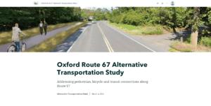
Building a multi-use path for cyclists and walkers along Route 67 is a key component of the Oxford Route 67 Alternative Transportation Study that the town did with NVCOG and the Connecticut Department of Transportation (CTDOT). The Oxford Board of Selection endorsed the final report in February 2022.
The study investigated the potential for bicycle, pedestrian, and transit improvements along Route 67 in Oxford. The study was funded by NVCOG with federal transportation planning funds and was conducted with support by TranSystems, a planning and engineering consultant with offices in Meriden, CT. It was overseen by the Oxford Main Street Committee that was formed in 2017.
A short section of that path opened in 2021 and runs from the Little River Nature Preserve (across from Oxford Town Hall) to Dutton Road.
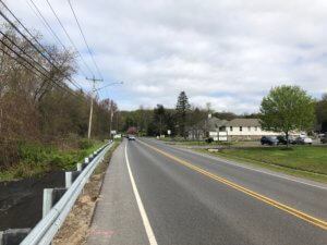
Existing Conditions along Route 67. Note the lack of pedestrian and bicycle accommodations.
Unlike many of its neighbors, Oxford does not have a typical walkable New England downtown or Main Street. Instead, municipal services and commercial areas are dispersed along with residences along State Route 67. Although Route 67 is fundamentally Oxford’s “Main Street,” it had no sidewalks or any safe bicycle or pedestrian access, and traffic speeds are excessive with no visual cues to alert motorists that they are driving through an area where they may encounter walkers or bicyclists. In addition, no public transit is operated along Route 67 that could provide residents an alternative transportation option. Transit options by train on Metro North and by bus on CT Transit are available only one mile from the Oxford town line, but there is currently no way for Oxford residents to safely access these services without a personal motor vehicle.
In Oxford’s 2018 Plan of Conservation and Development, the town prioritized creating more of a downtown feel along Route 67, and the Oxford Main Street Committee has been investigating streetscape improvements, sidewalks and trails within the corridor to improve non-motorized access. The study built on the committee’s prior work to develop a cohesive plan for the entire corridor to better enable the Town to plan, prioritize, and fund future improvements.