The Towns of Thomaston and Watertown received a federal Recreational Trails Program grant through the CT Department of Energy and Environmental Protection to design and construct a trailhead parking area and short section of Naugatuck River Greenway (NRG) trail in Thomaston and to design critical features along the future NRG route in Watertown. NVCOG is administering the grant on behalf of the towns, and Vanasse Hangen Brustlin (VHB) is the project engineer. The project is part of the larger 44-mile NRG trail that is planned to follow the Naugatuck River from Torrington to Derby.
The original purpose of the project was to design and construct a trailhead and trail on town property in Thomaston adjacent to the town water pollution control and animal control facilities connecting to an existing historic trolley bridge over Branch Brook, and design critical features including drainage and rail separation for a trail to be constructed in the future in Watertown. Investigation into the reuse of the Trolley Bridge revealed that it would be more cost effective to construct a new crossing. The scope was altered to use the limited construction funds to fully design a new crossing full design of a new crossing of Branch Brook.
The trail segment and trailhead parking in Thomaston will provide access to the NRG, Mattatuck and Branch Brook Trails via a new pedestrian bridge over Branch Brook that was designed as part of this project. Thomaston and Watertown each applied for Local Transportation Capital Improvement Program (LoTCIP) funding to construct sections of the NRG Trail in the respective towns.
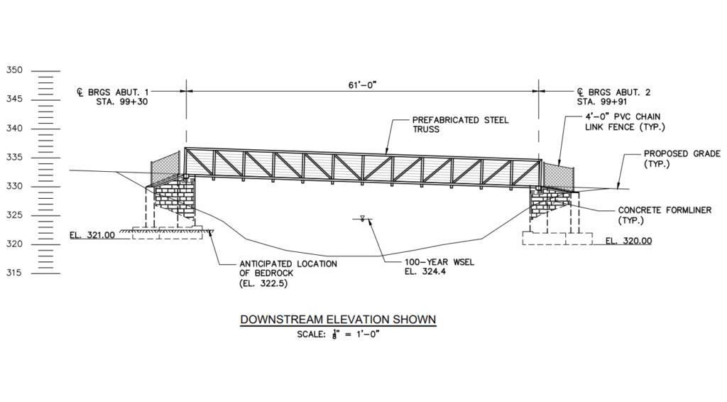
Detail of new pedestrian bridge over Branch Brook
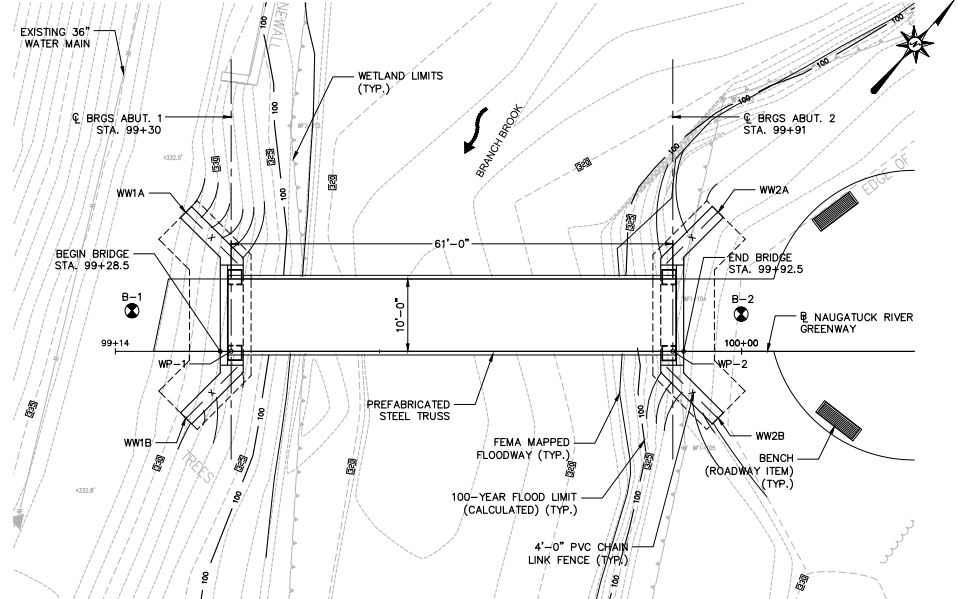
Plan view of new pedestrain bridge over Branch Brook
Project Webmap
Explore the project area and critical features in the interactive Project Webmap :