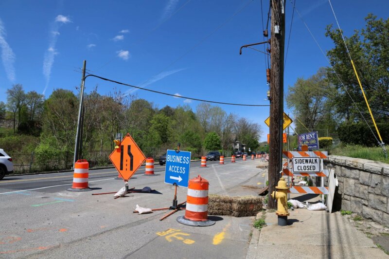
Main Street in Derby will be reconstructed between Bridge Street and Route 8. The construction is expected to continue through 2024 and be completed in Fall 2024.
Route 67 Seymour – Spot Improvements
GBV LRTP TIP PM 2.5 Air Quality Emission Results Summary October 2016
https://nvcogct.gov/wp–content/uploads/2016/10/GBV–LRTP–TIP–PM2.5–AQ–Emission–Results–Summary–2016–10.pdf
Metro Hartford Region Bike Share Plan (includes Waterbury)
https://nvcogct.gov/wp–content/uploads/2014/07/Metro–Hartford–Bikeshare–Full–Report.pdf
GBV LRTP TIP Ozone Air Quality Emission Results Summary October 2016
Ozone Air Quality Conformity Determination Page | 1 Emissions Results Summary REGIONAL AIR QUALITY EMISSIONS ASSESSMENT ONE -HOUR OZONE NAAQS TRANSPORTATION IMPROVEMENT PROGRAM – FFY 2015 -2018 FOR THE GREATER…
CNV LRTP TIP PM 2.5 Air Quality Emission Results Summary October 2016
https://nvcogct.gov/wp–content/uploads/2016/10/CNV–LRTP–TIP–PM2.5–AQ–Emission–Results–Summary–2016–10.pdf
Request for Proposals (RFP) – RBP Environmental Assessment Services Short List Only – Berlin 161 Massirio Drive
The Naugatuck Valley Council of Governments intends to select one (1) firm, currently a member of the RBP Short List, to conduct a Phase II Environmental Site Assessment with remedial…
Summary PM 2.5 Air Quality Conformity Determination May 2017
PM2.5 Air Quality Conformity Determination Page | 1 Emissions Results Summary REGIONAL AIR QUALITY EMISSIONS ASSESSMENT PM2.5 NAAQS for the Conn ecticut portion of the NY -NJ -CT PM2.5 Attainment/Maintenance…
web map
A map that is not simply on the web, but rather one that is powered by the online GIS technologies.
urban area
A United States Census Bureau–defined geographic area of contiguous census block groups with a population density of at least 1,000 people per square mile.
Annual Reports
2024 NVCOG Annual Report February 2024 The Naugatuck Valley Council of Governments (NVCOG) strives to implement and create programs and projects that better align the Naugatuck Valley to a changing […]


