
NVision50: The Metropolitan Transportation Plan for the NVCOG and the Central Naugatuck Valley MPO lays out a comprehensive vision for transportation in our region leading up to 2050.
NVision50: The Metropolitan Transportation Plan for the NVCOG and the Central Naugatuck Valley MPO lays out a comprehensive vision for transportation in our region leading up to 2050.

For nearly two centuries, migratory fish have been blocked from most of the Naugatuck River by Kinneytown Dam in Seymour. That continues today, with the facility no longer producing electricity and serving no useful purpose. Now, a project is underway led by NVCOG in partnership with Save the Sound to remove Kinneytown Dam. Removal will open miles of restored habitat to shad, alewife, lamprey, river herring and other anadromous fish, and will also reduce flood risk, remove a safety concern and eyesore, and reconnect communities to recreational opportunities along the Naugatuck River.
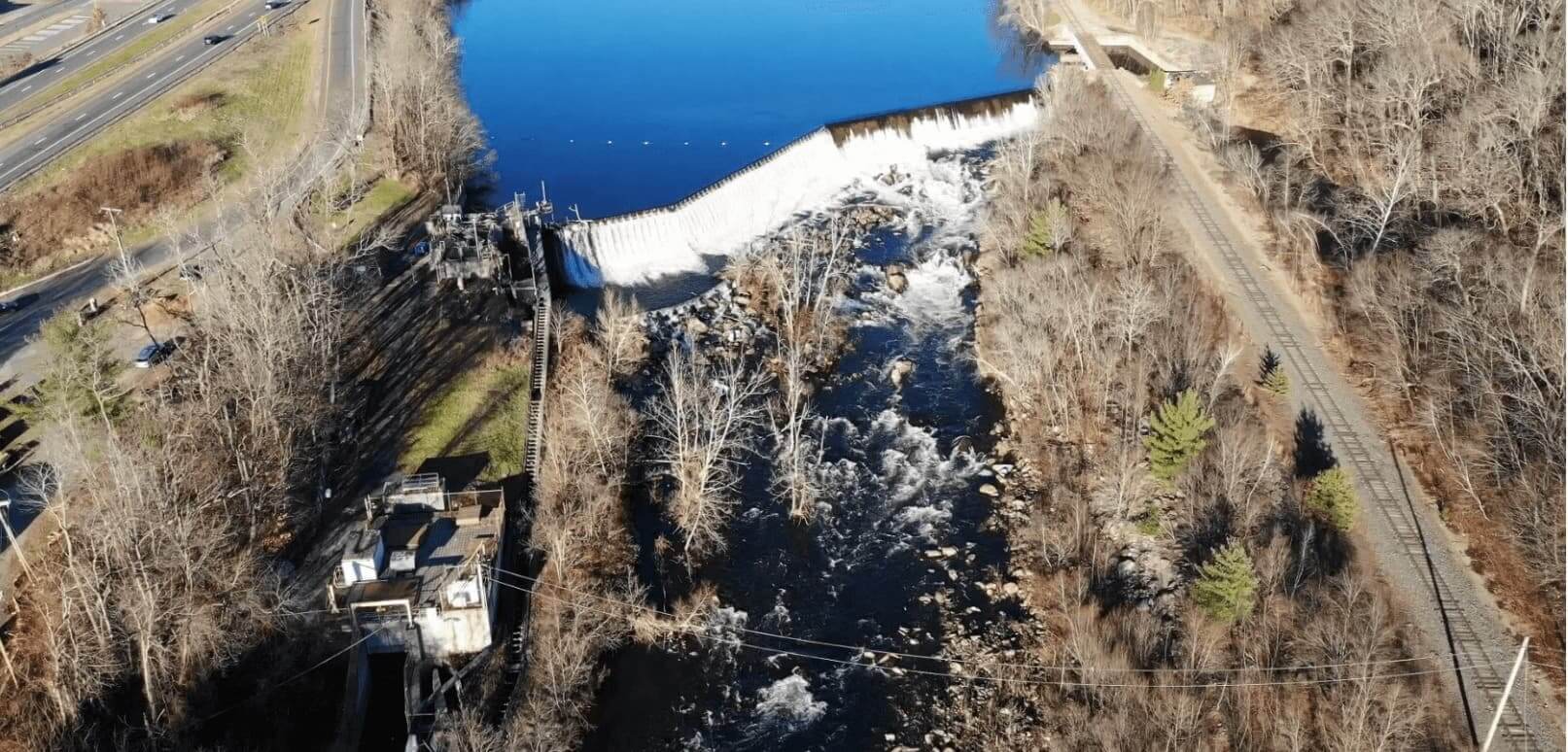
After the longstanding failure of a fish ladder at Kinneytown Dam came to light in 2019, the Naugatuck River Restoration Coalition was formed to advocate for the restoration of fish passage on the Naugatuck River. Consisting of NVCOG, the Naugatuck River Revival Group, and Save the Sound, the Coalition has worked with state and federal regulatory agencies to shed light on the failure to pass fish as required by Kinneytown Dam’s federal license exemption and encouraging the dam owner to remedy the situation.
It has become clear that restoring hydroelectric generation while providing safe, timely and effective fish passage at Kinneytown Dam is not economical, and removal of the dam is the only way to fully restore fish passage at the site. In partnership with Save the Sound, NVCOG applied for and received funding through the NOAA Restoring Fish Passage Through Barrier Removal grant program under the Bipartisan Infrastructure Law (BIL) in 2022 for the acquisition and decommissioning of the facility, and for the design and construction work leading to the dam’s removal. The project is supported by municipal leaders, state and federal regulatory agencies, the CT federal delegation, environmental advocates, and the current dam owner.
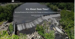
The Coalition has developed an Interactive Story Map to explain the issue. Project details will be continually added here and on the Story Map, so please check back often!

The final Regional Hazard Mitigation Plan and Municipal Annexes have been posted to the NVCOG Hazard Mitigation Plan webpage. The Plan has been adopted by all 19 NVCOG Communities, and the NVCOG Board endorsed the plan on December 10, 2021. FEMA approved the plan in January, 2022.
In 2019, NVCOG received funding from the Federal Emergency Management Agency (FEMA) to conduct a multi-jurisdictional Natural Hazard Mitigation Plan (NHMP) for all 19 NVCOG municipalities.
An approved NHMP is required by FEMA to qualify a municipality for certain federal mitigation funding. NHMPs must be updated every 5 years. The purpose of this project is to update municipal NHMPs and develop a consolidated multijurisdictional plan for the entire Naugatuck Valley planning region in compliance with FEMA standards and requirements that will serve as the approved NHMP for each NVCOG municipality.
The NHMP will identify natural hazards and risks, existing capabilities, and activities that can be undertaken by a community to prevent loss of life and reduce property damages associated with the identified hazards. Public safety and property loss reduction are the driving forces behind this plan. Careful consideration will also be given to the preservation of history, culture and the natural environment of the region.
Milone & MacBroom Inc. (MMI) was selected to serve as the project consultant. MMI has extensive experience developing NHMPs in the region and across the state. NVCOG is administering the project and has prepared a detailed scope of work in collaboration with MMI. The project is expected to take 18 months and will include extensive public and stakeholder outreach and coordination with various municipal officials and departments.


The Towns of Thomaston and Watertown received a federal Recreational Trails Program grant through the CT Department of Energy and Environmental Protection to design and construct a trailhead parking area and short section of Naugatuck River Greenway (NRG) trail in Thomaston and to design critical features along the future NRG route in Watertown.