MAP Forum Annual Meeting – December 7, 2017 at 1:30 p.m. in Lower Manhattan.
For security purposes, please RSVP via Eventbrite at www.2017mapforum.eventbrite.com.
The meeting agenda can be found here.
Please note that the meeting also will be available remotely as a webinar using the following link at the time of the meeting: www.bit.ly/2017MapForum
- Meeting Number: 318 315726
- Meeting Password: NYMTC123
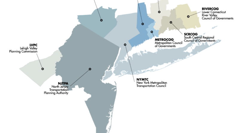
The MAP Forum is a consortium of metropolitan planning organizations (MPOs) in New York, New Jersey, Connecticut and Pennsylvania that have signed a Memorandum of Understanding (MOU) for the coordination of planning activities in the multi-state metropolitan region.
The MAP Forum complies with the Americans with Disabilities Act and federal Limited English Proficiency guidelines. If you need special accommodations to participate in this meeting, or translation services, please contact Andrea.Miles-Cole@dot.ny.gov no later than 72 hours prior to the meeting.
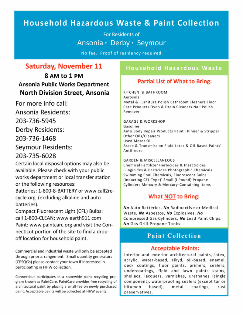
Household Hazardous Waste Collection for Ansonia, Derby and Seymour residents November 11
Public Notice – MAP Forum announces November 1, 2017 Meeting of the Multi-State Freight Working Group
PUBLIC NOTICE
The Metropolitan Area Planning (MAP) Forum announces the first meeting of its Multi-State Freight Working Group on November 1, 2017 at 10:00 am in Lower Manhattan. For security purposes, anyone interested in attending in person should RSVP using the following link no later than noon on Tuesday October 31st: www.freightmapforum.eventbrite.com. Please also have a photo ID at the meeting location.
Please note that the meeting also will be available as a webinar if you cannot attend in person. To participate in the webinar, go to https://meetny.webex.com/meetny/j.php?MTID=m3d58752e44dea9bd50e7264115e47cd2 . Meeting Number: 319 707 375; Meeting Password: Nov0117. The teleconference number is 518-549-0500 and use attendee access code 319 707 375.
MULTI-STATE FREIGHT WORKING GROUP
First Meeting; Wednesday November 1, 2017 at 10:00 a.m.
NYMTC office, 25 Beaver Street, 2nd floor
Lower Manhattan
NVCOG Releases Request for Proposals at Waterbury Industrial Commons Site (1875 Thomaston Avenue)
NVCOG has released a Request for Proposals for environmental assessment services through the Regional Brownfields Partnership (RBP) shortlist at the former Chase Brass and Copper stock room site (1875 Thomaston Avenue). More information is available at http://nvcogct.org/content/vendors.
The Waterbury Area Transit Study (WATS) is available for public comment
The Waterbury Area Transit Study (WATS) is available for public comment.
The WATS developed a list of short- and long-term recommendations to improve bus service in the greater Waterbury area. The Project Team developed the recommendations using rider input received from on-board surveys as well as technical analysis of the existing system.
Please see the handout (En español) for a summary of the study’s recommendations or the draft report for the full findings. Additional information can be found on the project web site http://www.waterburybusstudy.com.
We want to know what you think! Written comments can be submitted by email to comments@waterburybusstudy.com. The comment period will be open through October 31.
NVCOG Regional Profile Report Now Available
For Immediate Release:
Contact:
Glenda Prentiss
Naugatuck Valley Council of Governments
203-757-0535
gprentiss@nvcogct.gov
NVCOG Regional Profile Report Now Available
Naugatuck Valley Council of Governments (NVCOG) staff recently completed an update to the Regional Profile for the 19 municipalities comprising the NVCOG region. The Regional Profile compiles population, economic, and housing data from a variety of sources, including the U.S. Census Bureau, the Connecticut Department of Labor, and the Connecticut Department of Economic and Community Development.
This report provides useful statistical data to public officials, local organizations, developers, private citizens, students, businesses, and others interested in population, housing and economic trends. NVCOG staff prepares an update each year. The data is intended to assist municipalities with grant applications, updates to planning and economic development documents, and provide information to local boards and commissions. An analysis and overview of important regional trends is found in the beginning of the report. More detailed tables and maps showing information for each municipality are found in the appendices.
As a supplement to the Regional Profile, NVCOG staff has created an interactive web-based application to provide access to the U.S. Census Bureau’s American Community Survey data at the block group or block level. This tool allows users to obtain statistics for smaller areas within a municipality.
The Regional Profile report and web-based application can found on NVCOG’s website at www.nvcogct.org
“Just as the State of Connecticut is very diverse as a whole, the NVCOG region demonstrates considerable diversity in demographic data, which the Regional Profile summarizes well,” said NVCOG GIS Program Coordinator Glenda Prentiss. “Providing supplemental access to the U.S. Census Bureau’s American Community Survey data at the block group or block level is a new feature that offers the opportunity to provide even more specific data.”
(END)
Waterbury Area Transit Study Open House Sept. 27, 2017
NVCOG is conducting an onboard survey of the Waterbury Branch Line service starting September 19, 2017
The survey will be conducted September 19, 20, 21. This survey can also be completed online here until the end of October: http://nvcogct.org/content/survey
State Conservation and Development Plan Update 2018 – 2023 – Public Hearing at NVCOG Offices September 8, 2017
The State Office of Policy and Management (OPM) held a public hearing regarding its draft Conservation and Development Plan 2018 – 2023 after the NVCOG Council meeting this past September 8, 2017. The slide presentation given prior to the public hearing may be viewed through the link above. Public review and comment period is underway – comments regarding the State Plan and its associated Locational Guide Map (LGM) are being accepted until October 16, 2017. For more information about the State’s Conservation and Development Plan Update for 2018 – 2023, and how to submit comments, visit the OPM website.


