Recharge Mapping: | 1 COUNCIL OF GOVERNMENTS CENTRAL NAUGATUCK VALLEY RECHARGE MAPPING: A GIS‐ based tool for identifying areas of land with significant groundwater recharge September 2009 Prepared in…
NVCOG Annual Report 2015 – 2016
New NVCOG Study Outreach to Include Five Workshop Opportunities and Online Survey
For Immediate Release:February 26, 2018 Contact: Mark Nielsen Naugatuck Valley Council of Governments 203–757–0535mnielsen@nvcogct.org New NVCOG Study Outreach to Include Five Workshop Opportunities and Online Survey Study to Determine Effective…
NVCOG Annual Report 2017 – 2018
1 | Page Report to the Connecticut General Assembly Committees on Planning & Development Co -Chair s: Senator Steve Cassano, Senator George S. Logan Representative Roland J. Lemar and Finance,…
Existing Conditions Report
Oldread, Krystal Exis tin g Co n d itio n s TABLE OF CONTENTS Executive Summary ………………………….. …………………………………………………………………………. i…
Pedestrian and Bicycle Safety in the CNVR: An Assessment of Existing Conditions
Pedestrian and Bicycle Safety in the CNVR: ý ó An Assessment of Existing Conditions Council of Governments of the Central Naugatuck Valley Approved by the Council of Governments: February 11,…
CNVR Profile 2013
https://nvcogct.gov/wp–content/uploads/2014/03/COGCNV–Regional–Profile–2013.pdf
NVCOG MTP 2019–2045 Executive Summary
DRAFT Metropolitan Transportation Plan: 2019 ~ 2045 For the Naugatuck Valley Planning Region & Central Naugatuck Valley Metropolitan Planning Area February 2019 Title: Metropolitan Transportation Plan for the Naugatuck Valley…
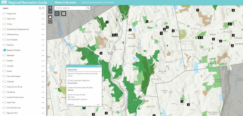
Regional Recreation Guide now available online!
Unified Planning Work Programs (UPWP) for the Greater Bridgeport & Valley MPO FY 2018–2019
Unified Planning Work Program for the Greater Bridgeport & Valley Planning Region: 2018 & 2019 June 15, 2017 Shelto n Ea sto n Fair fi eld M onro e Tru…
NVCOG Hosting Governor’s Council on Climate Change Stakeholder Event on July 26th at NVCC
The Governor’s Council on Climate Change (GC3) will hold a second round of stakeholder events on Tuesday, July 26th, 5:30pm -7:30pm (refreshments available at 5:00pm). RSVP at http://bit.ly/GC3–July26 The primary/central…
I–84/Rt 8 Interchange Study: Deficiencies and Needs Report
Deficiencies and Needs Final Report I -84/Route 8 Waterbury Interchange Needs Study ____________________________________________________________________________________________________________________ June 2010 i TABLE OF CONTENTS TABLE OF CONTENTS……………………………………………………………… ……………………………i LIST OF TABULATIONS……………………………………………………………… …………………………v LIST OF FIGURES……………………………………………………………… […]


