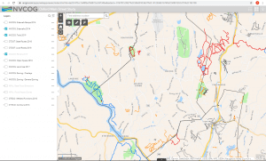
The NVCOG, in collaboration with the CTDOT, Federal Highway Administration, the City of Bristol, and the Town of Southington, has engaged a multidisciplinary team to conduct a corridor study along CT Route 229 between Interstate 84 and US Route 6. The intent of the study is to plan for future development while addressing safety and traffic flow concerns, and provide for improved pedestrian, bicycle, and transit-user accessibility.
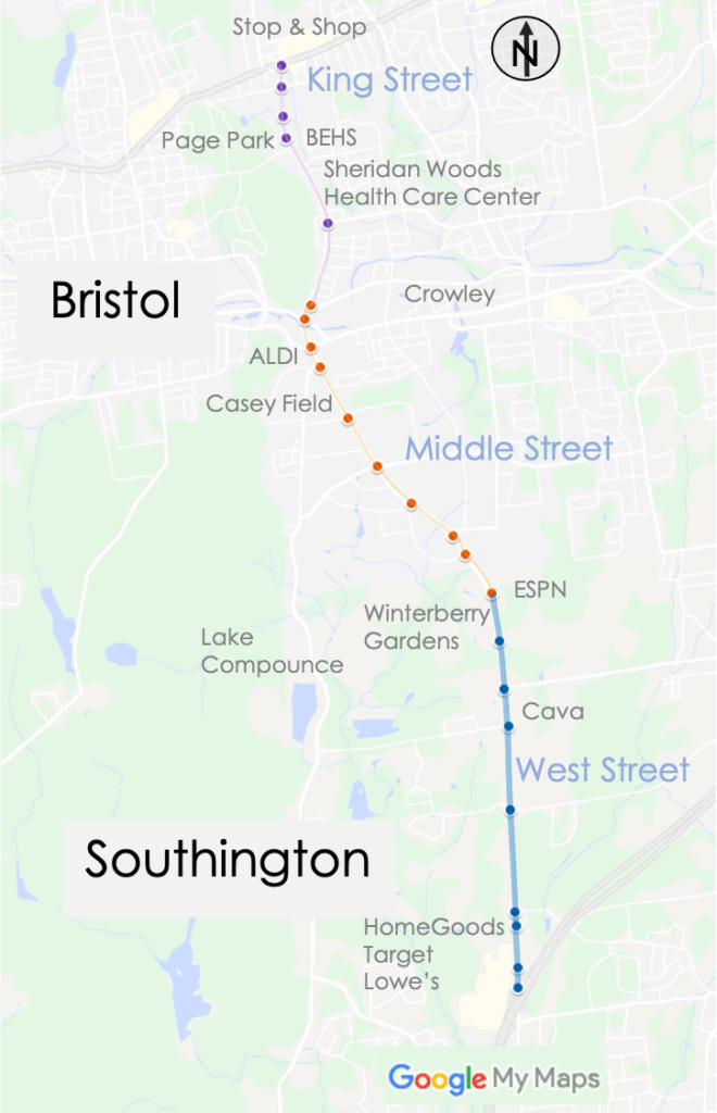
Route 229 is characterized by a variety of typologies and traverses diverse land uses. North of Route 72, King Street is a two-lane road through a residential neighborhood, providing access to the Route 6 commercial district and Bristol Eastern High School. At Broad Street, Route 229 widens to multiple lanes in both directions. The intersections of Middle Street and Route 72 and Middle Street and Pine Street/Mountain Road are of particular hazard due to high vehicle volumes, multiple lanes, and a large number of vehicles entering and exiting the roadway. This section of roadway is a hotspot for crashes. South of Pine Street, Route 229 becomes a four-lane undivided highway and remains four lanes until the Southington town line. This is a regionally significant commercial and industrial district and a significant employment center. The region’s largest employer, ESPN, is located on Middle Street, just north of the Southington town line. Additionally, the seasonal theme park, Lake Compounce, is accessed from Middle Street. The corridor’s only transit route, CTfastrak, services the Lake Avenue park-and-ride. At the Southington town border, the road narrows to one southbound lane and is the site of recurring congestion. The road remains as such until roughly 1500 feet north of I-84 Interchange 31. Land use throughout the West Street portion of the corridor is a mix of commercial and residential with several substantial business parks located in the close vicinity on intersecting streets.
As part of the study, we will collect and analyze traffic and safety data, work with the public to identify weaknesses and opportunities along the corridor, propose countermeasures to improve safety and traffic flow, produce a final report summarizing the analysis and recommendations, and provide conceptual engineering drawings for spot improvements along the length of the corridor needed to create a safer environment for all users, better traffic flow and support ongoing economic development.
The study was conducted by a team of planning experts and key stakeholders, led by BL Companies, a multi-discipline firm with extensive expertise in planning and traffic engineering. Additional expertise in real estate market trends and land use demand is being provided by The Williams Group.
Staff Contact:
Rich Donovan
Transportation Planner
rdonovan@nvcogct.gov,
Thank you to all who participated throughout the course of this study. Your input was invaluable in ensuring that our proposed concepts meet the needs of the community. Opportunities for future engagement will be possible as projects move forward in the design and implementation process.
Public Involvement Process
We strive to create a public involvement process that is collaborative, accessible and inclusive. During the course of the study, our team used a variety of tools to engage the public in a discussion and dialogue regarding the future of Route 229 and how future improvements can better integrate all users.
We conducted interviews with stakeholders, prepared an online survey, developed an interactive map, held 3 public information meetings, and maintained this web page as well as provided updates via the NVCOG’s social media platforms.
Stakeholder Interviews
Several in depth interviews with key project stakeholders were held with the goal of better understanding the issues and opportunities along Route 229 and feedback was incorporated into the final recommendations.
Public Meetings
Three public meetings were held with the dual purpose of sharing our findings and hearing directly from the community about their concerns and ideas for Route 229. These meetings were open to all, and recordings of all three are available linked below and on the NVCOG YouTube Page. The first meeting was held using a virtual workshop format. Meeting #2 was able to be held as a hybrid, offering an online and in-person option at the Bristol Public Library. Meeting #3 was also held with both a virtual option and an in-person option at the Bristol Public Library.
Social Media
In addition to this website, we will keep you up-to-date regarding the project’s status and progress on NVCOG’s social media platforms, which include Facebook, Twitter, and LinkedIn. Follow us there!
Below is a map showing the three segments of this corridor as it travels between US Route 6 in Bristol and Interstate 84 in Southington.
Thank you to all who participated in our corridor survey. Results of the survey are included in the final report as an appendix.
The study is now complete and a final report is available for review. As the project moves forward into design and construction additional opportunities for review and comments will be available. Thank you to all who contributed comments and time to make this study valuable for our communities.
Document Appendices